• Hello, please take a minute to check out our awesome content, contributed by the wonderful members of our community. We hope you'll add your own thoughts and opinions by making a free account!

Pattern Januworry

2013-2014 was a very solid winter pattern as well. That was to me the last great winter, at least for my area.

This right here is just an example of how drastic the differences of 50 miles and 500 feet of elevation can be the difference in a region. The north and northwest burbs have had 12-15 inches of snow over he past 4 winters, while south and east have had almost nothing. Hopefully something more widespread happens this January.
 
Seriously, do we need Dubuque crap in here? Clogs the thread. Make a Dubuque thread........
It's kind of been explained numerous times, we allow post from members all over and maybe one day there will be sub-regional threads. Until such time his post about weather discussion in his backyard are welcome, just like post about Texas, Ok, Ga, etc. Also, your comment was more whambyish as many are becoming in here and I'd actually love to see those decrease in here. Thanks

We even allow some guy from Montana to complain about how cold it is up there while we bask in the torch of the ser. Lol
 
I keep asking for someone to show me evidence of a sustained wintry pattern for the SE and no one has yet to provide said evidence.
No one is saying sustained wintry pattern coming for months on end … but we’re seeing significant signs that a shake up of the CURRENT sustained pattern of SER and days on days of 70s is going to change that is called pattern change. Remember where we live the SOUTH EAST we don’t see weeks and weeks of a great pattern .. we usually just go through roller coaster rides and when we are headed down we watch for winter potential. How long has everyone lived here? This is the first thing you have to understand being a winter weather lover but also being in the SE.
 
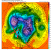
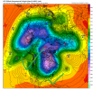
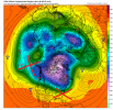
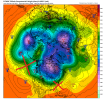
Ok, let's see what we have. Looking at D10+ because we know the pattern isn't great beforehand (although it's not impossible to sneak some wintery weather in for some parts of the region). LR stuff in the D10 period and beyond will obviously change. But maybe we can see something by comparing the images below and find us some evidence, at least from our beloved models, of a better pattern on the horizon.

0z GFS 240

0z 240.png

0z GFS 384

0z384.png

0z CMC 240

0zcmc.png

0z ECFWMFCMEF

ecmwf_z500_mslp_nhem_11.png

6z GFS 234

6z234.png

6z GFS 384 Back to square 1

6z 384.png

trainwreck.jpg

On to 12z, I guess.
 
No one is saying sustained wintry pattern coming for months on end … but we’re seeing significant signs that a shake up of the CURRENT sustained pattern of SER and days on days of 70s is going to change that is called pattern change. Remember where we live the SOUTH EAST we don’t see weeks and weeks of a great pattern .. we usually just go through roller coaster rides and when we are headed down we watch for winter potential. How long has everyone lived here? This is the first thing you have to understand being a winter weather lover but also being in the SE.
Dude you might want to reel it in a bit. Why go to the extreme with everything? No one suggested months on end sustained wintry pattern but as RC pointed out we usually do have sustained period or two to work with. And remember where you live? NC usually has longer sustained periods then other's in the SE, so these "remember we live in the South East" general statements don't pan out for everyone. Now I'd really like to see you answer his first question posed to you a few days back, seriously generally curious as to what you see that says we are headed for a much better pattern.
 
Ok, let's see what we have. Looking at D10+ because we know the pattern isn't great beforehand (although it's not impossible to sneak some wintery weather in for some parts of the region). LR stuff in the D10 period and beyond will obviously change. But maybe we can see something by comparing the images below and find us some evidence, at least from our beloved models, of a better pattern on the horizon.

0z GFS 240

View attachment 99645

0z GFS 384

View attachment 99647

0z CMC 240

View attachment 99648

0z ECFWMFCMEF

View attachment 99649

6z GFS 234

View attachment 99655

6z GFS 384 Back to square 1

View attachment 99656

View attachment 99657

On to 12z, I guess.
I don’t see anything that wrong with any pictures you showed .. what I see is absolutely no sign of a strong SER which is what everyone should be feeling great about.. all the other stuff 240 out specifically is nonsense .. we’ve seen literal exact opposite flips from images 240+ Within the time span of 6 hours .. there’s no need to think the world is ending with anything out there
 
No one is saying sustained wintry pattern coming for months on end … but we’re seeing significant signs that a shake up of the CURRENT sustained pattern of SER and days on days of 70s is going to change that is called pattern change. Remember where we live the SOUTH EAST we don’t see weeks and weeks of a great pattern .. we usually just go through roller coaster rides and when we are headed down we watch for winter potential. How long has everyone lived here? This is the first thing you have to understand being a winter weather lover but also being in the SE.
And no one is asking for a "months on end" wintry pattern. And I don't need your sarcasm. I've been genuinely asking for evidence of a favorable pattern for us snow lovers. All I get in return is one-liners and !? symbols. I'm legit trying to discuss the pattern here. I don't see a favorable pattern for snow here.
 
Dude you might want to reel it in a bit. Why go to the extreme with everything? No one suggested months on end sustained wintry pattern but as RC pointed out we usually do have sustained period or two to work with. And remember where you live? NC usually has longer sustained periods then other's in the SE, so these "remember we live in the South East" general statements don't pan out for everyone. Now I'd really like to see you answer his first question posed to you a few days back, seriously generally curious as to what you see that says we are headed for a much better pattern.
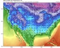
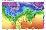
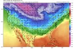
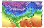
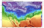
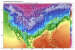
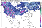
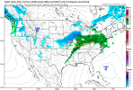
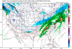
Fair. Here’s most of the entire run of the most recent GFS (remember I still believe anything 240 out can change on a dime) yes for people in Florida and southern areas of the SE states you’re still in line to see possible warm temperatures 60-70 degrees .. but for most everyone else? Consistently much colder than 70s every single day. This is a pattern change. If you live by the coast or in Florida I wouldn’t be expecting extended periods of cold any time of the year A8EF4FF0-198F-42F6-B7F0-56FF259B3581.jpeg7F67DEE7-FA50-49CF-9404-E16869D97AA7.jpeg40F938FB-B426-401E-B955-8C928524BFB0.jpegDE059326-DA24-4C0C-9766-19915504D333.jpegFFC4A63B-33CC-477D-A66C-21EAB2D6F15A.jpegE17B9EF4-7684-45C6-BEDF-217887DCE033.jpeg
 
View attachment 99643

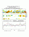
I haven't seen much evidence on the LR guidance that the better MJO phases are going to help us. But that may change. The 0z GFS at least had the ridge axis out west in a better position farther east to get the yellows out of the SE. Unfortunately, the 6z GFS went back to crap at the end.

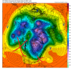
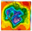
I agree. I'm still waiting for the Aleutian Ridge to move. It just won't. And it won't until the MJO stops spinning around phase 7 and tropical forcing migrates east. Until then we're stuck still, and it's beyond frustrating. I will say the ridge seems to have drifted north, a bit east and tilted less positively allowing more of a conus trough. This bleeds enough cold air east that we cool down, go a bit below normal which will be nice.

However, we've lost the -NAO to pretty much a +NAO and we still have the pacific ridge and -PNA. I doubt that's enough to get us a winter storm, but we'll see. I think it's the best we get this winter. And welcome back WAR! It's been so long! ? ?

gfs-ens_z500a_nhem_65.png

gfs-ens_T2ma_nhem_65.png
 
I don’t see anything that wrong with any pictures you showed .. what I see is absolutely no sign of a strong SER which is what everyone should be feeling great about.. all the other stuff 240 out specifically is nonsense .. we’ve seen literal exact opposite flips from images 240+ Within the time span of 6 hours .. there’s no need to think the world is ending with anything out there
Correct. I didn't show the world ending. I showed a train wreck for a sustained wintry pattern in the SE. If your goal is not to have days on end of 70+, then mission accomished (just don't look at the 6z 384 GFS). But if you're looking for sustained cold in any of those images for our region, good luck. Big PV bottled way up in Canada, no helpful -NAO/-AO, no big tall western ridge, ugly trough tilted west though the Pacific NW. = Not a sustained cold and wintry pattern for the SE US. Will we get there later? Probably at some point.
 
Fair. Here’s most of the entire run of the most recent GFS (remember I still believe anything 240 out can change on a dime) yes for people in Florida and southern areas of the SE states you’re still in line to see possible warm temperatures 60-70 degrees .. but for most everyone else? Consistently much colder than 70s every single day. This is a pattern change. If you live by the coast or in Florida I wouldn’t be expecting extended periods of cold any time of the year View attachment 99662View attachment 99663View attachment 99664View attachment 99665View attachment 99666View attachment 99667
I'm not too excited about lows in the 30s/40s
 
Correct. I didn't show the world ending. I showed a train wreck for a sustained wintry pattern in the SE. If your goal is not to have days on end of 70+, then mission accomished (just don't look at the 6z 384 GFS). But if you're looking for sustained cold in any of those images for our region, good luck. Big PV bottled way up in Canada, no helpful -NAO/-AO, no big tall western ridge, ugly trough tilted west though the Pacific NW. = Not a sustained cold and wintry pattern for the SE US. Will we get there later? Probably at some point.
I suppose that’s fair. I look for cold and anything below 70s is now doing it for me lol. But we need cold air to even thing about winter weather and we are finally getting that piece to the puzzle .. the rest comes with time .. I suppose it’s the other posters who continue doom and gloom that have irked me cause clearly it’s not that doom and gloom right I just think they trolling
 
Honestly the last several years have been tough to come by multiple days on end with temperatures near or below freezing for daytime highs. I guess I can only speak for my corner of the SE, in the lower MS valley. Average temps in January run around 60/40 here anyway, so getting multiple bouts of temps below 55/35 would still be a win. One winter storm with that pattern, and I'm good for the winter. I guess it helps if we define our terms and expectations.
 
Back
Top