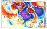
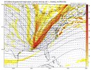
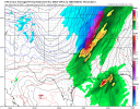
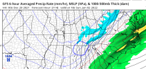
Its also like the tropical region keeps trying to make a push NW. Nice to see the upper midwest get crunk. International Falls cashing in on old man winter.Hello there TPV View attachment 98945
Thats a start!! And driving distance!!Probably 10 or so EPS members want to give VA border North a decent snow event around day 11-12
I mean part of me really wants to lash out at you thinking your old cause you remember something that happened 22 years ago.......
Could be a solid overrunning or CAD scenario here if we can play our cards right … the cards are in the table but jumbled around right now .. still have plenty of time for adjustmentsYepView attachment 98949
View attachment 98950View attachment 98948For us to even have a shot we need a Great Lakes vortex suppressing the SER
The only good news I see is that atleast we won't be spending as much time wasting a strongly -NAO/AO pattern on such an awful Pacific pattern. As much as I think -NAO/-AO have become underrated in recent years,when we are dealing with such a stubburn GOA ridge/-PNA pattern,there really not much the NAO/AO can do beside maybe prevent us from recording breaking warmth and maybe give us some CAD here and there.Still not seeing much to get excited about for any lengthy cold potential in the SE based on the models in general as well as the NAO/AO being projected to rise, the PNA projected to stay negative, and the MJO being stuck in 7 for another 2+ weeks. Also, the CFS has warmth dominating through 1/20 or so with no big cold shots til after then.
Just think we’re still ways to go … I quit my ranting. Sorry .I know some don’t want to admit it, but we’re clearly taking positive steps. It’s not a good pattern yet, but this is the best trends we’ve seen finally in a week or so, I’d love to see more, and I’ve already accepted the fact we’re possibly gonna see negative trends as well along with this, given the -PNA losing it’s strength just a bit around this time on ensembles, we need to hope for a GLs vortex to press on the SER as that’s the classic way to get overrunning setups in the SEView attachment 98954View attachment 98955View attachment 98957
I know some don’t want to admit it, but we’re clearly taking positive steps. It’s not a good pattern yet, but this is the best trends we’ve seen finally in a week or so, I’d love to see more, and I’ve already accepted the fact we’re possibly gonna see negative trends as well along with this, given the -PNA losing it’s strength just a bit around this time on ensembles, we need to hope for a GLs vortex to press on the SER as that’s the classic way to get overrunning setups in the SEView attachment 98954View attachment 98955View attachment 98957
Oh I know your being real and so am I, but we’re seeing -NAO/-AO with mostly no results over the next week, imo there’s always more to indexes, like random pieces of energy/TPVs, the overall trend has to expand a TPV east towards the GLs as mostly no models had that 36 hours ago but rather a torch. Sure indexes are a big piece of the puzzle, but there’s more.I’ve been as hopeful as just about anyone in my posts, but now the -AO and -NAO are projected to rise to neutral to possibly positive in early January and they’re no longer projected to dip down nearly as low as earlier projections showed in the next few days. The NAO is now forecasted on the GEFS to dip only down to -1 at the lowest vs -1.5 to -2 as of a few days ago. The AO low is now forecasted to be just above -3 vs near -4 on earlier runs.
Meanwhile, the PNA is still not forecasted to go positive for at least two weeks.
I’m not saying winter cancel as we will almost definitely get a cold week or two, but rather am saying I see more delays in getting that week or two of cold domination. Just being a realist but still hopeful for later. Hoping for a mid to late January cold dominated period of 1-2 weeks as well as a return of similar cold in Feb.
Oh I know your being real and so am I, but we’re seeing -NAO/-AO with mostly no results over the next week, imo there’s always more to indexes, like random pieces of energy/TPVs, the overall trend has to expand a TPV east towards the GLs as mostly no models had that 36 hours ago but rather a torch. Sure indexes are a big piece of the puzzle, but there’s more.
Yep definitely agree with you on the last part !Fair enough but I don’t think much was supposed to happen til after January 1st despite the -AO/-NAO per models other than hopefully an end of the torch domination. Now models have extended that torch domination into early January from what I’m seeing ( outside of CAD wedging). The GOA ridge still isn’t going away in the ensemble means, am I looking at that right? Maybe I’m missing something. It just seems to not want to go away that soon. Eventually it will of course. Maybe we need phase 8 MJO to get that to occur.
Definitely not winter cancel! That would be silly to say do with most of the winter still to come and the vast majority of snow and wintry precip climo still yet to come.