NBAcentel
Member
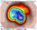
We’re allowed 1 toss of a 12z euro full run .. cashing inYep it’s problematic View attachment 99715
Maybe we don’t toss I see a general trend to rising heights in the PNA region .. this is key and we will hope this continues on subsequent runs
My biggest fear is there’s to much interaction between the Aleutian low and TPV and it just dumps a trough in the NE US and quickly backs off afterMaybe we don’t toss I see a general trend to rising heights in the PNA region .. this is key and we will hope this continues on subsequent runs
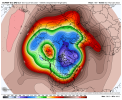
You can see a good bit of what is expected in a nina here. Extend the jet enough so that you cut off the existing ridge, feed cold into Noam, get a consolidated vortex near Hudson Bay and a ridge along the WC maybe as far east as the rockies. In time the jet will start to relax and retract and we will see this pattern begin its retrogression and toward more of the SER dominate late winter pattern. The big question will be how long does it stay favorable? My guess would be we have until around 2/1 if we are lucky before it's backing out. Big wildcard would be trying to wave break a -nao as things move west
Short time to cash in.You can see a good bit of what is expected in a nina here. Extend the jet enough so that you cut off the existing ridge, feed cold into Noam, get a consolidated vortex near Hudson Bay and a ridge along the WC maybe as far east as the rockies. In time the jet will start to relax and retract and we will see this pattern begin its retrogression and toward more of the SER dominate late winter pattern. The big question will be how long does it stay favorable? My guess would be we have until around 2/1 before it's backing out
Probably and if we go the route of the eps we may not have much time to cash in or anything to cash in on. The lack of polar blocking and the retraction of the pv poleward is concerning. This is incredibly meh we probably get an intense cold shot or 2 from this look and avg near to bn but it doesn't exactly make me jump around in excitementShort time to cash in.

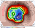
Other then the SPV evolution, look sorta reminds me of jan 2019. Intense but short lived cold duration. I like the overall theme but this pattern is very prone to delays and quickly exitingProbably and if we go the route of the eps we may not have much time to cash in or anything to cash in on. The lack of polar blocking and the retraction of the pv poleward is concerning. This is incredibly meh we probably get an intense cold shot or 2 from this look and avg near to bn but it doesn't exactly make me jump around in excitementView attachment 99725
Eps had 2 opportunities to link up western ridging to the ridge near ak and drop the hammer but didn't. Something to watch I guess.Other then the SPV evolution, look sorta reminds me of jan 2019. Intense but short lived cold duration. I like the overall theme but this pattern is very prone to delays and quickly exiting


At this range completely doable but we gotta see trends of that in the coming days to feel better about itEps had 2 opportunities to link up western ridging to the ridge near ak and drop the hammer but didn't. Something to watch I guess.
View attachment 99729
View attachment 99730

18z GFS is better for the upcoming possible snow event. The trough is digging deeper, but it still needs more tilt for a significant widespread winter storm.
Looks good for the Avery county ski resorts


We were so close. Just some minor tweaks and a lot of people would be happy.Incoming???

You could tell it was going to because the high was in an ideal position when the storm was still well back west. West based strong -NAO would have helped a lot. It's still way out there though. Lots of time.And...it warms up and rains...


