WxBlue
Meteorologist
This is a formidable arctic airmass even by January standards, much less mid-November.
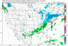
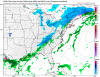
Thanks for these charts above! Sad to see the cutback in snow amounts, but expected as we get closer.
Living in New Hampshire really messed with my perspective of what's "cold" here in North Carolina because I kept feeling "meh" seeing these cold temps... then NWS GSP pointed out that we're having January-level of cold. I forgot how impressive teens/20s can be here in Carolinas.