iGRXY
Member
When I say northeast Alabama I mean the northeastern chunk so most of east central Alabama as well lol ?. But I see what your saying. Depends how strong it is, on how far it will get really. I just want some snow lolBorn and raised in Birmingham so just my .02.....You are more likely to get CAD into East Central AL than you are in the NE part of the state. I am talking about areas like Scottsboro, Guntersville, down to Gadsden are less likely to see CAD than Anniston. It used to happen a lot in the 80's.
I was talking about the greater Charlotte area. FRAM ice accumulations had a bullseye of 1" ice accrual from Rock Hill to South Charlotte to Monroe. But yes it's possible we stay mostly sleet. It's what's saved us for the past two decades.soundings looks like sleet, not frz rain. just need to hope that warm nose isnt stronger than modeled.
I know some say CAD is always underestimated, but I have also seen times when it ended up being warmer than forecast when there's CAD.
View attachment 104464
Good luck getting any “snow”


I like power, please give the west trackCentral NC and down east, horrible track

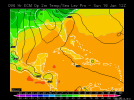
I am telling you...trust me...? knick off 2 to 3 degrees for Atlanta. I see this trending colder.20s into all the way into NE Atlanta midday Sunday.View attachment 104478
Indeed, though I don’t quite see how it takes that track with such strong CAD. Seems like it would need to be another 50-100 miles east? But I’m a modernweenie .Central NC and down east, horrible track

