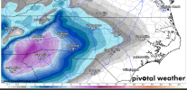
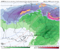
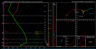
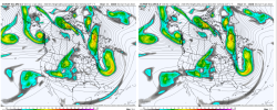
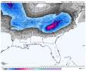
To go with my reasoning above; CAD is slow to erode and always overdone, especially by the GFS operational run. The NAM will allow us to see thermal profiles better here in next few days. I will say though, that the slower this thing is, the more chances of a Northern track. The support we have/had to the North.. to suppress and keep this thing South's window is closing.
-
Hello, please take a minute to check out our awesome content, contributed by the wonderful members of our community. We hope you'll add your own thoughts and opinions by making a free account!
You are using an out of date browser. It may not display this or other websites correctly.
You should upgrade or use an alternative browser.
You should upgrade or use an alternative browser.
Wintry Jan 15-16 Winter Storm Discussion & Obs
- Thread starter SD
- Start date
Dewpoint Dan
Member
But how far south do you think ZR would extend ? Griffin?The ZR extends all of the way to the AL border on the 12Z Euro. So, it suggests it isn’t borderline and that ATL has a good opportunity for its biggest icestorm since Feb of 2014 and the biggest on the northside since Dec of 2005!! This wedge apparently means business.
Side note: The last check on the MJO had it inside the circle then, which is favorable for an Atlanta icestorm per history.
LovingGulfLows
Member
- Joined
- Jan 5, 2017
- Messages
- 1,499
- Reaction score
- 4,100
For more to get into the snow, wouldn't we want this sucker to dig a bit more?
View attachment 104498
Yes, ideally, you want the center of the ULL to be just to the south of you for some of the heaviest snows.
Downeastnc
Member
Been there done that, stick around Wake Co a while, it will make you a believer.
Yeah I have had it go from onset ice and snow to 50ish and heavy rain and then back to snow on the backside all in 12 hrs lol.....
Pretty sure I am on the outside looking in this time around, gonna take some pretty big shifts at this point to get this back to a classic snowstorm for MBY....the SE trend down the stretch is rare, but I gotta think/hope this is as far NW as it goes and we see it take baby steps back east....dont wanna be bullseye 4 days out blah blah blah.....
iGRXY
Member
It'll be interesting to see just how much of a front end thump we get here and how much if any over performance there is on initial cooling. Won't change the long term game but someone in this area could get a quick 2-4 of snow/sleet before changeover
how about Columbia SC? How do you think we will do with MJO?The ZR extends all of the way to the AL border on the 12Z Euro. So, it suggests it isn’t borderline and that ATL has a good opportunity for its biggest icestorm since Feb of 2014 and the biggest on the northside since Dec of 2005!! This wedge apparently means business.
Side note: The last check on the MJO had it inside the circle then, which is favorable for an Atlanta icestorm per history.
Reminder: In the past the GFS has been too progressive with the Northern stream/branch. Another thing to watch out for here.
ForsythSnow
Moderator
So taking the Euro verbatim, it'd be rain, then that freezes and turns to a sheet of ice as 7 or so inches of snow piles up on that. Then we switch to sleet and get an inch on that which switches to freezing rain and drops .25 to .5 inches on that, following a coating of up to 2 inches of snow on the back side. A sandwich that spells disaster for the power grid.
ryanardo
Member
Yeah if the system pans out to even half of that, it's still badMaybe we can avoid these totals with more sleet?
NWMSGuy
Member
iGRXY
Member
You'd want it to dig yes but that's still irrelevant if it's trying to run the primary west of the Apps. You need this to take on a Miller A look, not a Miller BFor more to get into the snow, wouldn't we want this sucker to dig a bit more?
View attachment 104498
Thanks for that. Exactly my thinking at this point.The ZR down around I20 is going to be bad. Aiken to Columbia into the pee dee are going to get wrecked. Looking at the soundings it's a quick burst of snow to sleet, then the soundings are definitely ZR soundings.
Below is a sounding for Columbia:
View attachment 104507
You would normally, but the original low(surface through 700mb) is occluding as the transfer begins to take place.Would anyone believe we would see a deform band set up with this look? Would rates be higher than currently advertised?
View attachment 104506
For NC Dec 2002 comparisons—that one had miller b low develop offshore as it lifted NE. This one’s stubbornly determined to take a shortcut inland. The CAD is stout though (and probably similar to that setup).
IP super cells? ?Looks very wonky

IP islandsIP super cells? ?
SnowsWonderful
Member
Is it possible (since yesterday evening trends) that this becomes strictly an Apps runner & nobody wins in the southeast except Cumberland plateau and everywhere NE of there?
No.Is it possible (since yesterday evening trends) that this becomes strictly an Apps runner & nobody wins in the southeast except Cumberland plateau and everywhere NE of there?
Selfish weenism but I fully expect to pick up 2" from that, they have been known to go pound town just before the transition.It'll be interesting to see just how much of a front end thump we get here and how much if any over performance there is on initial cooling. Won't change the long term game but someone in this area could get a quick 2-4 of snow/sleet before changeover
And you're much better at recalling past systems than I, do you remember a storm we tracked a number of years ago (prob over on TW), strong CAD, models wanted to drive it right up the wedge and last day or 2 they actually shifted more east around the "dome" of cold air? I know it doesn't always happen but seems I remember this very thing being tracked and us discussing it but I don't recall when or the details. I'm sure it was a different setup and models are better now, maybe.
iGRXY
Member
No. The CAD is what's driving this regardless of storm track.Is it possible (since yesterday evening trends) that this becomes strictly an Apps runner & nobody wins in the southeast except Cumberland plateau and everywhere NE of there?
NEGaweather
Member
Sent from my iPhone using Tapatalk
I've got my electrician father coming over on Saturday to finally wire up my generator disconnect just in case. I'm in the 32.1 degree CAD zone typically but this has a 2000/2005 vibe to me.So taking the Euro verbatim, it'd be rain, then that freezes and turns to a sheet of ice as 7 or so inches of snow piles up on that. Then we switch to sleet and get an inch on that which switches to freezing rain and drops .25 to .5 inches on that, following a coating of up to 2 inches of snow on the back side. A sandwich that spells disaster for the power grid.
ATLwxfan
Member
So taking the Euro verbatim, it'd be rain, then that freezes and turns to a sheet of ice as 7 or so inches of snow piles up on that. Then we switch to sleet and get an inch on that which switches to freezing rain and drops .25 to .5 inches on that, following a coating of up to 2 inches of snow on the back side. A sandwich that spells disaster for the power grid.
North Fulton and Forsyth counties are in for a smorgasbord. Going to be an absolute mess in Alpharetta.
Sent from my iPhone using Tapatalk
Avalanche
Member
Was this back on Talkweather? I remember that and Shane was calling it like that well in advance.Selfish weenism but I fully expect to pick up 2" from that, they have been known to go pound town just before the transition.
And you're much better at recalling past systems than I, do you remember a storm we tracked a number of years ago (prob over on TW), strong CAD, models wanted to drive it right up the wedge and last day or 2 they actually shifted more east around the "dome" of cold air? I know it doesn't always happen but seems I remember this very thing being tracked and us discussing it but I don't recall when or the details. I'm sure it was a different setup and models are better now, maybe.
JLL1973
Member
i think our area is losing this one. Looks like its headed i40 northwardMan here in far n bama we so close!!maybe we can trend back a little south
Dewpoint Dan
Member
Gwinnett also. I don't think the airport and areas south and west will have many issues. This is a classic east and northeast of Atl storm.North Fulton and Forsyth counties are in for a smorgasbord. Going to be an absolute mess in Alpharetta.
Sent from my iPhone using Tapatalk
iGRXY
Member
JLL1973
Member
yep and i think your in a good spot for that unless the north trend continuesWould anyone believe we would see a deform band set up with this look? Would rates be higher than currently advertised?
View attachment 104506
iGRXY
Member
850's actually recover faster on this run as well.
Gwinnett also. I don't think the airport and areas south and west will have many issues. This is a classic east and northeast of Atl storm.
Based on what?
Flotown
Member
Yep just like the last one...lol but we still kind time...maybei think our area is losing this one. Looks like its headed i40 northward
BufordWX
Member
Dewpoint Dan
Member
All the models I've seen. Certainly areas like Carrollton, Cedartown, Griffin are right on the edge.Based on what?
Clem282340
Member
Does this count freezing rain and sleetEPS looks a little better so far.View attachment 104516

