• Hello, please take a minute to check out our awesome content, contributed by the wonderful members of our community. We hope you'll add your own thoughts and opinions by making a free account!

Wintry Jan 15-16 Winter Storm Discussion & Obs

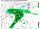
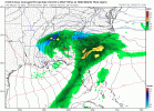
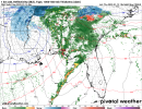
This run was better hopefully the GFS can follow shortly View attachment 104283
GSP seems to be leaning more towards the EURO/EPS and GEFS right now based on their overnight discussion. Also they give the indication that they will be watching for overrunning precip to start well out ahead of the system as the event draws closer
 
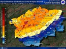
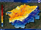
Sorry for the sloppy screenshots. Couldn’t figure out how to save the image. But this is the WPC for this weekend. I feel like this gives a pretty 64E39D38-846E-4B6A-8B05-1AA8B786A232.pnggood idea on who will be seeing the bulk of wintry weather for now. But wow. It’s been a while since I’ve seen a 30-50% chance of a winter storm in the southeast. View attachment 104288View attachment 104288
586BBEE4-20D2-4A38-A136-B15EEBAB4522.png
 
Fairly rare winter storm with temps in the teens. Only “trend” I’m watching now is for less qpf. Miller B Transfer and too cold I bet there is some last minute swings to slightly dryer conditions..or I hope so
 
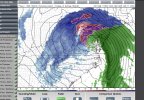
That was a worse GFS run; especially for RDU folks (then up through DC). Looks like the storm traverses close to Raleigh (warm surface temps nears 50). RAH also acknowledging the models signaling an inland path for the storm once it transferred. The only thing I can go on is the storm will get better sampling starting tonight. Lets see if we can now get a few shifts in our favor.
 
EPS/GFES seems to indicate there could be major cutoffs in the ATL area on who sees frozen precip and who doesn't. Eastern half of the metro seems more favored for potentially more snow/sleet/ice than the western half because of the CAD.
 
93b9088a5dbf5e48004848ce8da1f9f7.jpg

6 inch probability. Huge run of the EPS for western NC


Sent from my iPhone using Tapatalk
Yall starting to make me feel guilty. But I'm holding by a hair if these trends continue.
 
That was a worse GFS run; especially for RDU folks (then up through DC). Looks like the storm traverses close to Raleigh (warm surface temps nears 50). RAH also acknowledging the models signaling an inland path for the storm once it transferred. The only thing I can go on is the storm will get better sampling starting tonight. Lets see if we can now get a few shifts in our favor.
While I hate the trends myself, typically models don’t go one way every single run until go time, especially with 108 hours still left
 
Back
Top