Jrips2710
Member
It is weird to me that they have a whole tier of counties further southwest in the impact expected tier as opposed to the watch. I’m gonna bet it gets expanded tomorrow morning.
That's the more likely scenario IMO. I really do not trust any wrap-around snow/back side snow, unless there's a modeled legit deformation band.
Even when one is modeled, I feel like it hardly ever makes it over the mountains. I wish it would though!
Sent from my iPhone using Tapatalk
Idk about that. In the December 2018 storm I had a solid 3 inches at the end of that storm from an ULL. They have potential in these kinds of storms
Sent from my iPhone using Tapatalk
Very interesting…..might explain why the snowfall totals for places like Chattanooga and Dalton weren’t even close for January 2nd stormevery weather model site has slightly different snowfall algorithms BUT the differences in outputs for the exact same model run are extraordinarily large. marginal thermals, mixing issues, etc really giving the algorithms a hard time
for example, the 18z GFS for here shows...
tropical tidbits: 2"
college of dupage: 8.4" (10:1), 4.7" (kuchera)
pivotal weather: 5.8"
weatherbell: 6.4"
buyer beware lol
I read his post around lunch today so he was going off of earlier runs, not 18Z...He’s saying the models are trending south and snowier, NAM, icon and GFS latest runs are North
We had that feature on the big 96 storm. Several inches out in front of the main show. ?For further clarification. It’s often under modeled and creates headaches when people try to get groceries the day before the storm. Why does this matter for the rest of us you ask? It can help build and lock that CAD in. View attachment 104957
Not really buying the back end snow in much of NC/SC outside the mountains. we need the upper level low further south for me to bite on the backend snow, DGZs are dried up while ptype maps are trying to show snow, I’m more intrigued by front end snow then I am back end snow atm View attachment 105137View attachment 105138
And the chances at front end snow are dwindling quicklyNot really buying the back end snow in much of NC/SC outside the mountains. we need the upper level low further south for me to bite on the backend snow, DGZs are dried up while ptype maps are trying to show snow, I’m more intrigued by front end snow then I am back end snow atm View attachment 105137View attachment 105138
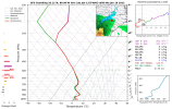
I believe they are playing it conservative for now.Memphis was not impressed… yet
Yep. Playing the waiting game which I think is smart with so much uncertainty. We are still like 54 hours out anyways. I agree another strip will be added overnight if things hold.It is weird to me that they have a whole tier of counties further southwest in the impact expected tier as opposed to the watch. I’m gonna bet it gets expanded tomorrow morning.
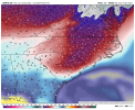
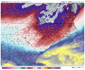
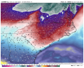
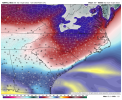
This is porn fro. How dare you there's children in here lol looking good for 85 N though hopefully that ull will trend better and give everyone some love on the back side.Some backside snow on the GFS, ideally we need the ULL to pass around Columbia SC for any real/legitimate backside snow in the Carolinas View attachment 105132View attachment 105134View attachment 105133
And the chances at front end snow are dwindling quickly
View attachment 105145
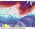
Yep. Playing the waiting game which I think is smart with so much uncertainty. We are still like 54 hours out anyways. I agree another strip will be added overnight if things hold.
They said they didn’t buy the GFS. Going with a combo Nam/E/cmcYou gotta wonder though. The GFS isn’t impressive for metro ATL outside of the areas currently under watches. Also the ZR threat appears diminished. That may induce some healthy skepticism.
Sent from my iPhone using Tapatalk
I dunno....if I am going to bite on this.View attachment 105146
You will be right more times than not if you take the Nam, EURO, and CMC blend. Let's just see what the 0z suite has to say.They said they didn’t buy the GFS. Going with a combo Nam/E/cmc
I haven’t bought into the GFS the last 2 days… I’m especially not going to worry about it’s thermals when we’re so close to being able to follow that on the NAM and HRRRYou will be right more times than not if you take the Nam, EURO, and CMC blend. Let's just see what the 0z suite has to say.
Charlotte is probably gonna stay below freezing with temperatures in the peak being in the mid-20s.Regardless of tentative accumulations, models are pointing out an area encompassing the CLT metro that has the highest probability for the most ZR. Does Charlotte look to stay below freezing for the duration of the entire storm? If so this may spell trouble for roads with ZR and IP.
Looking at the NBM shows some reasons for why they put the watch where so far. The 2 inch+ area matches up somewhat with the current watch. I’m very interested to see where we go with the next set of models.Yep. Playing the waiting game which I think is smart with so much uncertainty. We are still like 54 hours out anyways. I agree another strip will be added overnight if things hold.
