• Hello, please take a minute to check out our awesome content, contributed by the wonderful members of our community. We hope you'll add your own thoughts and opinions by making a free account!

Wintry Jan 15-16 Winter Storm Discussion & Obs

Just IMO, I feel like this year there’s been a lot of times where the models have amplified the storm too much around this range before the NAM comes out. Then it trends the other direction once the storm starts being sampled.


Sent from my iPhone using Tapatalk
 
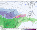
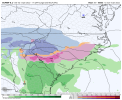
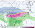
The GFS Did well moving this to a Miller B which the GEFS is figuring out but the evolution of the two are nothing alike. GEFS actually shows how a LP would track through central Alabama before a transfer occurs to the coast which is believable due to the strength and f the Cold dome. The GFS basically cuts through the Ohio valley and transfers to the 95 corridor and still plows the low through the CAD. That isn’t happening. Idc how much y’all want to push that theory but the GFS does this with any storm that has any type of CAD.

Thankfully at this point GSP agrees on the ensemble approach for now. Sucks bad this has morphed to a Miller B, however somehow keeping this 100% to our south seemed very odd to begin with based on how far east it was coming down the pipe. Hopefully it can transfer low and south and operationals will tick south/east. But that may be a losing battle. Long term, I think we're going to need to some west based blocking or a STJ wave to realistically keep our storms south of us in this pattern. Lesson learned.

GSP Discussion:
The period of deepest moisture and best forcing now looks slated for
Saturday night through Sunday as a Deep South surface wave
transitions to the Carolina coast. Strong jet-level divergence is
indicated during this period and deformation zone forcing will
likely impact our area by Sunday, especially over western NC given
the current low track forecast. Precipitation types remain
challenging. Profiles have trended to stronger warm nosing across
the southern half of the area, with prolonged sleet and southern
tier freezing rain now quite possible. However, the operational
model runs appear warmer than most of the ensemble members, so much
of the QPF could still fall as snow. An ensemble approach has been
adopted for weekend profiles, which leads to more snow in the
forecast than might be indicated on operational model profiles
. The
mixed ptype belt should especially impact locations southeast of I-
85, but with a changeover back to snow likely occurring from the
west throughout on Sunday night as the system pulls away to the
northeast. Scattered upslope snow showers should persist along the
TN border counties through Sunday night, and possibly well into
Monday, further enhancing snow amounts there. We are still a
bit out of the Winter Storm Watch timeframe, so this will remain
highlighted in the HWO. The main change will be the addition of
sleet and freezing rain to the forecast, especially across the
southeast part of the area
 
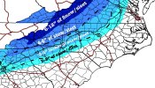
Now with me saying all this, upstate and pretty much everyone south of 40, you need to prepare yourselves that a switch to sleet and freezing rain is likely at some point but the front end thump of snow to me looks likely as of right now. It just depends on how long you can hold off the change and how far north that 850mb LP tracks north.
 
Regardless, the way this thing looks right now, somewhere in the CAD areas of Upstate, Ne Ga, NC is gonna see a 12" wallop!

Sent from my SM-A526U using Tapatalk
Sleet will probably cut those high total were seeing down imo it will be almost go time before we can pinpoint accumulations.
 
Now with me saying all this, upstate and pretty much everyone south of 40, you need to prepare yourselves that a switch to sleet and freezing rain is likely at some point but the front end thump of snow to me looks likely as of right now. It just depends on how long you can hold off the change and how far north that 850mb LP tracks north.

Personally, I think the front end snow will be rather difficult at first. There will be a lot of virga


Sent from my iPhone using Tapatalk
 
Not sure how this all shakes out. You never really know how the trends will go. We all talk about the Northwest trend but I don’t think there’s actually any real data that says that that happens every time and that that modeled trend is irreversible.

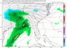
Pretty soon it will be time to look at the mesoscale models where I think will get a better picture of what is about to unfold.


Sent from my iPhone using Tapatalk
 
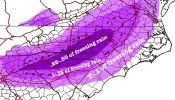
The extent of the warm nose will be sniffed out as soon as the NAM gets in range. Warm nose usually overperforms. The fact that we’re already seeing this much modeled ice is concerning. Wedge always undermodeled as well.
Except when it doesn’t. PDII, SuperCad 2010 and 2011, etc.
 
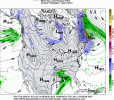
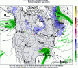
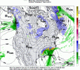
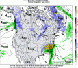
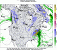
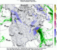
Can see the importance of that 50/50....UK is a little weaker with the ull than the Euro but has the 50/50 in a better spot and high pressure is stronger. I think the GFS is on crack but I'm mostly wishcasting...these 50/50's seem to want to lift out quicker so Euro is probably right.

UK v/s Euro

UKEuro.gif
 
Back
Top