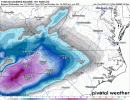
Alright now show us the ice storm on the euro ?? has to be interesting where dews are projected
-
Hello, please take a minute to check out our awesome content, contributed by the wonderful members of our community. We hope you'll add your own thoughts and opinions by making a free account!
You are using an out of date browser. It may not display this or other websites correctly.
You should upgrade or use an alternative browser.
You should upgrade or use an alternative browser.
Wintry Jan 15-16 Winter Storm Discussion & Obs
- Thread starter SD
- Start date
iGRXY
Member
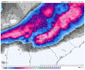
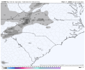
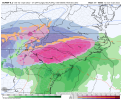
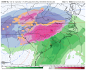
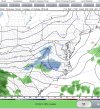
Dang, unless there is some good precip with the ULL which I presume is still back in Bama, the primary seems done with Ga. by Sunday AM?That’s a hell of a FGEN snow band on the euroView attachment 105174View attachment 105175View attachment 105176View attachment 105177
Flotown
Member
Can u post further west please?
iGRXY
Member
packfan98
Moderator
The 18z Euro was a little further north with the precip shield.The low is significantly further south on the 18z but appears warmer temps all around.
Ron Burgundy
Member
Dang. Back to front-end snow we go in the ATL.
Those totals up near Boone are just unreal
Can you post it? It'd be good to have to compare to the CMC.The 18z Euro was a little further north with the precip shield.
FamouslyHot
Member
Didn't notice any major differences this run so here's the fun maps


No, it shows you how conservative they are...they aren't going to post crazy amounts from the get go, that's for sure.Not sure if anybody has posted the RAH briefing. One thing they show is a stronger hold of cold air from Raleigh westward. But they also don't show the high amounts of wintery precip some of the models are showing; which goes to the point that models tend to overdue amounts (especially freezing rain).
Sent from my SM-A716U using Tapatalk
snowlover91
Member
The EURO has really been trying to show that band since last night. The soundings look great even down into where it’s showing the mix. This is definitely something to keep an eye and if the HRRR starts picking up on it, that would be a great thingThat’s a hell of a FGEN snow band on the euroView attachment 105174View attachment 105175View attachment 105176View attachment 105177
BHS1975
Member
saturday sneaky treat View attachment 105180
The HRRR has it too.
Sent from my iPhone using Tapatalk
Nerman
Member
The Euro has been by far the most consistent model for several days now. I'll be shocked if it busts.
NBAcentel
Member
iGRXY
Member
Could you post central NC totals that’s looking nasty for a large portionDidn't notice any major differences this run so here's the fun maps


FamouslyHot
Member
Sorry, forgot to take it off of SC before postingCould you post central NC totals that’s looking nasty for a large portion


Nomanslandva
Member
Hope you guys can pull out something legit and avoid the damaging ice!While these totals are to high, the euro has been hellbent on this front end band of snow View attachment 105187
Would be nice to see this overperform.21z RAP has a nice little band saturday. Drops a dusting across a few areas. View attachment 105186
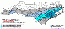
Does anyone remember the band of snow that came through on 2/11/2014 prior to the main storm (which came on 2/12) and absolutely clobbered some areas of S NC? New Bern got 10” and I don’t think it was even close to being forecasted. I don’t remember the synoptic setup for that one and if this bears any similarities. I assume I’m just being a modernweenie .
Hypsometric
Member
Nice looking map! My gut tells me that a lot of folks are going to sleet more than anything else, but I wouldn't be shocked to see a narrow corridor of some significant freezing rain either.My first call snow/sleet map, I went on the slighty lower side vs models/NWS offices. given the chances of cutting down/warm nose, however, I do think many areas along 85 start out as snow including CLT/GSP/GSO, and even areas like Raleigh could have a quick shot at some snow/then to sleet longer. I have a black dashed line for bust potential if dynamical cooling is very successful in keeping front end snow longer, however I eventually think this switches to sleet and there could even be a couple of inches of sleet in some spots, as you get in the foothills/upper part of the SC upstate into NE GA snow totals increase given there are in a better spot/axis where colder 850s can hold longer, I do however even expect those areas to change to IP. the mountains/VA around RNK I think score big in this setup, the only thing I could possibly see going wrong here is the mid level dry slot aloft passing over and cutting Down on snow totals for the NC mountains/VA
View attachment 105170
Now for the ice map, while I normally see ice being cut down by sleet lasting longer, I think this setup is a little bit different imo, the SFC low as soon as it enters C/ENC hooks back a bit and delivers a very large warm nose in the Piedmont of NC/upstate of SC, which I think takes things over to freezing rain for a solid 3-6 hours, this could cause some big ice accretion, especially around the NC/SC border into Charlotte, damaging impacts from the ice appear likely (esp in the dashed line), esp with there being some wind in this setup. Imo i think areas as far/east as ENC/low country of SC could see some brief ice, with Columbia SC seeing some decent icing, when it comes to the ice however, I’m on the colder camps of this setup, I do expect areas further east to change to rain however, including Raleigh/Fayetteville View attachment 105171
Enjoyed tracking this first one on here with y'all. Found myself starting to venture into wishcasting vs objective analysis so decided to take a step back. Still kind of frustrating to see how close this was/is to a nice snow for many more, but those are the breaks. At least it appears this probably won't be the last maps made for this winter (hopefully)!
Good map Fro. Appreciate all your work chasing this storm.
Im on the fence again with frzng rn verse sleet. We will get front end thump, then over to sleet no doubt. Def stay below freezing at surface duration.
Im getting a sinking feeling We are gonna go over to frzng rn longer than I thought earlier today.
2 things I also am leaning toward is quicker start up and exit time. Ill do qpf tommorow night.
And the backside snow is fake news. Dont be up waiting for it. Frzng drizzle will be the p type
Stormlover
Member
18z national blend of models


Snowflowxxl
Member
I remember it. A lot of N GA for 4-5 inches while I got cold rain. I was traumatized lolWould be nice to see this overperform.
Does anyone remember the band of snow that came through on 2/11/2014 prior to the main storm (which came on 2/12) and absolutely clobbered some areas of S NC? New Bern got 10” and I don’t think it was even close to being forecasted. I don’t remember the synoptic setup for that one and if this bears any similarities. I assume I’m just being a modernweenie .
View attachment 105195
Stormlover
Member
This has serious shot, not slam dunk, of rivaling Dec 2002.
We had 0 wind 2002. That want be the case post this storm. Gonna know when we flip and look at radar at that point.
To be clear, not saying this is gonna match it yet. Just saying its only a tweak away, to close for comfort.
We had 0 wind 2002. That want be the case post this storm. Gonna know when we flip and look at radar at that point.
To be clear, not saying this is gonna match it yet. Just saying its only a tweak away, to close for comfort.
So amateur question. Could wind also help limit ice accretion too? Or in this case, would be too little too late?This has serious shot, not slam dunk, of rivaling Dec 2002.
We had 0 wind 2002. That want be the case post this storm. Gonna know when we flip and look at radar at that point.
To be clear, not saying this is gonna match it yet. Just saying its only a tweak away, to close for comfort.
JHS
Member
Coming back east and south with the snow too. Shows a bad icestorm for much of SC, specifically for the Columbia area over towards Florence.While these totals are to high, the euro has been hellbent on this front end band of snow View attachment 105187
JHS
Member
The low still tracks inland on the Euro and gets temps up to 46 around Raleigh. Up into the 40's too around Columbia, but the damage is already done there. . Never above 30 here once we go below freezing.
JHS
Member
The freezing line on the Euro kind of reminds me of Jan 1999. In that storm a few miles made all the difference between a minor icestorm and a serious one. Here in my county most of it warmed to slightly above freezing during the heavier precip, along with the southern Charlotte Metro. Not so for me and for Charlotte north until the precip was over. Lost power for 30 hours with it.
Heelyes
Member
For all the folks too young to remember 2002, there was no power anywhere for days. That was the lucky people, the rest went up to and over a week without power. Fun times
2002 was a disaster. I was very young, granted but I remember driving through SouthPark and remembering every other tree or branch on roads, cars, homes, it was like a bomb went off. If Saturday and Sunday are anything like that, it's going to surpass 2002.For all the folks too young to remember 2002, there was no power anywhere for days. That was the lucky people, the rest went up to and over a week without power. Fun times
The sound of branches breaking and transformers blowing that night is still with me 20 years later. Didnt have power for 10 days. Dad had to drive to Hickory to get a generator.For all the folks too young to remember 2002, there was no power anywhere for days. That was the lucky people, the rest went up to and over a week without power. Fun times
Heelyes
Member
Now just imagine adding a couple hundred thousand new people to the area since then2002 was a disaster. I was very young, granted but I remember driving through SouthPark and remembering every other tree or branch on roads, cars, homes, it was like a bomb went off. If Saturday and Sunday are anything like that, it's going to surpass 2002.
I live/lived in the Myers Park area of Charlotte. It's known for it's large oak trees, After 2002 it took weeks to recover, almost like Hugo.The sound of branches breaking and transformers blowing that night is still with me 20 years later. Didnt have power for 10 days. Dad had to drive to Hickory to get a generator.
With temps in the mid 20s, no. Also the wind is gonna be most noticeable after storm exits up east coast or coastal plain I should saySo amateur question. Could wind also help limit ice accretion too? Or in this case, would be too little too late?
For those who werent around 2002. All of Randolph County lost power. Thats a fact, not exaggeration. 100% of the county. There was a gas store in asheboro between hospital and courthouse who was runing off a generator. I walked 3 blocks from parked truck and stood in line with 100 plus folks for 4 hours with 5 Gas cans. 8 days in the dark. Knew folks who spent up to 14 days.
Last edited:
FV3 hi-res really nails Greensboro NC west with a pre snow would be nice to get 1-2” before the precip even reaches Atlanta Georgia

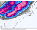
 saturday sneaky treat