L
Logan Is An Idiot 02
Guest
Does anyone have the 18z EPS? Did it pretty much match the OP?
Sent from my iPhone using Tapatalk
Sent from my iPhone using Tapatalk
James, I don't remember the synoptic setup, but I think you're right this "pre-event" was a complete surprise down there. Think everyone was focused on the real event just after that, which I think performed as expected.Would be nice to see this overperform.
Does anyone remember the band of snow that came through on 2/11/2014 prior to the main storm (which came on 2/12) and absolutely clobbered some areas of S NC? New Bern got 10” and I don’t think it was even close to being forecasted. I don’t remember the synoptic setup for that one and if this bears any similarities. I assume I’m just being a modernweenie .
View attachment 105195
Only problem is heavy ZR can accrue much more easier when it’s in the 20s, but there is a shot sleet saves us for sureI feel like the NC side of the CLT metro will be saved by sleet, not to mention as I said earlier the heavy precip will make it hard for ZR to accrue, especially onto trees and other objects.
Yea heavy zr at 31.5 might not accrue.. but at 26 on top of a little snow/sleet it will.Only problem is heavy ZR can accrue much more easier when it’s in the 20s, but there is a shot sleet saves us for sure
Does the euro have a better handle on this storm better than the other model seems to me it keeps on showing the same thing over and over the last few runs
I'd rather have all rain and the ice potential is what's scaring me with this storm. Especially since I'm in Dillon and that is more of what we seem to be on track of getting.Coming back east and south with the snow too. Shows a bad icestorm for much of SC, specifically for the Columbia area over towards Florence.


Not good for the Raleigh to Boone 421 corridor anything on Saturday would wash away treatments on roadways before the main feast.HRRR was trying for something on Saturday up in North Carolina.View attachment 105222
Not good for the Raleigh to Boone 421 corridor anything on Saturday would wash away treatments on roadways before the main feast.
It also helps moisten the lower levels. Less moisture waisted cause it gonna be dry cold ?It would also further solidify the CAD.
Sent from my iPhone using Tapatalk
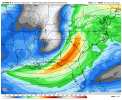

21 inches near Clarksville, lol, geebus
Most of you guys were not even here, or your parents, in January 1973. Atlanta got obliterated by an ice storm, we had no power for 11 days, it was fun at first for this 17 year old, but got old after about the 4th day. Ironically this started sat night into Sunday. And how about the blizzard a month later in central GA which dumped 15-24 inches. This was a La Nina year as well.
And I guess a tick stronger and the high is a tick weaker. But such small differences not sure it's significantHour 36. Little further south with the low.
I believe HRRR had it just north in southern AR at the same hour.Hour 36. Little further south with the low. View attachment 105230
Most of you guys were not even here, or your parents, in January 1973. Atlanta got obliterated by an ice storm, we had no power for 11 days, it was fun at first for this 17 year old, but got old after about the 4th day. Ironically this started sat night into Sunday. And how about the blizzard a month later in central GA which dumped 15-24 inches. This was a La Nina year as well.


I feel a 2014!!!
The 12z NAM had that as well but further west. Definitely further east this run.Gulf of Mexico at 48
