• Hello, please take a minute to check out our awesome content, contributed by the wonderful members of our community. We hope you'll add your own thoughts and opinions by making a free account!

Wintry Jan 15-16 Winter Storm Discussion & Obs

Ultimately, don’t we need to simply hope for a less strong and consolidated energy, so that it does not tilt negative so soon?
Yeah the more it can get elongated and sheared as it's moving through the plains the better for us. If you could take and average out the 0z and 12z euros we'd really have something here
 
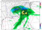
I haven't looked at it much other than the pretty maps on here, but if the CAD isn't retreating then I kind of agree with what Allan Huffman said on Twitter that he doesn't buy the low riding that far inland with that strong of a CAD in place. It seems to be in a good spot off of SC then goes due north into the NC coastal plain. That has to be an odd track right? I want to see this thing just as modeled for GA and SC but then move ne of the NC coast and dump 6-10 all the way from ATL to RDU. But that may be wishcasting idk
The placement of that LP is also going to be steering our 850 and 700 mb LP as well so the track of the low is absolutely important IMO. If it can't come as far north as the GFS and EURO are showing right now, then your upper level tracks are also going to be shifted south.
 
All of the “snow” in atlanta is probably sleet

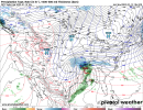
Per 12Z Euro for Atlanta: ~0.50” of qpf is initially with 850s at or slightly colder than 0C. So, if 10:1, that would be ~5” of snow to start keeping in mind 2M temps are 27-28 F:

54B86011-177E-4F64-88E5-A367BB8B9C75.png
24B4E13B-021D-4383-84D9-768E398E49C0.png


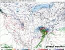
The next 0.50” of qpf is with 850s mainly 0 to +3, which would typically mean per history when there’s a strong wedge mainly sleet though there would probably also be some ZR. Temps remain 27-28. I’d call this very roughly 1.5” of sleet and ~0.10” of ZR on top of the 5” of snow:

7FEB6A8D-D4D0-4FA8-9B0B-03E346F34D6C.png24C12355-EDA8-49DC-BA6E-A3C57FA1C893.png

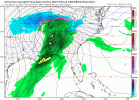
Lastly, it changes back to mainly snow on the backside with 850s dropping back to mainly the 0C to -3C range and ~0.20” of qpf along with 29-30 F. So, I’d call that ~2” of snow:

D0650BA3-6F5D-42BD-9945-673D3CA3023C.png
C7906CE0-14A1-488A-A326-31C7A1E4FB80.png

So, the 12Z Euro has for Atlanta ~1.2” of qpf falling with temps mainly 27-30 F translating to roughly 7” of snow, 1.5” of sleet, and 0.10” of ZR. That would mean 8.5” of total accumulation, which would be the heaviest since the 10” of January of 1940 and 3rd heaviest total accumulation on record. If this were to fall as almost all sleet, it would be near the 4”+ of sleet that Atlanta got in 2/1979 and 1/1988 and would be an absolute mess based on my experiencing those two storms. That would actually likely make it a more impactful storm imo than if it were to be the Euro output of 7” of snow, 1.5” of sleet, and 0.10” of ZR.
 
Last edited:
Which is beyond reasonable given we’re still 90+ hours to it tilting
It's not impossible but with the lack of a good -nao its hard to find a smoking gun for a SE trend. The good thing is even with the bad runs its still very possible our area gets a pretty decent shot of fgen/waa/upglide as this are getting underway and we see a period of snow on the front. Models typically underdo that process so even if this ends up being underwhelming here and buries areas to the west we could still get a nice 3-4 hour event before we get into the mixed mess
 
It's not impossible but with the lack of a good -nao its hard to find a smoking gun for a SE trend. The good thing is even with the bad runs its still very possible our area gets a pretty decent shot of fgen/waa/upglide as this are getting underway and we see a period of snow on the front. Models typically underdo that process so even if this ends up being underwhelming here and buries areas to the west we could still get a nice 3-4 hour event before we get into the mixed mess
Agreed. At the very least, there will be a large portion of the SE under Winter Storm Warnings for the first time this winter. For my area, I call a good winter if I get two WSW's.
 
It's not impossible but with the lack of a good -nao its hard to find a smoking gun for a SE trend. The good thing is even with the bad runs its still very possible our area gets a pretty decent shot of fgen/waa/upglide as this are getting underway and we see a period of snow on the front. Models typically underdo that process so even if this ends up being underwhelming here and buries areas to the west we could still get a nice 3-4 hour event before we get into the mixed mess
What's the best short range model to pick that up the earliest usually?
 
Per 12Z Euro for Atlanta: ~0.50” of qpf is initially with 850s slightly colder than 0C. So, if 10:1, that would be ~5” of snow to start keeping in mind 2M temps are 27-28 F:

View attachment 103939
View attachment 103940


The next 0.50” of qpf is with 850s mainly 0 to +3, which would typically mean per history when there’s a strong wedge mainly sleet though there would probably also be some ZR. Temps remain 27-28. I’d call this very roughly 1.5” of sleet and ~0.10” of ZR on top of the 5” of snow:

View attachment 103941View attachment 103942

Lastly, it changes back to mainly snow on the backside with 850s dropping back to mainly the 0C to -3C range and ~0.20” of qpf along with 29-30 F. So, I’d call that ~2” of snow:

View attachment 103943
View attachment 103944

So, the 12Z Euro has for Atlanta ~1.2” of qpf falling with temps mainly 27-30 F translating to roughly 7” of snow, 1.5” of sleet, and 0.10” of ZR. That would mean 8.5” of total accumulation, which would be the heaviest since the 10” of January of 1940 and 3rd heaviest total accumulation on record. If this were to fall as almost all sleet, it would be near the 4”+ of sleet that Atlanta got in 2/1979 and 1/1988 and would be an absolute mess based on my experiencing those two storms. That would actually likely make it a more impactful storm imo than if it were to be the Euro output of 7” of snow, 1.5” of sleet, and 0.10” of ZR.
1641934156369.png
This should help a bit more. Breaks down how much QPF was used on each precip type.
 

Attachments

  • 1641934119642.png
    1641934119642.png
    128.4 KB · Views: 35
Back
Top