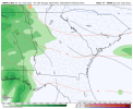
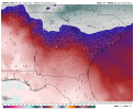
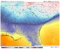
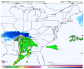
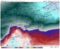
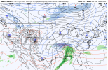
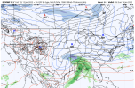
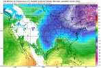
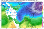
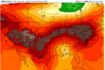
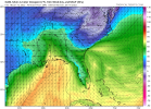
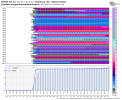
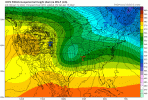
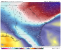
Has some negative dew points (-1) pushing into NE NC.NAM is more sheared still through 66. And our 50/50 has really slowed down and gained strength. It warms 850's in the short term but as the low continues north it works in tandem to funnel in cold air all through the atmosphere further south as our storm is coming into the picture.
-
Hello, please take a minute to check out our awesome content, contributed by the wonderful members of our community. We hope you'll add your own thoughts and opinions by making a free account!
You are using an out of date browser. It may not display this or other websites correctly.
You should upgrade or use an alternative browser.
You should upgrade or use an alternative browser.
Wintry Jan 15-16 Winter Storm Discussion & Obs
- Thread starter SD
- Start date
BufordWX
Member
NBAcentel
Member
- Joined
- Jan 5, 2017
- Messages
- 3,774
- Reaction score
- 5,985
Depoint of 14 in Columbia early Sunday morning on the NAM with precip incoming. Also, the sounding on Pivotal has me starting off briefly as snow, possibly, early Sunday. Most likely sleet then quickly changing to rain.
John1122
Member
The NAM has been super amped all year, as always, until around the 36 hour mark for the events in Tennessee this year. Inside that, the 3k has led and it catches on.
NBAcentel
Member
Not often you see 29/3 proceeding a winter storm hereOne more frame in the Nam would likely have had snow breaking out in North Georgia.View attachment 104565View attachment 104566View attachment 104567View attachment 104569
iGRXY
Member
D
Deleted member 609
Guest
packfan98
Moderator
My takeaways comparing the 18z to the 12z Nam
-Stronger High Pressure and in a more favorable spot slightly further west.
-Stronger Confluence that helped keep the HP a bit west
-Shortwave was slightly weaker. Many frames it stayed open where it was closed off at 12z
-Weaker surface low
-Surface low was a touch faster than 12z. This seemed to be because the Shortwave wasn't digging quite as much earlier in the run.
LovingGulfLows
Member
- Joined
- Jan 5, 2017
- Messages
- 1,499
- Reaction score
- 4,100
One more frame in the Nam would likely have had snow breaking out in North Georgia.View attachment 104565View attachment 104566View attachment 104567View attachment 104569
That now also makes the LR NAM close here for frontend snow.
accu35
Member
Nam pushing that low south towards Mobile in the last frame
iGRXY
Member
At H5 the NAM was definitely doing what we wanted. It stayed sheared out enough coming down the plains and started consolidating and closing off in Arkansas. Likely would have kept diving further south before moving NE.
Good stuff and as you mentioned it is keeping the the wave open a little longer each run. NAM is decent inside of 60 hrs, curious to see if it continues to stay open further east with each successive run nowMy takeaways comparing the 18z to the 12z Nam
-Stronger High Pressure and in a more favorable spot slightly further west.
-Stronger Confluence that helped keep the HP a bit west
-Shortwave was slightly weaker. Many frames it stayed open where it was closed off at 12z
-Weaker surface low
-Surface low was a touch faster than 12z. This seemed to be because the Shortwave wasn't digging quite as much earlier in the run.
Nerman
Member
I wouldn’t be surprised at all if the north and east Atlanta suburbs get in on that front end snow band for a few hours Sunday morning before changing over to freezing rain. I would even say that we may end up below freezing all day Sunday based off some of the models. Kinda feels like Feb. 2014.
Where it stands now I'd suggest snow, sleet, freezing rain, sleet, snow for our area. Really hoping the freezing rain portion is kept to a minimum.
Yea with Dewpoints so low and even actual temps…locals here and esp Ashe County NC will tell you funky things can happen during transfers with qpf. @BIG FROSTY knows this well too. Already GFS vs Euro disagree on amounts and with plenty of days if the euro were to cut in half then we are talking a low grade winter storm. Of course, always prepare for the worse but saying absolutes in all caps after many storms we know what could happen.Modeling the CAD is always the trick. Moisture is NOT going to be a problem with this storm. It's going to be a very bad ice storm for many. Hopefully, most of the ice will be sleet and not fzrn. Whomever gets the fzrn it's going to be lights out, literally. Also, the winds are going to be high, esp once the storm rides up the coast.
Downeastnc
Member
NAM and ICON at 18Z had that jump to the low more south near the panhandle, just need to see that translate out east from there...could be the beginning of a correction.....I hope.
This is ahead of schedule: But it happens to many times to count, almost always. as we get closer to start time for precip, it seems to always arrive earlier than forecasted by models. Reading the Metwannabe and SD talk of frontogensis early thump etc. This would help get some folks a couple hours of the good stuff, before the waa comes along to wreck the soundings upstairs.Not often you see 29/3 proceeding a winter storm here
28/4 for me at the end of that NAM run. I’ve always felt for to see a strong CAD to lock things under freezing here, I want to have my temperature in the mid 30s and the single digit dewpoints right about the NC/VA state line…this far and away exceeds that. This really does have the potential to be one of the stronger CAD set ups we’ve seen in a long time
iGRXY
Member
One other thing to root for that would make things favorable is for this pup to speed up, get here quicker by 6-12 hours. would make huge difference and stay suppresed off to the east moreNAM and ICON at 18Z had that jump to the low more south near the panhandle, just need to see that translate out east from there...could be the beginning of a correction.....I hope.
Pilotwx
Member
Hard to get Miller B to pan out for the foothills usually, things just have to be right
iGRXY
Member
I know we don't see jogs south usually on models and usually see NW trends but this isn't you're regular storm system. We usually don't get Alberta clippers as the makers of our winter weather so the progression of them are a little different than a traditional southern wave. We can trend this further south by doing what the NAM and some other guidance is hinting at and that's keeping our energy sheared out enough until it comes into the southeast. Then we want it to close off and dig south closer to Mississippi and Alabama before making its eventual turn to the east and NE. That will push it further south and keep the warm nose further south. There's still time to see this take shape.
packfan98
Moderator
Honestly, I suspect the NW trend we all talk about is more of a myth than reality. Confirmation bias can be a hell of a thing. Unless there is some modeling bias that causes it to happen and hasn’t been fixed for decades, I don’t see how it would truly be the case. But what do I know.I know we don't see jogs south usually on models and usually see NW trends but this isn't you're regular storm system. We usually don't get Alberta clippers as the makers of our winter weather so the progression of them are a little different than a traditional southern wave. We can trend this further south by doing what the NAM and some other guidance is hinting at and that's keeping our energy sheared out enough until it comes into the southeast. Then we want it to close off and dig south closer to Mississippi and Alabama before making its eventual turn to the east and NE. That will push it further south and keep the warm nose further south. There's still time to see this take shape.
CAD is deep at the end of the NAM
Z
Zander98al
Guest
That's some crazy CADGood grief dude
ForsythSnow
Moderator
And they're still dropping through that time as it goes deeper into the CAD regions.Good grief dude View attachment 104579
? agreed. There is a reason why we don’t have many 19 degree winter storms to reference in Wilkes/Surry. We have the CAD but will moisture hit the ground and verify on the projected amounts?Hard to get Miller B to pan out for the foothills usually, things just have to be right
Wouldn't this still be considered a hybrid Miller a/b i always thought a Miller b was a low that tracked up into N Tennessee S Kentucky that transfered off too the coast. Now those setups always dry slots the nw piedmont/foothills with the transfer but this setup is diffrent.
NBAcentel
Member
ATLwxfan
Member
CAD is deep at the end of the NAM
Even if she’s overdoing it, there’s wiggle room with those temps.
Sent from my iPhone using Tapatalk
iGRXY
Member
This shows you just how deep this CAD is. The NAM is 10-15 degrees colder with the DP than the EURO and nearly 20 degrees colder than the GFS at the same time. The globals are just not capable of picking up of just how deep this cold air will probably be. That absolutely plays a role in what type of precip we get and just how far north the low can go.Good grief dude View attachment 104579
Ingested new data, has made the GSP forecast, absolutely ridiculous!! @Jimmy Hypocracy ???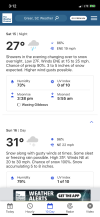

look at those dews to the NE!One more frame in the Nam would likely have had snow breaking out in North Georgia.View attachment 104565View attachment 104566View attachment 104567View attachment 104569
I don't think it is overdone...that's the problem! ???Even if she’s overdoing it, there’s wiggle room with those temps.
Sent from my iPhone using Tapatalk
iGRXY
Member
ICON coming in colder and further south.
Snowflowxxl
Member
If the NAM is even close to correct it gonna be hard to switch over to all rain if you start out frozen

