Shaggy
Member
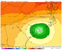
Clearly its how fast the high slides into the blocking position on the icon. A faster storm or slower H building in is what would make it shift back to its 18Z run positions.
I’m not sure when the last time that a hurricane made landfall in GA…it’s obviously rare due to the shape of the coastline, but this would certainly be a rare track2nd LF in Savannah as potentially a cat 1 again. Huge rainfall all over SC, NC, Georgia. This track would really increase the winds even more over our area.
Wait, how does this work? Friction from land helping consolidate, I’m interested in that….(Sorry if banter).I highly doubt you see any weakening over that small portion of Cuba. If anything the friction from land looks to be helping consolidated the eyewall and form the eye now.
Agreed and this is why I would not be suprised at all if the rain spread much further north in advance than what models are showing now. Remember what the radar looked like when Floyd’s eye was still east of Jacksonville, there was rain spread all the way up the east coast into New EnglandIf you want to see just how serious the rainfall with this thing is going to get. Just look at the current radar over Florida. Huge bands already rolling in from the interaction between Ian and the stalled front over central Florida. This trough is serious business and you can bet there’s going to be some big totals all along that from as it moves north.
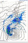
Are we really expecting a 1035mb high over NY in September?Wouldn't the GFS being weaker than reality miscalculate speed/direction though?
Are we really expecting a 1035mb high over NY in September?
Probably not that much. The GFS is still seeing it as a deep system.Wouldn't the GFS being weaker than reality miscalculate speed/direction though?