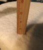
The coastal got going just in time to keep the back edge at bay for a while and even enhance it some. It's still moderate snow and measured 3". And yes plastered to everything definitely one of the most beautiful snows
-
Hello, please take a minute to check out our awesome content, contributed by the wonderful members of our community. We hope you'll add your own thoughts and opinions by making a free account!
You are using an out of date browser. It may not display this or other websites correctly.
You should upgrade or use an alternative browser.
You should upgrade or use an alternative browser.
Wintry February 19-21, 2020 Winter Storm
- Thread starter Six Mile Wx
- Start date
WxBlue
Meteorologist
2.7" on the ground now.
FFC actually mentions a few models showing possible light snow in Atl overnight in the SWS. Cause is "cold air rushing in over warm Lake Lanier"
Whom?A local TV Met bashing “social media” Mets tonight. Sad. I can’t recall any of the “better known” social media forecasters ever bash WRAL or TV Mets publicly. Sad to see someone use their platform and bring other down to raise themselves.
pcbjr
Member
2.9" more than I this year ... Good show!2.7" on the ground now.
GaSnowhound
Member
This is a great point. I used to really get frustrated w our locals here (Atl) and just like any profession some are better than others but honestly, snow in the south has to be one of the absolute most difficult forecasting scenarios. Esp if you’re in a major market.......I mean with all of the skill, science and technology in this world you’re still dealing w forces of nature which no human controls nor even 100% undesstands and as result no model can perfectly simulate. Yet, you’re tasked w making a forecast, that if inaccurate either causes unnecessary closings of businesses and public services that cost folks lots of $ and time. Or.....exposes public to potential safety issues and associated costs. Bottom line, even w best data available today it’s very very difficult to perfectly nail a snow forecast in SE US. Glad I don’t have to make those calls and grateful for those willing to put themselves out there for public scrutiny. It can’t be easy.I'm just not a fan of people going after the mets especially after a storm like this. A lot of people were heralding the NAM for days and showing off it's clown maps. Not much they can do when nearly every model shows accumulation, then an area gets little to none.
Was just going to ask the same.Whom?
pcbjr
Member
Love seeing this, especially for the midlands SC crew!

Lots of snow and ice reports around the Columbia area. What you guys seeing?
im switching between snow and sleetLots of snow and ice reports around the Columbia area. What you guys seeing?
Final snow summary for mby.
Got a rogue skinny band or 2 might come through for 5 minute snow shower. But we done with accums.
Had 3-6 fall today no doubt. Ended up about 2.25 best I can tell. Beatifull snow in the branches, etc.
Thought Nam did an oustanding job verse Globals espeacilly from 84 hours on in. Enjoyed the chase and hope Downeast,Shaggy, everyone to my east, Brickster, SD, Metwannabe etc keep it going, get some good lollipops.
Looks like we all got one more chase for next weekend into following week before the 6 month sweat season sets up shop.
Little over 2" and still coming down at a pretty good clip. Based on radar that looks like that will be it. Have about an inch of slush on my driveway and 0.5-1" of slush on my street. If it gets down to the mid-20's tonight it will be a sheet of ice in the morning.
I know out west Scotty Powell got a lot of complaints and had to apologize. He’s wrong more than right. Raysweather indirectly called him out on FB since their viewers overlap in the foothills. I’m not sure why Scotty thinks we need even more social media avenues when we got GSP, Blacksburg, Brad P, Raysweather and more. He’s hurting his reputation big time.Whom?
No thunder reports?
Rooting for a ULL wrecking ballMarch 1 if we cant get a triple phaser. Prob get screwed eitheir way, but worth the gamble
Rooting for a ULL wrecking ballMarch 1 if we cant get a triple phaser. Prob get screwed eitheir way, but worth the gamble
Nomanslandva
Member
Might get away with saying this now that things are calming down but you need to work less and play moreJust pulled in from work and got back on line ... only 1 thing to say ... Congratulations and job well done Folks ... ❄
 On topic, Wakefield said Emporia area had 3-4 so I bet some in NE NC did well.
LovingGulfLows
Member
- Joined
- Jan 5, 2017
- Messages
- 1,499
- Reaction score
- 4,100
Wpw look at the high pressure dominating nearly the entire CONUS. We could have a country wide fair weather day tomorrow.
I wonder when the last winter was when the 1st 2 somewhat widespread snowstorms of the season had AO’s of 3+ and 4+, respectively. That could easily be a first going back to the start of daily AO records in 1950. A strange winter, indeed!
Last edited:
pcbjr
Member
Oh I play ... it's called work and I love my sandbox ...Might get away with saying this now that things are calming down but you need to work less and play more
... and love weather so long as no one is hurt by it ... relish what y'all had/have today and tonight ... ?
Sctvman
Member
Ended up with just a dusting in Concord.
Took a drive around the area since I wanted to try my new WRX in the snow. There's definitely a lot of slushy spots out there in the areas where there's no running water and shady areas where the pavement didn't get a lot of radiation this afternoon. Also, there's some power outages up near Duke and some trees are bending down hanging over the roadway blocking some of the roads because of the heavy wet snow. They actually had one of the roads near Duke closed down.
Light snow continues, but it seems to be tapering off now.
Light snow continues, but it seems to be tapering off now.
STI or no? I had the 2002 WRX (I think that was the first year) and then had to trade it in for a CR-V when my son was born. WRX was fun to drive!Took a drive around the area since I wanted to try my new WRX in the snow. There's definitely a lot of slushy spots out there in the areas where there's no running water and shady areas where the pavement didn't get a lot of radiation this afternoon. Also, there's some power outages up near Duke and some trees are bending down hanging over the roadway blocking some of the roads because of the heavy wet snow. They actually had one of the roads near Duke closed down.
Light snow continues, but it seems to be tapering off now.
Oh, and still snowing pretty good. Around 2".
I'm about 25 miles south of Emporia and measured 3", probably a little more now, so that certainly seems accurate.Might get away with saying this now that things are calming down but you need to work less and play more
Nah, no STI. I cheaped out on paying the extra $10k for that, haha. The regular WRX is still a lot of fun to drive, though, and gets a little better gas mileage. And I like the WRX is a pretty practical car (4 doors, etc.) compared to most “sporty” cars out there. It’s my only car, so it needs to check a lot of boxes.STI or no? I had the 2002 WRX (I think that was the first year) and then had to trade it in for a CR-V when my son was born. WRX was fun to drive!
Oh, and still snowing pretty good. Around 2".
Yeah, latest HRR still wants to put nearly another 0.4” QPF down before the end here, though, so I’ll hug that. Looks like the accumulating snow will be done by 10, though (obviously not so further east).
On another note, moderate/heavy snow under the streetlights is so striking.
The HRRR’s depiction of the snow hanging around until around 10 looks about right. The 0.4” QPF may be about right, too. We certainly didn’t get 4” of snow, but we are also dealing with continuous melting, compaction, and likely subpar ratios (5:1?).
I wonder when the last winter was when the 1st 2 somewhat widespread snowstorms of the season had AO’s of 3+ and 4+, respectively. That could easily be a first going back to the start of daily AO records in 1950. A strange winter, indeed!
I forgot to mention this. Each of these 2 snowstorms will have happened (per GEFS AO forecast) exactly two days before the only two days on record (since 1950) with an AO of over +6! (Forecast has it exceeding +6 again on 2/22. It was over +6 for the first time ever on 2/10.)
4.5” Beech MTN, Watauga. 3” just west of Boone, NC. 1” Alleghany County NC. Dusting to half inch spots in Wilkes/Surry/Yadkin/Iredell with locally more in southern Wilkes on the brushy mtns.
Check out how it even accumulated on the wire of the fence imby. So cool to me

Sent from my SM-G950U using Tapatalk

Sent from my SM-G950U using Tapatalk
Webberweather53
Meteorologist
Snow tapering off here in SW Cumberland County, final total was just under 2/3rds of an inch (0.6”)
NCCWOP9077
Member
About 2 1/4 inches of snow here 3 mi north of Lucama, NC. Roads have a slushy buildup. Certainly a wet, gloppy snow but it sure is pretty. How sweet it is!

Sent from my SM-J727U using Tapatalk

Sent from my SM-J727U using Tapatalk
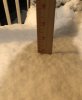
Measured some areas with 2 inches and some with 3 inches ... overall this was probably the wettest snow I’ve seen in a while.. stuck to literally everything in sight and you could pick it up and squish it a bit and an immediate snowball .. for this crappy winter this was an A+ event for me ... truly love seeing and tracking winter weather and it’s what got me into weather in the first place .. that’s why my inner weenie comes out a lot when tracking this type of stuff
Attachments
Sctvman
Member
You can see how quickly the precip has eroded here.
Dang, I thought you would do better there.Snow tapering off here in SW Cumberland County, final total was just under 2/3rds of an inch (0.6”)
Flurries/-SN here, but our accumulating snow is basically over. I would estimate around 2-2.5” here. I may try to measure later, but it’s kind of hard given how wet and variable it is from surface to surface.
Downeastnc
Member
Finally got some decent flake size and its straight ripping out there right now.....if it was colder I would have 6" by now easy......if I can somehow sustain the current band for a few hrs I will end up at 6 or better anyways its coming down hard....
Video doesnt do it justice....
Video doesnt do it justice....
Webberweather53
Meteorologist
Dang, I thought you would do better there.
Flurries/-SN here, but our accumulating snow is basically over. I would estimate around 2-2.5” here. I may try to measure later, but it’s kind of hard given how wet and variable it is from surface to surface.
Warmer temps definitely hurt us, spent so much time getting rained on and air temps in the mid 30s don't help.
Webberweather53
Meteorologist
Finally got some decent flake size and its straight ripping out there right now.....if it was colder I would have 6" by now easy......if I can somehow sustain the current band for a few hrs I will end up at 6 or better anyways its coming down hard....
Video doesnt do it justice....
Interesting, what are you up to exactly at the moment?
You can see how quickly the precip has eroded here.
Yeah, those back end flakes myrtle beach was suppose to get dried up fast. Looks like the 792 snowless streak continues
Downeastnc
Member
Interesting, what are you up to exactly at the moment?
hard to say, on the vehicles probably 4-5", in the yard 3-4" but its also packing down....looking at radar its tough to tell how much longer this will last...there appears to be some enhancement between RDU and Goldsboro that is moving into my area this may be what has caused my flake size to improve....the real question is how long does this last....if somehow we can squeeze 2-3 hrs of this kind of rate and flake size in then I think we got a legit chance at 6"+....just hard to say how how it plays out at this point, earlier the HRRR had the best rates etc from 10-2 so maybe thats what we are seeing....
WxBlue
Meteorologist
3.5" on my car. The snow is super wet and is compacting on itself.