droptines35758
Member
Sun is trying to come out in Athens now.
Talk about continental divide.


Looks like the cell is losing rotation.
Boundary seems to be stuckWinter time sun just doesn't have the heating like spring. Still barely hitting 60 degrees here
Sent from my Armor 9 using Tapatalk
Buffordwx said something about a storm rotating earlier. It never got warned thoughTornado in South Georgia earlier?
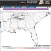
IEM LSR App
mesonet.agron.iastate.edu


Bainbridge, GA earlier


 Two little storms are trying, have they look on reflectivity.
That one near verona has a good signature. I didn't see which radar you were using or tilt but I'd say that's good enough for a warning for todays environment.View attachment 99746Two little storms are trying, have they look on reflectivity.
GWX, tilt1That one near verona has a good signature. I didn't see which radar you were using or tilt but I'd say that's good enough for a warning for todays environment.
Sent from my Armor 9 using Tapatalk
That has been the one of the two sticking points on the size of the event, the warm layer aloft and the relative lack of forcing . You can clearly see the cap here.Low level lapse rates aren’t that impressive, with at the most some 6-6.5C near that sfc boundary.
, I’m not saying this threat isn’t gonna happen but this setup isn’t really scaring me much, still definitely a threat tho, that cell that entered MS definitely is the most interesting one imo