-
Hello, please take a minute to check out our awesome content, contributed by the wonderful members of our community. We hope you'll add your own thoughts and opinions by making a free account!
You are using an out of date browser. It may not display this or other websites correctly.
You should upgrade or use an alternative browser.
You should upgrade or use an alternative browser.
Z
Zander98al
Guest
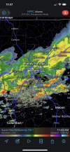
Lol I did some magic to it, jk my screen turned as I was screenshotingThe screen is sideways.
Z
Zander98al
Guest
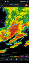
Severe warned nowHello….
Two mesos in that joker.
Last HRRR has this beast really wrapping up in the next hour. We are about to see if the HRRR and other CAMs are off their rocker.Severe warned now
VIL off the charts. Some good sized hail is failing.
Z
Zander98al
Guest
I’m gonna go ahead and say the CAMs were of their rocker.
Impressive supercell just SE of Billingsly.
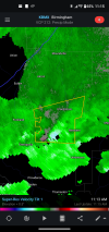
Edit: nice couplet on it now.
Edit: nice couplet on it now.
If we had stronger low level shear, we would be seeing a show.
Loganville Winter
Member
Shaking the whole house here in Loganville.
Z
Zander98al
Guest
Seems like Case closed on today's Alabama threat  lol
lol
BufordWX
Member
Z
Zander98al
Guest
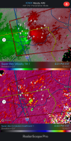
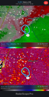
Strong coupletTornado OTG in southern GA. Colquitt county.View attachment 100014
NWMSGuy
Member
BufordWX
Member
That is what the CAMs were seeing. Everything from south AL into GA and SC is rotating in the upper levels.
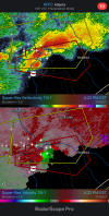
Strong gate to gate now.Looks like another on the ground.View attachment 100024
BufordWX
Member
@deltadog03Another warning now a little ways west of Macon.View attachment 100029
Z
Zander98al
Guest
Z
Zander98al
Guest
That's a bad tornado.
BufordWX
Member
BufordWX
Member
BufordWX
Member
Z
Zander98al
Guest
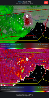
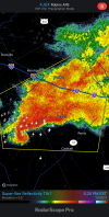
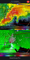
Got a donut hole on radar, may still be strengthening.Another decent circulation in southeast Georgia.View attachment 100075
Jessy89
Member

Meanwhile in northern Pickens county SC
Sent from my iPhone using Tapatalk

