Z
-
Hello, please take a minute to check out our awesome content, contributed by the wonderful members of our community. We hope you'll add your own thoughts and opinions by making a free account!
You are using an out of date browser. It may not display this or other websites correctly.
You should upgrade or use an alternative browser.
You should upgrade or use an alternative browser.
Z
Zander98al
Guest
Z
Zander98al
Guest
Z
Zander98al
Guest
Attachments
@Arcc what do you think of tomorrow nights event? Overproducer or dud lol?
Honestly, normally I would say a slight risk with this setup would suffice, but on the other hand the over producing event earlier this month has me spooked. Usually when setups over produce, they continue to over produce. This setup is giving me vibes of a setup in either February or March in 2019 when I didn’t think much of that little event which turned out to be a supercell fest. While thankfully the tornadoes were on the weaker side, one tracked within a half mile of my house.
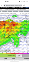
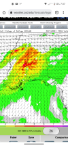
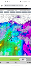
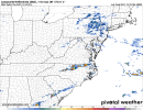
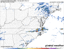
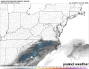
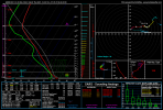
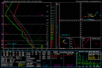
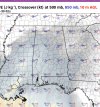
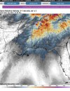
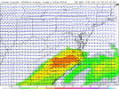
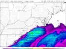
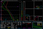
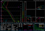
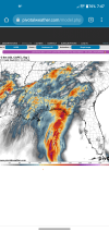
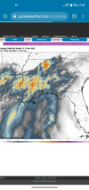
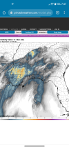
Much better directional shear in that top image.Update on tommorow. HRRR is doubling down on a more volatile setup. Cape now reaching around 2000 and over in central Alabama. Shear is looking a good bit better. With the surface low being more defined now than previously thought. A enchanced area is needed soon. View attachment 99589View attachment 99590View attachment 99591
Z
Zander98al
Guest
What makes me nervous is all the simulated radar showing tons of isolated kidney beans. I'm afraid it'll turn into a big event very quickly. And not many people will get much warning.Honestly, normally I would say a slight risk with this setup would suffice, but on the other hand the over producing event earlier this month has me spooked. Usually when setups over produce, they continue to over produce. This setup is giving me vibes of a setup in either February or March in 2019 when I didn’t think much of that little event which turned out to be a supercell fest. While thankfully the tornadoes were on the weaker side, one tracked within a half mile of my house.
Hpdb301
Member
I'm still seeing a cluttered mess down towards Birmingham and points south, which is a positive for the northern parts of Alabama. This seems to be the new common for these setups. Crap part is you never know until the day of, if it comes to fruition. If there is no development to the south, well... the north suffers the consequences, but we've been saved time and time again by it. Hopefully it can rain itself out for the folks to the south and spare the damage and loss of life.
Sent from my Armor 9 using Tapatalk
Sent from my Armor 9 using Tapatalk
Z
Zander98al
Guest
This event wensday 29th, shouldnt be too cluttered actually, (the new years one might be). There's a lot of dry air aloft. And not a strong cold front or forcing to get a bunch of precip going. This kinda reminds me of pop up summer showers. But with more dry air, and a bit more forcing lol.I'm still seeing a cluttered mess down towards Birmingham and points south, which is a positive for the northern parts of Alabama. This seems to be the new common for these setups. Crap part is you never know until the day of, if it comes to fruition. If there is no development to the south, well... the north suffers the consequences, but we've been saved time and time again by it. Hopefully it can rain itself out for the folks to the south and spare the damage and loss of life.
Sent from my Armor 9 using Tapatalk
Z
Zander98al
Guest
The interesting thing is. HRRR has shown some decent rotating updrafts along a boundary into Tennessee and Alabama. That may be the best axis for moisture and shear combo, but less of a renegade cell threat. Two main threat areas imo, the boundary to the north with less instability but a bit more shear and then to the immediate south with pop up confluence cells.This event wensday 29th, shouldnt be too cluttered actually, (the new years one might be). There's a lot of dry air aloft. And not a strong cold front or forcing to get a bunch of precip going. This kinda reminds me of pop up summer showers. But with more dry air, and a bit more forcing lol.
HSVweather
Member
Hpdb301
Member
Call it hopeful for the north Alabama area but, that screams southern clutter, cutting inflow and moisture return to the possibilities of storms to the north. Not a guarantee, but looks highly probable. I agree the atmospheric potential will be high in north Alabama, should the north pop before the southern fringes there are certainly possibilities for dangerous storms. Based off of past systems and some hope for the northern region, I'm going with the most significant event to the south. Not ruling out some svr storms to the north. My thoughts.... Certainly Stay weather aware, we will see soon enough! Stay safe everyone in the region!
Sent from my Armor 9 using Tapatalk
Sent from my Armor 9 using Tapatalk
NBAcentel
Member
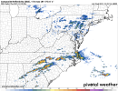
We got to get some sort of ice in winter timeThat’s a solid setup for Nc in December, especially for hail/damaging winds, a April look View attachment 99598View attachment 99599View attachment 99597View attachment 99600View attachment 99601
The ARW is wayyy more bullish on directional shear this run. Gonna look through the others.
Edit: the other WRF shows about the same as does the 3km NAM.
Edit: the other WRF shows about the same as does the 3km NAM.
Attachments
Last edited:
BufordWX
Member
I’m not sure how much stock to put into this, but this is interesting.
I’m not sure how much stock to put into this, but this is interesting.
That is concerning; it’s been pretty decent in the past. Looking through the WRFs, the best instability and shear line up pretty well with that bullseye and to the SW as the low level jet cranks just after dark. If convection could sustain itself, there could be a few hours of really dangerous weather in that area with sbcape of 1500-2000 and 0-1km helicity 250-300.
I’m not sure how much stock to put into this, but this is interesting.
FWIW, that same model was showing high parameters as well for the KY tornado outbreak.
Pretty significant changes with the Day 1 outlook.
Metro Atlanta and much of N. Georgia are now in the Slight Risk area. It has also been expanded westward to include all of S. Arkansas and the southern reaches of the area has been notably trimmed in AL / MS.
There's also an enhanced risk area with a 10% tornado risk area along the TN / MS / AL borders.
Last edited:
Darklordsuperstorm
Member
I’m not sure how much stock to put into this, but this is interesting.
That bullseye is sitting right on top of the mobile home community i live in
Z
Zander98al
Guest
Looks like that stupid thing I was talking about yesterday is coming to fruition. A sig tornado area needs to be put in on north Alabama. Updraft helicity has really taken off over the northern section of Alabama. Things may start rolling a few hours early in north Alabama as well.That is concerning; it’s been pretty decent in the past. Looking through the WRFs, the best instability and shear line up pretty well with that bullseye and to the SW as the low level jet cranks just after dark. If convection could sustain itself, there could be a few hours of really dangerous weather in that area with sbcape of 1500-2000 and 0-1km helicity 250-300.
Attachments
Hpdb301
Member
Yeah I just looked at that  my hopes for southern clutter has all but diminished with faster progression. Damn it.... Sure was hopeful. Still a chance but most southern activity is being booted to the east rapidly, leaving little to no blocking. Not looking good.
Sent from my Armor 9 using Tapatalk
 my hopes for southern clutter has all but diminished with faster progression. Damn it.... Sure was hopeful. Still a chance but most southern activity is being booted to the east rapidly, leaving little to no blocking. Not looking good.
Sent from my Armor 9 using Tapatalk
Z
Zander98al
Guest
09z hrrr is printing 400 1km srh helicity splotch in north Alabama through the afternoon . Wow.
Z
Zander98al
Guest
We may have a mini tornado spree in north Alabama today ?. Strongest tornado potential through the afternoon appears to be around a boundary in north Alabama
One thing to watch for is to see if the trend from last year continues with the threat verifying farther south than the models suggest.We may have a mini tornado spree in north Alabama today ?. Strongest tornado potential through the afternoon appears to be around a boundary in north Alabama
NBAcentel
Member
Hpdb301
Member
That was my thoughts until the latest model runs that seem to kick any southern convection off to the east leaving the north to soak up that southern stream. It's become the norm to get the convection further south and setup some blocking but the models backed off that trend. They never do a good job of depicting this phenomenon. In past if the hint at any development south and ahead of the system you can generally say it will fill in and rob the northern storms of instability. However, the last run appears to quickly rush any southern convection off to the east early leaving the primary system wide open for moisture transport north.. these are my thoughts and observations over the years and lack any scientific support. But the blocking from southern clutter has been a poorly forecasts phenomenon.
Sent from my Armor 9 using Tapatalk
Sent from my Armor 9 using Tapatalk
HRRR also has a nice line of storms that move through Wednesday night into early Thursday morning .. yummy
Z
Zander98al
Guest
HSVweather
Member
Latest nadocast has bullseye over Huntsville.
Z
Zander98al
Guest
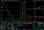
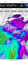
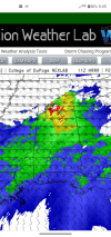
Probably a nasty hodo in that north Alabama region. SRH helicity in that region is screaming tornado threat. HRRR is starting to try and conjeal a semi convective line. But I doubt that will happen . The backing of the winds in north Alabama is phenomenal. 1000 cape will definetly suffice for a winter event. It may even push into 1500 cape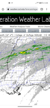


Attachments
Z
Zander98al
Guest
Potential for a strong/violent tornado is there in central north Alabama.
That tornado model is very good…likely gonna see a brief tornado across southern NC maybe Charlotte points west either late tonight and also later this week. Clouds are screaming fast overhead Wilkesboro this morning. It felt like Myrtle Beach early this morning with the wind in the foothills.
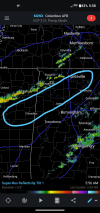
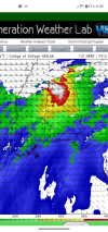
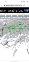
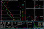
Meso low forms over MS and tracks into AL significantly backing low level winds.Probably a nasty hodo in that north Alabama region. SRH helicity in that region is screaming tornado threat. HRRR is starting to try and conjeal a semi convective line. But I doubt that will happen . The backing of the winds in north Alabama is phenomenal. 1000 cape will definetly suffice for a winter event. It may even push into 1500 capeView attachment 99621View attachment 99622View attachment 99623
Z
Zander98al
Guest
Id be shocked at this point if a hatched area isn't added over north Alabama. Don't you just love mesoscale features lol..Meso low forms over MS and tracks into AL significantly backing low level winds.
View attachment 99625
Z
Zander98al
Guest
NBAcentel
Member
Z

