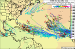
Duly noted! Still early but could be a bust or a peak to late bloomer! I laugh at the social media posts that declare it’s over. We haven’t even hit peak season! Not that I’m not wishing a landfall as I’ve lived through a few and the aftermath sucks but something to track would be nice!Yeah I get it. Weather is the weather, and not an exact science. And maybe September picks up big time. But so far this one's just an epic fail, not sure how you get around it. If you publish and make public a scientific meteorological prediction (and it's done every year mind you) and it turns out to be the exact opposite, like polar opposites of the forecast....well it's just a funny fail that's all. Like all the "you had one job" memes. I get a kick out of those. Long range forecasting is really just entertainment for every season and I'm not really sure why it's published and given to the public at all. Just my opinion.
-
Hello, please take a minute to check out our awesome content, contributed by the wonderful members of our community. We hope you'll add your own thoughts and opinions by making a free account!
You are using an out of date browser. It may not display this or other websites correctly.
You should upgrade or use an alternative browser.
You should upgrade or use an alternative browser.
Tropical 2022 Atlantic Hurricane Season thread
- Thread starter Snowfan
- Start date
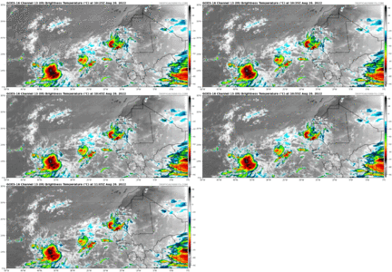
Want be much longer now. Blobs growing:


smast16
Member
We've not had a storm since, so i'm updating, we are now at the point we need to have more than 1 storm every 4 days to reach that target.Wait... To have 15 more storms from August 15 (probably not much starting before this date) to say October 15 (realistic end) we would need to have one storm FORM every 4 days to reach that number. Seems a tad high, and I doubt we see an 'O' storm.
I'm not saying the season is doomed and blah blah, but I am doubting it's THAT active.
Taylor C
Member
There are a lot of strong prospects on satellite.
I wouldn't be surprised to see a flurry of activity in the next 7 days followed by a dead period with another round of activity in the day 15-21 period
NoSnowATL
Member
Day 45-52 looks promising.I wouldn't be surprised to see a flurry of activity in the next 7 days followed by a dead period with another round of activity in the day 15-21 period
Gulf/carribbean look interesting in that time frameDay 45-52 looks promising.
Brent
Member
The GFS is all over the place with that day 10 storm... Today's runs yeah not so good
Shaggy
Member
At this point I revert back to only caring about 144 hrs and under. It's clear the models are pretty inconsistent after that time so anything beyond that is just good to look at for fun.The GFS is all over the place with that day 10 storm... Today's runs yeah not so good
Brent
Member
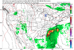
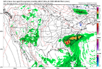
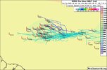
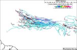
Looks good to me! But, it’s the 18Z GFSView attachment 120925View attachment 120924
Different storm. The original one goes into Mexico now
lizajane
Member
I'm just waiting to see if both farmers almanacs are right.
Brent
Member
I'm just waiting to see if both farmers almanacs are right.
What did that say.
The wave just off Africa is looking hot right now
It aint gonna fish /ots thats for sure. Low rider track.What did that say.
The wave just off Africa is looking hot right now
accu35
Member
0z coming in further north with Icon/gfs
Taylor C
Member
Good morning Atlantic, I see you remain active with persistent area of thunderstorms. More time and favorable conditions are ahead for you to become something more.
Watching IR Loop, things are really starting to change. This wave in eastern Atlantic is really getting its act together more an more as we've been all noting , pointing out since yesterday. Ill be very surprised if this doesn't manage to get a circulation down to the surface and spin up into the next named storm here soon.


Last edited:
Season cancel.
Season cancel.
Absolutely.
Season cancel.
Yeah, his pattern recognition, is second to none! Especially in winter! ?
Brent
Member
Taylor C
Member
Would be nice to get the area listed as an Invest.
Shaggy
Member
That east Atlantic wave is looking better and better
Tornadocane
Member
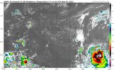
This wave at 35W might be the one to watch. I wouldn't be surprised to see the models pick up on it as it looks to be organizing while it pulls away from this weird east Atlantic Gyre/Blocky Pattern. In addition to the strong convection and vigorous mid-level spin, it does look like energy is coalescing around that area. It's breathing. https://www.tropicaltidbits.com/sat/satlooper.php?region=catl&product=ir
It looks like the Atlantic is starting to get interesting. I'm definitely staying up for the 00z suite tonight.
It looks like the Atlantic is starting to get interesting. I'm definitely staying up for the 00z suite tonight.
Shaggy
Member
I wouldn't be surprised if it's an invest by noon tomorrow.This wave at 35W might be the one to watch. I wouldn't be surprised to see the models pick up on it as it looks to be organizing while it pulls away from this weird east Atlantic Gyre/Blocky Pattern. In addition to the strong convection and vigorous mid-level spin, it does look like energy is coalescing around that area. It's breathing. https://www.tropicaltidbits.com/sat/satlooper.php?region=catl&product=ir
It looks like the Atlantic is starting to get interesting. I'm definitely staying up for the 00z suite tonight.
Tornadocane
Member
I wouldn't be surprised if it's an invest by noon tomorrow.
If it continues to produce strong convection as it moves west and wrap those vorticities at varying levels, I wouldn't be surprised if the NHC mentions it tomorrow morning. It could just be shear and a mid-level spin playing some tricks, but it kind of looks like there's a pocket of low shear where the vorticities are attempting to merge.
Tornadocane
Member
Tornadocane
Member
Brent
Member
accu35
Member
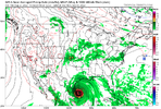
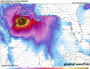
I do not like these north trends0z GFS has the massive Gulf hurricane backView attachment 120953
Tornadocane
Member
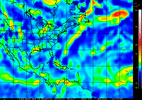
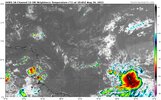
It was one of those nights where I only slept for 4 hours, because I'm super-excited about tracking a storm. Our Tropical Wave in the Central Atlantic has made substantial improvements overnight. Although the system still looks stretched, vorticity has become more stacked and vigorous from 500Mb to 925Mb. Vorticity Map clearly shows the SW area of the system taking control. https://tropic.ssec.wisc.edu/real-time/windmain.php?&basin=atlantic&sat=wg8&prod=vor5&zoom=&time=
This systems has the potential to be a monster once it passes 40W. I'm not surprised the GFS and ECMWF, as well as increasing members of their ensembles, are both developing this system.
This systems has the potential to be a monster once it passes 40W. I'm not surprised the GFS and ECMWF, as well as increasing members of their ensembles, are both developing this system.

Tornadocane
Member
BHS1975
Member
What's with the GFS popping a low out of nowhere taking this ots?
lexxnchloe
Member
The euro appears much more interesting.It was one of those nights where I only slept for 4 hours, because I'm super-excited about tracking a storm. Our Tropical Wave in the Central Atlantic has made substantial improvements overnight. Although the system still looks stretched, vorticity has become more stacked and vigorous from 500Mb to 925Mb. Vorticity Map clearly shows the SW area of the system taking control. https://tropic.ssec.wisc.edu/real-time/windmain.php?&basin=atlantic&sat=wg8&prod=vor5&zoom=&time=
This systems has the potential to be a monster once it passes 40W. I'm not surprised the GFS and ECMWF, as well as increasing members of their ensembles, are both developing this system.
View attachment 120956
BHS1975
Member
Yeah the gfs has been all over the place.The euro appears much more interesting.
Shaggy
Member
I think if this holds on to the convection through dmin then it is gonna get an invest and a increase km probabilities from the NHC
Tornadocane
Member
They're paying attention that's for sureI have it saved in a folder. LOL. I bet the Puerto Rico NWS Office is already concerned about that scenario. The EURO has a few Irma scenarios, but the GFS thinks it will be more like Maria.
View attachment 120960
Although ECMWF and GFS have some
discrepancies with the time of the arrival and the intensity of a
tropical cyclone, both guidances are now suggesting a tropical
cyclone near the region by the weekend.

