Yep this one is coming I think the last big hurrah for the USA...could be a major hit for Florida
-
Hello, please take a minute to check out our awesome content, contributed by the wonderful members of our community. We hope you'll add your own thoughts and opinions by making a free account!
You are using an out of date browser. It may not display this or other websites correctly.
You should upgrade or use an alternative browser.
You should upgrade or use an alternative browser.
Tropical 2020 Atlantic Hurricane Season Discussion
- Thread starter Snowfan
- Start date
Henry2326
Member
18z GFS.....third run in a row with similar path although this run much much weaker.....

Henry2326
Member
Henry2326
Member
Is Paulette still out there west of the Canary Islands?
Henry2326
Member
Tornadocane
Member
That escalated quickly. So the 18z GFS has the first storm interacting with front in a manner that would impact South Florida with some convective bands within 4 days? Thanks 2020.
Henry2326
Member
06z GFS.....washed them all out....no land interaction......Euro shows nothing

Henry2326
Member

Henry2326
Member
00z Icon flushes the first before it can get in the gulf....2nd one waiting.

Henry2326
Member
00z GFS Para.....lord a moses......6 lows moving around. Nothing really substantial (except for 1 that dies off) with any of them but something for everyone throughout the gulf and eastern coastline to watch.
It reminds me of the finale of a fireworks show.
It reminds me of the finale of a fireworks show.
Henry2326
Member
accu35
Member
Nothing excites me with the tropics, gulf is destroying it all
Whereas the 0Z EPS had only ~7 sub 1000 mb Gulf storms from the two waves, the 12Z EPS has ~13 (25%) sub 1000 mb storms. Most of the geneses are by 10/8. 3 sub 1000 hit LA and 5 sub 1000 hit the area from the FL Panhandle to Big Bend making that area the highest risk on this run. Climo suggests 2 areas at highest risk of landfall from storms that form in the W Caribbean or Gulf in early Oct: S FL and the Gulf coast from LA east to the FL Big Bend. This run is suggesting the Gulf coast area may be at highest risk this year, but that’s just speculation based on this run.
However, though just speculation, the 12Z GEFS sort of agrees regarding sub 1000 mb landfalls from its 31 members with 2 TX, 7 LA to FL Big Bend, and 2 SW FL.
The importance of these runs is that this implies a not so small chance that there will be a N Gulf coast landfall that will subsequently significantly affect many of the well inland active members here at some point, most likely within or near 10/10-14. If anyone here is planning on outdoor activities around 10/10-14, you probably should monitor the tropics extra carefully. To add to this, history shows that in or near that period has had many times when the SE had significant inland effects from earlier Gulf landfalls.
Members in well inland places like Birmingham, Atlanta, Columbia, the Gainesvilles, and Raleigh among others would be well advised to monitor the tropics for potential significant effects from an earlier Gulf coast landfalling TC. It isn’t just the coasts that could be significantly affected.
Last edited:
Henry2326
Member
12z Para
Good times.....

Good times.....
This isn't from TD 25 but rather is from the followup system now in the Caribbean. it is the CMC so it is just fwiw. But the trend of model consensus has been for the N Gulf to be at highest risk, which would have significant implications for many on here for some point most likely within 10/10-14 as stated yesterday:

Tornadocane
Member
This LLC is clearly open or greatly elongated to the N or NW side as I can see it on Visible Satellite to the NW of the deep convection. I don't think the upper level low is over the storm right now, and the LLC is going to get blasted with greater shear the further west or NW it goes.
Tornadocane
Member
This isn't from TD 25 but rather is from the followup system now in the Caribbean. it is the CMC so it is just fwiw. But the trend of model consensus has been for the N Gulf to be at highest risk, which would have significant implications for many on here for some point most likely within 10/10-14 as stated yesterday:
View attachment 49674
I have to completely agree with the CMC depiction of events, because it's current placement of the ULAC to East of TD25 looks the most correct right now. The GFS has the ULAC over 25, but that just isn't the case anymore.
Dawgdaze22
Member
Wait is Florida still in play for TD25 and the following wave?
Sent from my iPhone using Tapatalk
Sent from my iPhone using Tapatalk
Wait is Florida still in play for TD25 and the following wave?
Sent from my iPhone using Tapatalk
Yes, with the Panhandle to Big Bend seemingly at highest risk for FL per models.
The model consensus is continuing to suggest that the N Gulf coast is at highest risk from a landfall from the follow-up system to TD 25, currently in the E. Caribbean, which would later likely lead to strong effects for many forum members well inland within 10/10-15.
Here are two Gulf SST maps to show how much warmer it was with Michael's approach in 2018 vs now:
October 5, 2018: N Gulf all the way to the coast was 29-30 C (near 29C at the coast) or near an early Oct. record of ~85 F thanks to record SE US heat the prior two weeks. Note that SSTs off of SW FL were also near 29-30 C (~85 F):

In sharp contrast for the N Gulf, the October 1, 2020 map shows SSTs mainly in the 26-28 C range (near 26 C at the coast) or an average near 81 F meaning ~4 F cooler than it was on Michael's approach. And if anything, they'll likely cool down over the next week due to a cool next few days. So, if there were a H approaching the N Gulf coast in about a week, it would be traveling over much cooler water vs what Michael encountered as it approached the coast. Therefore, whereas there could still be a formidable H hitting the N Gulf coast and it be a big deal there and inland, the chance of it being anything near as strong as the historic Michael is between slim and none.
However, if a H were to approach SW FL south of Ft. Myers, where SSTs are 29-30 C, the fuel would be about the same as that of 2018 and the W Caribbean is actually ~ 2 F warmer at 30-31 C instead of 29-30 C:

Here are two Gulf SST maps to show how much warmer it was with Michael's approach in 2018 vs now:
October 5, 2018: N Gulf all the way to the coast was 29-30 C (near 29C at the coast) or near an early Oct. record of ~85 F thanks to record SE US heat the prior two weeks. Note that SSTs off of SW FL were also near 29-30 C (~85 F):
In sharp contrast for the N Gulf, the October 1, 2020 map shows SSTs mainly in the 26-28 C range (near 26 C at the coast) or an average near 81 F meaning ~4 F cooler than it was on Michael's approach. And if anything, they'll likely cool down over the next week due to a cool next few days. So, if there were a H approaching the N Gulf coast in about a week, it would be traveling over much cooler water vs what Michael encountered as it approached the coast. Therefore, whereas there could still be a formidable H hitting the N Gulf coast and it be a big deal there and inland, the chance of it being anything near as strong as the historic Michael is between slim and none.
However, if a H were to approach SW FL south of Ft. Myers, where SSTs are 29-30 C, the fuel would be about the same as that of 2018 and the W Caribbean is actually ~ 2 F warmer at 30-31 C instead of 29-30 C:
Last edited:
The 12Z EPS is pretty active and has these 8 sub 1,000 mb CONUS hits out of 51 members with a * indicating H strength:
1. Tampa, FL 10/10
*2. SE LA 10/10
3. SE LA 10/10
4. FL Panhandle 10/12
*5. LA 10/12
*6. LA 10/13
*7. FL Big Bend 10/14
8. Galveston, TX 10/17

1. Tampa, FL 10/10
*2. SE LA 10/10
3. SE LA 10/10
4. FL Panhandle 10/12
*5. LA 10/12
*6. LA 10/13
*7. FL Big Bend 10/14
8. Galveston, TX 10/17
BHS1975
Member
The model consensus is continuing to suggest that the N Gulf coast is at highest risk from a landfall from the follow-up system to TD 25, currently in the E. Caribbean, which would later likely lead to strong effects for many forum members well inland within 10/10-15.
Here are two Gulf SST maps to show how much warmer it was with Michael's approach in 2018 vs now:
October 5, 2018: N Gulf all the way to the coast was 29-30 C (near 29C at the coast) or near an early Oct. record of ~85 F thanks to record SE US heat the prior two weeks. Note that SSTs off of SW FL were also near 29-30 C (~85 F):
In sharp contrast for the N Gulf, the October 1, 2020 map shows SSTs mainly in the 26-28 C range (near 26 C at the coast) or an average near 81 F meaning ~4 F cooler than it was on Michael's approach. And if anything, they'll likely cool down over the next week due to a cool next few days. So, if there were a H approaching the N Gulf coast in about a week, it would be traveling over much cooler water vs what Michael encountered as it approached the coast. Therefore, whereas there could still be a formidable H hitting the N Gulf coast and it be a big deal there and inland, the chance of it being anything near as strong as the historic Michael is between slim and none.
However, if a H were to approach SW FL south of Ft. Myers, where SSTs are 29-30 C, the fuel would be about the same as that of 2018 and the W Caribbean is actually ~ 2 F warmer at 30-31 C instead of 29-30 C:
Wow the Caribbean is on fire this year and virtually untouched.
Sent from my iPhone using Tapatalk
For the E Car wave: About the most ominous run yet of GEFS for CONUS is 18Z with 14 TS+ hits of 31 members with 2 of these appearing to be from a followup:
* = H
*FL Big Bend 10/9
*SE LA 10/9
SE LA 10/10
SE LA 10/10
*AL 10/10
*LA 10/10
*AL 10/11
*FL {Pan} 10/11
FL (TPA) 10/11
MS 10/12
*TX 10/13
TX 10/14
From followup:
*SE FL 10/14
*SE LA 10/15
* = H
*FL Big Bend 10/9
*SE LA 10/9
SE LA 10/10
SE LA 10/10
*AL 10/10
*LA 10/10
*AL 10/11
*FL {Pan} 10/11
FL (TPA) 10/11
MS 10/12
*TX 10/13
TX 10/14
From followup:
*SE FL 10/14
*SE LA 10/15
Brent
Member
GFS takes the one behind Gamma into Louisiana but is very weak

CMC into the Panhandle

The Euro never gets out of the Southern Gulf it just hangs out there til it dies

CMC into the Panhandle
The Euro never gets out of the Southern Gulf it just hangs out there til it dies
Last edited:
BufordWX
Member
This map is getting busy again...
Henry2326
Member


Here is the 12Z GEFS. Check out the W Caribbean!

Look at the progged rainfall from these active members! Arguably, this is as strong a long range signal as any yet from the W Caribbean! So, it looks like we MAY get a 3rd Oct W Car TC. When I get time, I'd like to find the years that had 3+ in Oct.

Climo would very strongly favor anything developing there that late (10/17-19) to recurve either over or east of FL per this:

Look at the progged rainfall from these active members! Arguably, this is as strong a long range signal as any yet from the W Caribbean! So, it looks like we MAY get a 3rd Oct W Car TC. When I get time, I'd like to find the years that had 3+ in Oct.
Climo would very strongly favor anything developing there that late (10/17-19) to recurve either over or east of FL per this:
Henry2326
Member
12z Icon and CMC look out to Oct 13/14.....End of run for Icon but CMC strengthens it and takes it northwest.


Henry2326
Member
GEFS has a signal in 10-15 days in western Car.


lexxnchloe
Member

BufordWX
Member
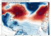
NHC monitoring a new area of interest in the eastern Atlantic. Correct me if I am wrong, but I don’t think we usually see them this far east this time of year.
Brent
Member
NHC monitoring a new area of interest in the eastern Atlantic. Correct me if I am wrong, but I don’t think we usually see them this far east this time of year.View attachment 49961
Wonder if it's gonna be another one in the Caribbean
Henry2326
Member
12z Icon places it here on Oct 15.....GFS is in a similar spot at that time too. CMC is riding further north.Wonder if it's gonna be another one in the Caribbean
Icon and CMC have been giving this signal for a couple days now.
The signal appears to want to pull it north.....so possibly an east coast risk.

Henry2326
Member
I think the EPS is on holiday....


BufordWX
Member

Henry2326
Member
Some development on GFS para (10/20) for storm crossing MDR. Later in the run it pulls northeast. Euro and Icon put an undeveloped wave traveling in the same direction on earlier dates.


Henry2326
Member


Henry2326
Member

Henry2326
Member