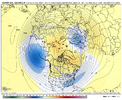
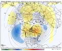
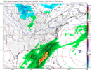
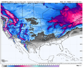
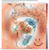
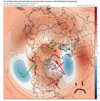
Don’t these literally show this every year lol. I feel like I see this same Extended control map every year.The GEFS Extended Control says samesies.
View attachment 139229
-
Hello, please take a minute to check out our awesome content, contributed by the wonderful members of our community. We hope you'll add your own thoughts and opinions by making a free account!
You are using an out of date browser. It may not display this or other websites correctly.
You should upgrade or use an alternative browser.
You should upgrade or use an alternative browser.
Wintry Winter Discussion 2023/24
- Thread starter Rain Cold
- Start date
Iceagewhereartthou
Member
12z CFS says hang in there. Webbs forecast works out exactly as planned. Only about 29-30 days away.
View attachment 139228
Those are beautiful! I appreciate the positivity and hope they work out but looking to 30 day maps to make ourselves feel better doesn't make me feel better.The GEFS Extended Control says samesies.
View attachment 139229
But then again I'll take my 8-10!
Webberweather53
Meteorologist
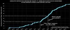
Here's the same CDF graph I made yesterday, but now for our neighbors to the north in the mid-Atlantic states.
The backloaded trend is even more prominent there.
A whopping 75% of major snowstorms from south-central VA to NYC occur after January 20th during moderate-strong Nino winters.
View attachment 139230
That is a crazy dead period from Dec 20 to around Jan 2nd.
Southern Track
Member
Thought this was interesting from a historical perspective:
"The single largest snowfall in South Carolina history, when measured over a one-day period, occurred on February 15, 1902, in Greenville County, and on February 10, 1973, in both Dorchester and Aiken Counties, with each event recording 15 inches of snow【6†source】. For a longer duration, the biggest snowfall on record in South Carolina was in Greenville County, with a three-day total of 2 feet, 4.9 inches on February 18, 1969【7†source】. Additionally, during the great Blizzard of 1973, which started on February 9th and lasted three full days, the midlands of South Carolina were hardest hit, receiving an overwhelming 24 inches of snow【8†source】."
I guess I'm implying that the largest snowfall from a one-day period and overall largest snowfall in South Carolina were both in February.
Last edited:
The weekly polar vortex novel.
Webberweather53
Meteorologist
Somebody in the deep south will see flakes by the end of January. Such a shame there's a few small lows trying to pop next week. Really could have been 2010 again if the cold was there. Oh well keep the faith guys.
Its like 3 taking perfect tracks next 10 days, energy so strung out, but the surface cold is meh, despite good 850s. Be watching Jan 12th time frame, see if this has legs. What we need to flush out all this pac jet soupy airmass off NA. This would not only do that, but cover canada,lakes,midwest with a snowpack. Fits the bill of webbs timetable, kinda kick start the progression.Somebody in the deep south will see flakes by the end of January. Such a shame there's a few small lows trying to pop next week. Really could have been 2010 again if the cold was there. Oh well keep the faith guys.
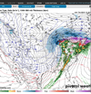
Agree 100% man. I've been watching the period around the 12th. Ole goofy has been decent this year at sniffing out big lows in the LR.Its like 3 taking perfect tracks next 10 days, energy so strung out, but the surface cold is meh, despite good 850s. Be watching Jan 12th time frame, see if this has legs. What we need to flush out all this pac jet soupy airmass off NA. This would not only do that, but cover canada,lakes,midwest with a snowpack. Fits the bill of webbs timetable, kinda kick start the progression.
View attachment 139235
LukeBarrette
im north of 90% of people on here so yeah
Meteorology Student
Member
2024 Supporter
2017-2023 Supporter
LukeBarrette
im north of 90% of people on here so yeah
Meteorology Student
Member
2024 Supporter
2017-2023 Supporter
View attachment 139242
View attachment 139243
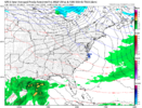
That’s quite the change in the northern stream energy on the GFS for the Jan 7th threat. Goes from nothing to a New England snowstorm. With that type of trend it makes me wonder if we can get a piece of this system as well
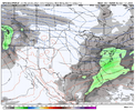
Plenty of time to make this work
ATLwxfan
Member
Somebody in the deep south will see flakes by the end of January. Such a shame there's a few small lows trying to pop next week. Really could have been 2010 again if the cold was there. Oh well keep the faith guys.
The mountains of north GA will absolutely score.
Sent from my iPhone using Tapatalk
accu35
Member
Webb said we can probably sneak one in before the climo. So there’s a chance something could happen for us before his prediction. Just going by what he said.
W
WSW
Guest
?Webb said we can probably sneak one in before the climo. So there’s a chance something could happen for us before his prediction. Just going by what he said.
The ole Lucy pulls the football trick. Reversal getting less likely in the short term in each of the past three runs.


Itryatgolf
Member
SnowNiner
Member
The ole Lucy pulls the football trick. Reversal getting less likely in the short term in each of the past three runs.

Absolute unicorn anyway IMO. Just keep the vortex weak and disturbed and that'll be fine for us.
I agree completely and with the AO about to go into to the tank it should stay quite weak. I’ve gotten to look at SSWE’s as a great bonus and a way to shake up things against climo… like what happened in the late January 2009 event, but when the climo of a Nino says that our best chances of winter weather occurs after 1/20, I don’t think it would make much of a difference.Absolute unicorn anyway IMO. Just keep the vortex weak and disturbed and that'll be fine for us.
- Joined
- Jan 5, 2017
- Messages
- 3,771
- Reaction score
- 5,974
That's ok. February is planting month and I need to build a fence around my garden. Maples will be in full bloom by 3rd week in February, too. I'm done chasing snow after the first week in Feb.
Cad Wedge NC
Member
Didn't realize GA was in the tropics now.That's ok. February is planting month and I need to build a fence around my garden. Maples will be in full bloom by 3rd week in February, too. I'm done chasing snow after the first week in Feb.
Drizzle Snizzle
Member
GA is subtropicsDidn't realize GA was in the tropics now.
- Joined
- Jan 23, 2021
- Messages
- 4,602
- Reaction score
- 15,197
- Location
- Lebanon Township, Durham County NC
Now that I am home, I have some stats in front of me that are valid for KCLT. There's been five winters(at least since official recordkeeping began in 1878-1879) where there has been no snow through Nov/Dec/Jan:
1900-1901 - 1"
1910-1911 - 0.1"
1923-1924 - 4.7"
2011-2012 - T
2014-2015 - 3"
2022-2023 - 0"
So as you can tell, there's only one even close to normal winter in the entire mix.
1900-1901 - 1"
1910-1911 - 0.1"
1923-1924 - 4.7"
2011-2012 - T
2014-2015 - 3"
2022-2023 - 0"
So as you can tell, there's only one even close to normal winter in the entire mix.
tennessee storm
Member
I like to give it bout February 17 …. Been my cutoff date chasing winter storms for my area … then bring on my spring severe weather ….That's ok. February is planting month and I need to build a fence around my garden. Maples will be in full bloom by 3rd week in February, too. I'm done chasing snow after the first week in Feb.
- Joined
- Jan 5, 2017
- Messages
- 3,771
- Reaction score
- 5,974
Yes, the planting zones moved up, 7b to 8a in my area.GA is subtropics
Heelyes
Member
Good thing Jan hasn't started yet.Now that I am home, I have some stats in front of me that are valid for KCLT. There's been five winters(at least since official recordkeeping began in 1878-1879) where there has been no snow through Nov/Dec/Jan:
1900-1901 - 1"
1910-1911 - 0.1"
1923-1924 - 4.7"
2011-2012 - T
2014-2015 - 3"
2022-2023 - 0"
So as you can tell, there's only one even close to normal winter in the entire mix.
- Joined
- Jan 23, 2021
- Messages
- 4,602
- Reaction score
- 15,197
- Location
- Lebanon Township, Durham County NC
That's true but it does seem important to get on the board in january.Good thing Jan hasn't started yet.
Heelyes
Member
How much better are the odds if we get a dusting??That's true but it does seem important to get on the board in january.
You must be planting greens. That’s too early to even plant potatoes. I’m not that much north of you and my ground takes until early May usually to be warm enough for most summer plants. I wasted a lot of rotten corn and okra seeds to discover that.That's ok. February is planting month and I need to build a fence around my garden. Maples will be in full bloom by 3rd week in February, too. I'm done chasing snow after the first week in Feb.
tennessee storm
Member
January is fixing be on the clock ….Good thing Jan hasn't started yet.
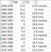
Great stats but doesn't really seem to strongly support ninos mean fab febs a whole lot. Seems to be a mixed bag. 6-ninos, 4-neuts, 3-ninas
I don't have a site that has pre 1950 enso data if someone does I'll expand the windowGreat stats but doesn't really seem to strongly support ninos mean fab febs a whole lot. Seems to be a mixed bag. 6-ninos, 4-neuts, 3-ninas
- Joined
- Jan 5, 2017
- Messages
- 3,771
- Reaction score
- 5,974
Yes, cool season veggies. You can usually get a crop in before it gets too warm in late spring. They bolt and then we can harvest the seed.You must be planting greens. That’s too early to even plant potatoes. I’m not that much north of you and my ground takes until early May usually to be warm enough for most summer plants. I wasted a lot of rotten corn and okra seeds to discover that.
Your list is missing 1999-2000
LukeBarrette
im north of 90% of people on here so yeah
Meteorology Student
Member
2024 Supporter
2017-2023 Supporter
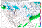
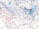
Way out in fantasyland but this the exact progression that everyone needs to hope for in terms of the West Coast trough dump. As systems slide SW to NE that cold slowly progresses east. Then as that cold gets in position hope for a wave to slide through and board wide hit becomes possible. Just have to endure a rainy and warm ridge to get to it.
I usually overwinter some garlic. I’ve grown greens but never tried seed saving. I need to do that.Yes, cool season veggies. You can usually get a crop in before it gets too warm in late spring. They bolt and then we can harvest the seed.
The surface look one day farther would be encouraging:View attachment 139349
Way out in fantasyland but this the exact progression that everyone needs to hope for in terms of the West Coast trough dump. As systems slide SW to NE that cold slowly progresses east. Then as that cold gets in position hope for a wave to slide through and board wide hit becomes possible. Just have to endure a rainy and warm ridge to get to it.
Cad Wedge NC
Member
So, what we gather from the data is this, if it doesn't snow in January, then February and March are off the table as well. Interesting that Webber is going against data that is 150 years old. Bet he is banking on us getting some snow that last week in January.Now that I am home, I have some stats in front of me that are valid for KCLT. There's been five winters(at least since official recordkeeping began in 1878-1879) where there has been no snow through Nov/Dec/Jan:
1900-1901 - 1"
1910-1911 - 0.1"
1923-1924 - 4.7"
2011-2012 - T
2014-2015 - 3"
2022-2023 - 0"
So as you can tell, there's only one even close to normal winter in the entire mix.

