• Hello, please take a minute to check out our awesome content, contributed by the wonderful members of our community. We hope you'll add your own thoughts and opinions by making a free account!

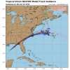
Tropical Tropical Storm Nestor

60 mph and no designation other than PTC still. I think this is a record or ties one. And lol at the wishcasting this east. I know I'm no better saying west, but we need it here. Bring it NW!

I think they held up because the LLC is elongated and the storm is extremely lopsided....recon is not finding a well defined LLC, they will pull the trigger at 5 if the LLC can tighten up.......

recon_NOAA2-0316A-PTC16.png
 
I think they held up because the LLC is elongated and the storm is extremely lopsided....recon is not finding a well defined LLC, they will pull the trigger at 5 if the LLC can tighten up.......

yep. Time is running out to see it fully tropical. The ULL trough to the NW is starting to interact with the system now. By 8PM tonight the HRRR has that blob dying and the ULL stacking into a broad system.

Here you can see the blob die to the east and the storm pull up under that trough. It will probably still be tropical in nature though.

The less tropical it is the better for rain. It will be much more spread out.

3.gif

Here you can see the "transition" or whatever you want to call it already well on its way. That blob's hours are numbered!

5.png
 
60 mph and no designation other than PTC still. I think this is a record or ties one. And lol at the wishcasting this east. I know I'm no better saying west, but we need it here. Bring it NW!

Yeah its a pretty unique setup. Wind is just one criteria though! NHC has it right. I could see this being problematic for the public though. Potential Tropical Cyclone 16 doesn't have the same ring to it haha.
 
Still hugging the 3k NAM!!3CF742E0-A9F9-4579-AEFD-65F2B25DBF32.png6022891A-FBE5-4F27-B0C1-F8CD6F40CDFD.png
 
So if or when it becomes a name system, it would go straight to a strong TS?
 
Its gonna be sometime this afternoon if it's going to become tropical. If not as it gets closer to land I have to think they'll name it as a subtropical storm.
 
Definitely interesting to have a 60 MPH storm that is not named.

Guess the Gulf can call this their little own "Gulf-easter" (although this will eventually go straight to Nestor).

I get it though. Looks decent on IR but the circulation still seems broad.
Gulf Easter? Lol. You must got that off TWC, because that's what the guy on there is calling it
 
Needs a closed center of curculation.
If it were a tropical storm would it be more dangerous than it is now ? With it not being a tropical storm, does that make it harder for it to intensify ? I guess the general public would probably not take it as seriously if it doesnt have a name.
 
Finally

BULLETIN
Tropical Storm Nestor Intermediate Advisory Number 5A
NWS National Hurricane Center Miami FL AL162019
100 PM CDT Fri Oct 18 2019

...DISTURBANCE BECOMES TROPICAL STORM NESTOR...
...DANGEROUS STORM SURGE AND TROPICAL STORM FORCE WINDS EXPECTED
ALONG PORTIONS OF THE NORTHERN GULF COAST LATER TODAY AND TONIGHT...
My guess is this was to benefit the public because it looks less organized now than the last advisory.

Sent from my SM-G950U using Tapatalk
 
Three Carnival cruise ships are apparently heading into the path of this storm right now, silver lining is it's not like that Lorenzo situation where a ship sank but there was enough of a chance of a tropical storm that you'd think that Carnival would've redirected their paths before today.
 
NAM shows impressive wind energy supportive of tornadoes, even some strong tornadoes near Tampa tommorow altho temp profiles aloft ain’t pretty for tornadoes which is typical for TCs so short lived ones are more likely, especially in situations where supercellular waterspouts come ashore E4FE11AE-8871-4B3E-B81C-BFEEF103BE80.png
 
Let's see if the Euro holds on to it's horrible max wind gust progs.... let us know if anybody gets close to these

View attachment 24640

Euro isn't completely overdone. A 50-60mph TS can bring 40-50mph gusts pretty far inland. Forward speed and transition to extra-tropical will also help.

Still can probably take these down 10% but its probably not tooooo far off.
 
Euro isn't completely overdone. A 50-60mph TS can bring 40-50mph gusts pretty far inland. Forward speed and transition to extra-tropical will also help.

Still can probably take these down 10% but its probably not tooooo far off.
I understand that completely but the Euro has had a track record lately of being well overdone with wind speed forecast. It showed some 60-70 gust with Dorian as it transitioned but it never verified, Florence last year it showed same thing well inland, I'm just saying it's been known to to over do it significantly. Watch it verify this time... Lol
 
I understand that completely but the Euro has had a track record lately of being well overdone with wind speed forecast. It showed some 60-70 gust with Dorian as it transitioned but it never verified, Florence last year it showed same thing well inland, I'm just saying it's been known to to over do it significantly. Watch it verify this time... Lol

Oh I agree. Florence and Dorian and even Matthew those wind gust maps never even got close. I usually take 20% off and its closer lol. I don't know how they come to those wind gusts measurements but they are not accurate. Maybe in a HUGE open field (like miles) you could get close to that but with the dense trees its not even close.

3km was TERRIBLE with Dorian. kept bombing it and showing 70+MPH winds well inland and many areas got barely over half of that. Of course its a terrible tropical model too.


As far as this scenario I can see widespread 35-45 gusts inland under the heaviest shield on the east side with the Atlantic inflow. outside of that core it'll drop off substantially.
 
3k NAM still preparing for glory!
 
Yeah its a pretty unique setup. Wind is just one criteria though! NHC has it right. I could see this being problematic for the public though. Potential Tropical Cyclone 16 doesn't have the same ring to it haha.

In order for this to be a significant wind event (and even then I am talking gust to 40-50 mph tops ) the low would have to really bomb out after it became extra tropical.....no model really does that, they all weaken more or less so I am skeptical of seeing anything remotely that high inland.....as usual OBX/IBX could see 50-60 mph gust especially once the center is just east of them....especially places like Alligator River Bridge, Duck, etc.....
 
18Z NAM deepens the low to 999 as it tracks near 95 in NC...should be the wettest run yet for the piedmont
 
namconus_apcpn_seus_20.png
 
1571435136882.png

Not totally sure about the GSP but I see that air sink anomaly in Central NC.

also if this run and other recent model runs are true, some areas around and near me will get removed from the drought.
 
18Z NAM deepens the low to 999 as it tracks near 95 in NC...should be the wettest run yet for the piedmont
With a little bit of a nose of a stj poking into the back of the system and done divergence approaching then a secondary jet steak over the mid Atlantic along with the movement we might see this thing hang in the upper 990s before it exits the coast. It also looks like it might get a little help from its proximity to the Atlantic and a band or 2 of convection feeding into the center.

Sent from my SM-G975U using Tapatalk
 
I can’t get over what a blessing this looks to be for much of the parched SE with a large area of 1-3” and no real strong storm to worry about. This is exactly what the doc ordered!
And don’t believe the widespread high wind gusts on some models. They overdo them all the time. High winds of 50+ should be mainly near the coast and only isolated inland.
 
For much of central nc the fast movement looks to keep this in the 1-3 inch range but there are a couple areas that could end up higher. The first is just to the west of the coastal front that may back al the way to US1. The second is going to be about 50-75 miles northwest of low track where the nest frontogenesis exists. These areas could see 3-5 inches.

Sent from my SM-G975U using Tapatalk
 
I can’t get over what a blessing this looks to be for much of the parched SE with a large area of 1-3” and no real strong storm to worry about. This is exactly what the doc ordered!
And don’t believe the widespread high wind gusts on some models. They overdo them all the time. High winds of 50+ should be mainly near the coast and only isolated inland.
Except for the fact the core of the moisture is going to completely miss us as we continue to dry up. Hopefully it overperforms.
 
Back
Top