BufordWX
Member
Under a tornado warning now taking cover!
You don't need that much instability when you have as much forcing, ascent, shear as we have. If we inch up into the 65-70 range with dew points close by that should be more than enoughLooks like the lower half of Wake County is in the level 3 threat now. Keeps moving north. How are we going to get any storms with all this rain this morning, though? Wouldn't that limit instability?

Liberty sc is getting hammer right now road is starting flood my yard looks like a little creekLatest HRRR looking ominous
You don't need that much instability when you have as much forcing, ascent, shear as we have. If we inch up into the 65-70 range with dew points close by that should be more than enough
I've already inched up to 61/61 at the houseI guess it depends on how long this rain lasts. It's pouring at my office again. Maybe we'll get lucky and it will be enough to keep the threat limited later on .
Not liking this lull that we are in, at least here in the Southern Piedmont. It's going to help the atmosphere further destabilize. It's not going to take much.
I've already inched up to 61/61 at the house
Over 3 inches here In liberty scThat is what I am worried about, too, a lull in the rain to allow things to warm up more and become more unstable. It's 61 here at my office in north Raleigh, too.

I wouldn't be at all surprised to see clouds start thinning over the next hour and maybe some breaks of sun in the early afternoon. If we start to get mixing we might scour this cloud deck out pretty well and really warm temps today.That is what I am worried about, too, a lull in the rain to allow things to warm up more and become more unstable. It's 61 here at my office in north Raleigh, too.
I wouldn't be at all surprised to see clouds start thinning over the next hour and maybe some breaks of sun in the early afternoon. If we start to get mixing we might scour this cloud deck out pretty well and really warm temps today.
I wouldn't be at all surprised to see clouds start thinning over the next hour and maybe some breaks of sun in the early afternoon. If we start to get mixing we might scour this cloud deck out pretty well and really warm temps today.
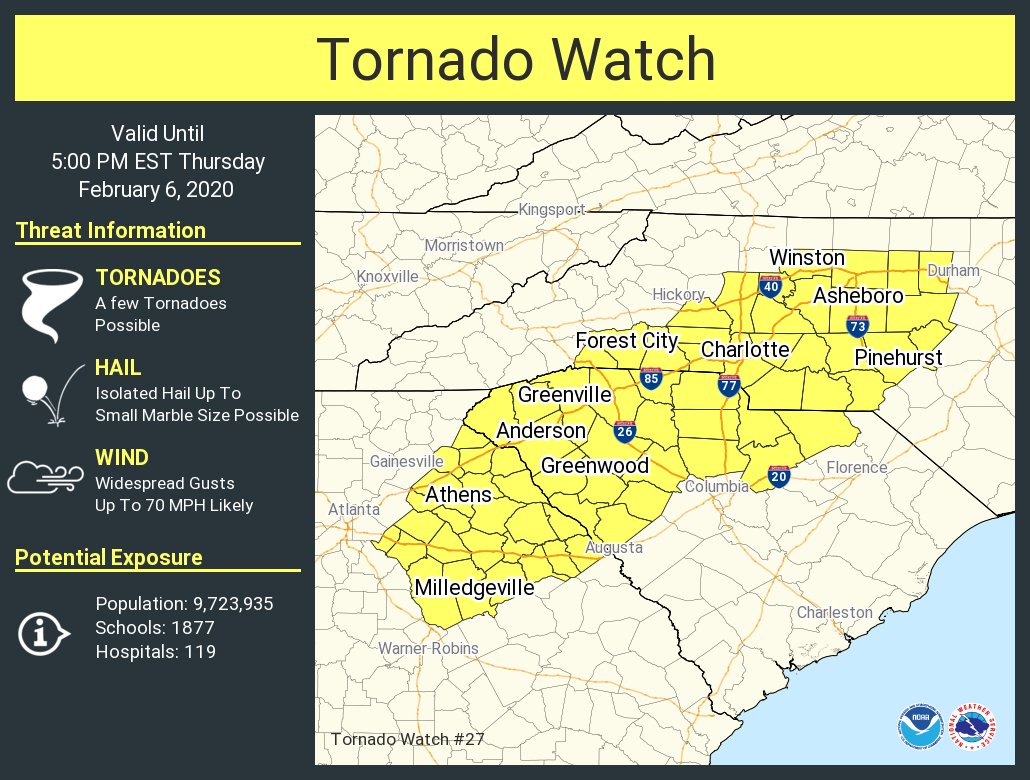
Yup. "Tornado watch will be needed soon"Mesoscale discussion coming out looks like a watch will be coming for SC into the Charlotte area.


 www.wsbtv.com

 www.wbtv.com