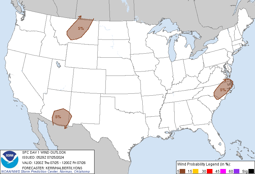
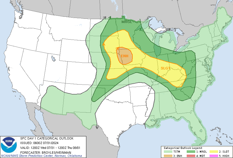
Yeah just a couple thousand feet up winds will be screaming, at very least I'll be shocked if there aren't numerous wind reports tomorrow.Lots of potential tomorrow. Doubt we see any sun with all the garbage out in front. Still with that 70kt LLJ things could get interesting.
-
Hello, please take a minute to check out our awesome content, contributed by the wonderful members of our community. We hope you'll add your own thoughts and opinions by making a free account!
You are using an out of date browser. It may not display this or other websites correctly.
You should upgrade or use an alternative browser.
You should upgrade or use an alternative browser.
Severe Possible severe weather February 4th-7th
- Thread starter Darklordsuperstorm
- Start date
FWIW, WPC says Greensboro is forecast to set a record high pwat value. And mentions some flooding could be SIG. I wouldn’t be surprised to see a last minute upgrade tomorrow for a small High Risk in the Mount Airy to Hickory areas.
Cad Wedge NC
Member
This is NOT the set up for a high risk anywhere in the foothills of NC. Moderate at best.... still not likelyFWIW, WPC says Greensboro is forecast to set a record high pwat value. And mentions some flooding could be SIG. I wouldn’t be surprised to see a last minute upgrade tomorrow for a small High Risk in the Mount Airy to Hickory areas.
BufordWX
Member
I think he is referring to the excessive rainfall outlook by the WPC not severe weather.This is NOT the set up for a high risk anywhere in the foothills of NC. Moderate at best.... still not likely
Have to remember that the dead of winter is the maxima runoff climo according to the NWS. Boone had over 6”+ of rain in December. Some areas had over 8”+ in January.
Gutters are running here. Moderate rain. Bout to put my new drainage system to the rest
BufordWX
Member
BufordWX
Member
Might be a CC dot.New tornado warning in Eastern MS. Solid looking rotation.View attachment 33161View attachment 33162

Edit: yep confirmed tornado
Jrips2710
Member
Incoming Enterprise MS. Red alert
Ron Burgundy
Member
On the ground. PDS issued. Oof.

https://forecast.weather.gov/wwamap/wwatxtget.php?cwa=jan&wwa=tornado warning

https://forecast.weather.gov/wwamap/wwatxtget.php?cwa=jan&wwa=tornado warning
EastAtlwx
Meteorologist
The RFD cold front is surging northward. Wonder if it will be able to cycle properly soon.
Jrips2710
Member
NBAcentel
Member
NoSnowJoe
Member
NoSnowJoe
Member
1.5” rain overnight. Occasional lightning rn
BufordWX
Member
BufordWX
Member
Flash flood warning now at my location
BufordWX
Member
BufordWX
Member
Snowflowxxl
Member
Woke up to a severe thunderstorm warning
BufordWX
Member
Tornado watch extended into metro Atlanta until 1 PM.
Storm5
Member
Over five inches of rain in the last 36 hours at the house . What a night ! The thunder was constant all night long and shook the house no telling how many times . Still rumbling as I write the at 620 . Amazing
Sent from my iPhone using Tapatalk
Sent from my iPhone using Tapatalk
Today will definitely be an interesting one. Still think a MDT is possible but either way the winds. Man the clouds are screaming already
45% area for winds now


BufordWX
Member
B
Brick Tamland
Guest
Looks like the lower half of Wake County is in the level 3 threat now. Keeps moving north. How are we going to get any storms with all this rain this morning, though? Wouldn't that limit instability?
Flash flood warning here now
BufordWX
Member
B
Brick Tamland
Guest
Just wondering what is going to be the spark to set the storms off in my area when we are getting heavy rain this morning. Is it supposed to stop raining? Usually we need some sun or a little clearing to get the heat needed to set off storms here.
Blue_Ridge_Escarpment
Member
Over 3 inches of rain already and just getting started. NWS had my forecasted storm total at 2.25....
wow
Member
Already hit 1.41 inches.
B
Brick Tamland
Guest
That is a large enhanced area.


ForsythSnow
Moderator
Up to 2.25 inches here total now. The most of it is still on its way.
1.31 and I see a big ol' splotch of yellow coming
JHS
Member
I'm not sure this dry slot I'm in goes north during the day, but right now most of SC south of i-85 is dry. A large part of GA is dry too. The area from south of ATL in Georgia to Columbia SC and south should be primed for severe storms later today.
NoSnowJoe
Member
Up to 73 here just south of Atlanta (Peachtree City) and the main part of the line is still on the north side producing heavy storms with temps in the mid 60’s.


