Yea sounds like a blend of the two. They mentioned the forecast uncertainty with outflow boundaries and a tornado risk if air mass has not been overturned.Seems like there going with a NAM 3kmish/12kmish option, but instead the warm sector is further north, including more surface based instability, don’t know bout that one tho, but I guess you can’t argue with it, since they have done well
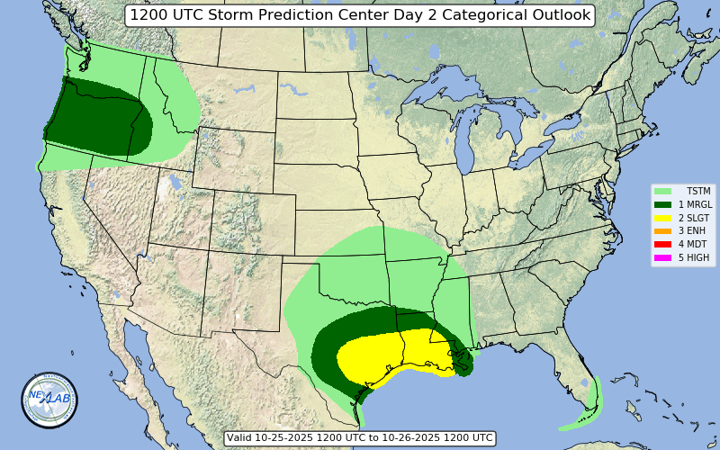
Low-level shear for tornadoes will be most favorable early in the
day across LA/MS/AL, and later in the day across GA and SC near the
warm front. Adding uncertainty to this forecast is potential outflow
boundaries from the early day storms, and questions regarding
airmass recovery in those areas (northern GA and SC). Tornado and
wind risk will largely depend on storm mode. If midday heating
occurs along the dryline, and the air mass has not been overturned,
supercells and tornadoes will be possible. A few strong tornadoes
might occur should sufficient SRH (200-300+ m2/s2) remain prior to
850 mb winds veering. Tornadoes will also be possible along the warm
front into GA/SC, assuming it is not reinforced with too much
outflow. Otherwise, a general upscale growth of storms is expected
for the remainder of the area including FL. Damaging winds are most
likely should the storm mode be linear. Given such large model
variability, large changes in area are possible in later updates.