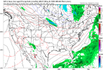
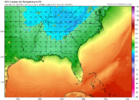
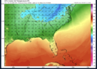
Heck of a look on the ICONThat's a fairly dynamic system next week likely going to be the first fall severe threat
-
Hello, please take a minute to check out our awesome content, contributed by the wonderful members of our community. We hope you'll add your own thoughts and opinions by making a free account!
You are using an out of date browser. It may not display this or other websites correctly.
You should upgrade or use an alternative browser.
You should upgrade or use an alternative browser.
Pattern October '22
- Thread starter ForsythSnow
- Start date
smast16
Member
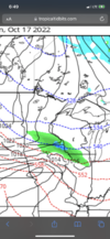
Cool October persists through the end of the month View attachment 122870
When do we flip back? Before or After Thanksgiving?
Itryatgolf
Member
12z Euro was pretty stormy. Also, Eric Webb mentioned persistent IO/Maritime Continent forcing is allowing for +pna for a while. Now, this is fall, but if that persisted into winter with that type forcing, would that be a bad sign for cold air here? Just curious
JHS
Member
The Euro looks like a severe threat for sure along with a lot of rain for many of us. Maybe even more than Ian gave some of us in the Carolinas.That's a fairly dynamic system next week likely going to be the first fall severe threat
Heelyes
Member
Not possible, I heard no rain until NovemberThe Euro looks like a severe threat for sure along with a lot of rain for many of us. Maybe even more than Ian gave some of us in the Carolinas.
I see the NWS is forecasting 44 for tomorrow night. That means it’s a good chance of 38-39 for the first time in this Fall.
Brent
Member
That wind tonight is a little preview of winter... High of only 68 tomorrow
Before December, that’s a givenWhen do we flip back? Before or After Thanksgiving?
Brent
Member
Heard a report earlier there was sleet in Northern Kansas ?
accu35
Member
iGRXY
Member
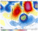
The H5 Look on the GFS is a thing of beauty. About as classic of a look as you could get for cold. If this was even late November that look would produce snow potential.
iGRXY
Member
L
Logan Is An Idiot 02
Guest
View attachment 122886
That’s about as good as you’re going to get it down here
I really hope we can have some of this for the winter. Maybe it can flip to warm in November then back in December or January
Sent from my iPhone using Tapatalk
Really does suck to get that look in mid October!! It won’t be back until April! ?View attachment 122886
That’s about as good as you’re going to get it down here
It would be more good if we get this in January.View attachment 122886
That’s about as good as you’re going to get it down here
This is the old discussion/theory about pattern flips leading up to winter; which I usually bring up ha ha. I for one do not like seeing an eastern trough at the end of October into the first three weeks of November (no big Halloween storm, no South Carolina low country snow, no cold in general). I do like seeing this early/mid October cold. Hopefully we go into Indian Summer right before Halloween, and it stays relatively warm leading up to Thanksgiving. Afterwards, let it get cold for the first of December and maybe that sets the predominant pattern for winter. Don't have anything to back this up except for the many years I've seen the lead ups to winter. I can't count the times we've had a cold start in late October, and everybody gets excited thinking this is going to be a really cold winter. But I also can't count the number of times it stays warm all the way up to Thanksgiving and everybody screams winter is dead. And then we end up with a decent year (snow and cold wise).I really hope we can have some of this for the winter. Maybe it can flip to warm in November then back in December or January
Sent from my iPhone using Tapatalk
accu35
Member
I think most of us is just thrill to see a pattern change period.This is the old discussion/theory about pattern flips leading up to winter; which I usually bring up ha ha. I for one do not like seeing an eastern trough at the end of October into the first three weeks of November (no big Halloween storm, no South Carolina low country snow, no cold in general). I do like seeing this early/mid October cold. Hopefully we go into Indian Summer right before Halloween, and it stays relatively warm leading up to Thanksgiving. Afterwards, let it get cold for the first of December and maybe that sets the predominant pattern for winter. Don't have anything to back this up except for the many years I've seen the lead ups to winter. I can't count the times we've had a cold start in late October, and everybody gets excited thinking this is going to be a really cold winter. But I also can't count the number of times it stays warm all the way up to Thanksgiving and everybody screams winter is dead. And then we end up with a decent year (snow and cold wise).
JHS
Member
Models trending drier later this week. The Euro is now .25 or less for many of us.
NWS says 43 here tonight. Seeing is how we hit 39 twice this week I saw 36 tonight with some frost maybe. It's not too breezy so we'll see.
36.7 with scattered frost, roof was solid white and we saw many frosty rooftops on our way into church this morning.
Downeastnc
Member
39 this am at PGV...
41 for Chattanooga this morning, 37 for Knoxville, 31 for Crossville
36.7 at 6am but then my internet went out so I’m assuming we hit 36. Had to be at church early so I’m not sure if frost but I’m sure there was some at the bottom of the hill if nothing else.
HugeSnowStick
Member
35.9 at 7am,,,,wow....
NoSnowATL
Member
58
ForsythSnow
Moderator
Bottomed out at 39, making it first 30s of the season. Look forward to next week with even lower.
Shaggy
Member
Same here at pgv. Hit 39 for our lowBottomed out at 39, making it first 30s of the season. Look forward to next week with even lower.
Iceagewhereartthou
Member
Orientation of the cold was a bit unusual, AVL only got down to 44, GSP only got down to 50!
Drizzle Snizzle
Member
Dang it was in the 40s in South Georgia and only 50 in GSP ?Orientation of the cold was a bit unusual, AVL only got down to 44, GSP only got down to 50!
JHS
Member
Cloudcover kept temps up.Dang it was in the 40s in South Georgia and only 50 in GSP ?
LickWx
Member
Them hollers are always colder than them hillsDang it was in the 40s in South Georgia and only 50 in GSP ?
Home: 43.3F
KATL: 45F
KPDK: 41F
KATL: 45F
KPDK: 41F
iGRXY
Member
55 here as we approach noon. This feels like a late November type of day with a breeze, clouds, and cold
BHS1975
Member
Trees are confused here. Same type trees with some changing quite a bit and some still all green.
Sent from my iPhone using Tapatalk
Sent from my iPhone using Tapatalk
I’m seeing the same thing here. The trees typically change first like oak and maples are changing and changing quickly… meanwhile ones that typically take longer haven’t really shown any signs yet. Personally I would like to get leaves changed and off the trees quicker than the last few years… I would like to not still be blowing leaves the week of ThanksgivingTrees are confused here. Same type trees with some changing quite a bit and some still all green.
Sent from my iPhone using Tapatalk
LovingGulfLows
Member
- Joined
- Jan 5, 2017
- Messages
- 1,499
- Reaction score
- 4,100
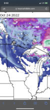
12z GFS with non-stop eastern troughing. We need this pattern in Dec or Jan!

