ForsythSnow
Moderator
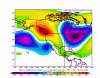
If only that tilt was different, then there could really be something going. Regardless, that's one strong trough axis.Look at how much colder is the 12Z GFS vs earlier runs around days 8+!


If only that tilt was different, then there could really be something going. Regardless, that's one strong trough axis.Look at how much colder is the 12Z GFS vs earlier runs around days 8+!
To be fair, we would have a foot of snow on the ground had it been 15 or so degrees colder throughout the column with more cold air push. We had a good inch and a quarter from this of rain.East AL would be getting crushed under the deformation band right now.
If only that tilt was different, then there could really be something going. Regardless, that's one strong trough axis.
And consistent with the 12Z GFS, the latest GEFS (12Z) is back in the freezer.
And consistent with the 12Z GFS, the latest GEFS (12Z) is back in the freezer.

Kudos to whoever created this thread. Nov could finish as one great pattern.
View attachment 26020View attachment 26021
The ridge off the W coast looks a little out of position!? Seems it wouldn’t take much to dump all the cold into a Western Trough? It just looks weird, verbatimKudos to whoever created this thread. Nov could finish as one great pattern.
View attachment 26020View attachment 26021
The ridge off the W coast looks a little out of position!? Seems it wouldn’t take much to dump all the cold into a Western Trough? It just looks weird, verbatim
Just saw the EPS at hour 270, and right when I was bouta click off the map, I saw a GOA ridge on it at hour 270, ummm we know that that has done to our EC trough before
I just saw it here, lol, but that’s a nice -NAOWhere is your feed from for the EPS?
Sent from my iPhone using Tapatalk

Once you flip the calendar to December it's game on for us the first 10 days of the month have done is well in the last 20 years no reason to think the last few days of November couldn't sneak something inThis is probably one of the best patterns you could possibly get around here, only limitation being the time of year. Late November is right on the edge of our legitimate climo window here in the Carolinas.
View attachment 26025
I guess the hope is for pattern repetition. That seems to be the case most years. Which is mainly bad pattern repetition. I think most would agree that we are long overdueThis is probably one of the best patterns you could possibly get around here, only limitation being the time of year. Late November is right on the edge of our legitimate climo window here in the Carolinas.
View attachment 26025
Flattered@Sleet City USA
I call for him to start the December thread when it’s time.
Sent from my iPhone using Tapatalk
I think December 2000 demonstrated that in North GA as well. Not to mention 2017.Once you flip the calendar to December it's game on for us the first 10 days of the month have done is well in the last 20 years no reason to think the last few days of November couldn't sneak something in

Oh, abbacusMan...why have we been getting front loaded winters? The key turns, the engine fires up, purrs like a throaty, 300 lb kitten, then starts to wheeze, then sputter, then just stall outs making summers longer and longer. What gives, abbacusMan? Is it sun spots, decaying mammoths in Siberia? Is it naughty southern boys and girls? Or is it simply a wiggle in the winds..on a repeating rythem... due to orbital purtuberance as our orb wobbles??And consistent with the 12Z GFS, the latest GEFS (12Z) is back in the freezer.
500mb anomalies for the days leading upAnybody have the pattern , upper air, of right around/before the Dec 2002 Carolina crusher I’ve storm
Too bad it’s not winter. We need this in a month. Not now.
Sent from my iPhone using Tapatalk
I agree once we get to December 15th or 20th and we can stay cold, I can jump on board with a cold winter. until then, there is no reason to believe that we are going to be cold past the 10th.Who's to say we won't have it then, too?
")
I think we’re reloading and with this great pattern showing up once again and at the ladder half of November into early December we may be in for another early season winter type of event just as we saw last year I mean this pattern is only a couple weeks prior to when we got our storm last year ... and this set up honestly looks way more classic for a southeast winter eventThis is probably one of the best patterns you could possibly get around here, only limitation being the time of year. Late November is right on the edge of our legitimate climo window here in the Carolinas.
View attachment 26025
Yep, I second that.....@Sleet City USA
I call for him to start the December thread when it’s time.
Sent from my iPhone using Tapatalk


Who's to say we won't have it then, too?
Yep, and make it chilly themed please, it brings the goods! ?@Sleet City USA
I call for him to start the December thread when it’s time.
Sent from my iPhone using Tapatalk
I think we’re reloading and with this great pattern showing up once again and at the ladder half of November into early December we may be in for another early season winter type of event just as we saw last year I mean this pattern is only a couple weeks prior to when we got our storm last year ... and this set up honestly looks way more classic for a southeast winter event
12z EPS. I know its still November, but I'm starting to think we get a threat around Thansgiving if this look holds. The 558dm benchmark line is sitting across TN.