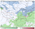
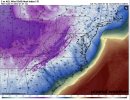
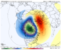
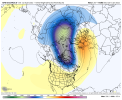
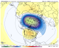
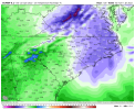
It's that great. Mentioned it this morning that the pattern would get kind of meh after the cold early next weekIs this marginal at best?
-
Hello, please take a minute to check out our awesome content, contributed by the wonderful members of our community. We hope you'll add your own thoughts and opinions by making a free account!
You are using an out of date browser. It may not display this or other websites correctly.
You should upgrade or use an alternative browser.
You should upgrade or use an alternative browser.
Pattern Januworry
- Thread starter SD
- Start date
- Joined
- Jan 23, 2021
- Messages
- 4,603
- Reaction score
- 15,199
- Location
- Lebanon Township, Durham County NC
whatalife
Moderator
LovingGulfLows
Member
- Joined
- Jan 5, 2017
- Messages
- 1,499
- Reaction score
- 4,100
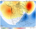
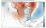
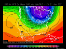
488 over the great lakes this is basically the opposite of the December patternView attachment 102191
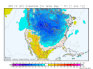
This is without snow on the ground in most of the South either. Would be one of the most prolific arctic outbreaks ever.

NBAcentel
Member
Hey the good thing is this upcoming pattern could deliver it. I think it's overdone but the overnight ensembles hinted at renewed cold and potential decadal cold after D10. Should be fun to watch pan outOne of these days, a map like that will have an 84 hour timestamp instead of 384. Nevertheless, it is a beaut.
Been trying to keep quiet and let the pros talk during these exciting times. But this post caught my attention because every time somebody posts one of these nowadays, it seems to be having 2-3 more snowy members. I like where we're headed
Biggest concern I have is we really build toward severe cold and we drop it into the same places as last feb
NBAcentel
Member
That could really happen lol especially if it waits to dump when the pac has basically retrograded where it sucks for usBiggest concern I have is we really build toward severe cold and we drop it into the same places as last feb
NBAcentel
Member
Lol the good ol Canadian ridge, @RainlessSnowless & Grumpy favorite !! 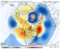

NBAcentel
Member
Gefs is moving toward the op post 240 this run should end colder across the conus vs 6zThat could really happen lol especially if it waits to dump when the pac has basically retrograded where it sucks for us
- Joined
- Jan 2, 2017
- Messages
- 1,566
- Reaction score
- 4,279
Likely overdone a bit..hopefully. Then it would scream over running potential...or else it's suppression city. But the #1 ingredient we shall get.
NBAcentel
Member
iGRXY
Member
Need a good storm to come before that massive attic outbreak. We’re not snowing or getting anything with that except cracked lips and ashy skin. Now if we can sneak a good storm in here right before we can get a good shot of keeping snow or ice on the ground for a while.
Dewpoint Dan
Member
We'll probably get a good storm as the pattern starts to relax.Need a good storm to come before that massive attic outbreak. We’re not snowing or getting anything with that except cracked lips and ashy skin. Now if we can sneak a good storm in here right before we can get a good shot of keeping snow or ice on the ground for a while.
This is without snow on the ground in most of the South either. Would be one of the most prolific arctic outbreaks ever.

Mid to late January of 1934 and 1972, both similarly strengthed La Niña analogs that had mild Decembers, both had a similar very cold (single digits at ATL/RDU) Arctic airmass plunge into the SE fwiw followed by cold February.
NoSnowATL
Member
But did they produce Snow? That’s the 1 billion dollar question.Mid to late January of 1934 and 1972, both similarly strengthed La Niña analogs that had mild Decembers, both had a similar very cold (single digits at ATL/RDU) Arctic airmass plunge into the SE fwiw followed by cold February.
NBAcentel
Member
This looks good?
ForsythSnow
Moderator
While totally fantasy land, those wind chills.This is without snow on the ground in most of the South either. Would be one of the most prolific arctic outbreaks ever.


BHS1975
Member
I've seen this movie before. Cut off takes forever to kick out if at all.
Sent from my iPhone using Tapatalk
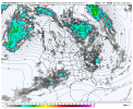
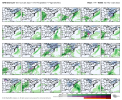
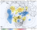
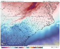
Ever so slightly we get more wintry members but still not enough to hang the hat on anything .. at least we know it an work out .. let’s keep grinding out the details in the days to comeLittle bit of a signal around this timeframe, at H5 look isn’t terrible, some hints of some southern stream energy and confluence/energy in the east/NEView attachment 102199View attachment 102200
This is that cancel classes type of cold for the southWhile totally fantasy land, those wind chills.

Everything cancels classes nowadays. You get enough clouds in the sky and school lets out.This is that cancel classes type of cold for the south
Everything cancels classes nowadays. You get enough clouds in the sky and school lets out.
 Granted some S.C. Buses still doesn’t have climate controls. We put our money where it’s more important.
 Sent from my iPhone using Tapatalk
NBAcentel
Member
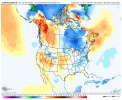
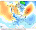
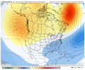
Meh, hopefully something like the 12z/18z gefs from yesterday comes back because to me, this ain’t what I’m looking for, I’m looking for a event under 32 degrees and a cold pattern, not a average pattern and a event at 36/37 degrees which the gefs has gone to after the cold shot early next week ?? I’m tired of marginal patterns atp


- Joined
- Jan 2, 2017
- Messages
- 1,566
- Reaction score
- 4,279
Had a nice over running event the week of the 24th is what I read.But did they produce Snow? That’s the 1 billion dollar question.
Don’t want any part of that it’ll we don’t get or have snow on the ground. NopeWhile totally fantasy land, those wind chills.

But did they produce Snow? That’s the 1 billion dollar question.
Not accompanying the single digit cold. But there was ZR soon following it from NE GA to NC and the very cold February of 1934 had multiple wintry including a big snow/ice around the 10th that later brought ice as far down as N Florida. Feb of 1972 was cold as well as very icey in especially NC. A mild February is far from a certainty and I’d argue not necessarily likely.
- Joined
- Jan 2, 2017
- Messages
- 1,566
- Reaction score
- 4,279
I knew you'd have specifics! And of course the next year in 73 was the blizzard!Not accompanying the single digit cold. But there was ZR soon following it from NE GA to NC and the very cold February of 1934 had multiple wintry including a big snow/ice around the 10th that later brought ice as far down as N Florida. Feb of 1972 was cold as well as very icey in especially NC. A mild February is far from a certainty and I’d argue not necessarily likely.
- Joined
- Jan 23, 2021
- Messages
- 4,603
- Reaction score
- 15,199
- Location
- Lebanon Township, Durham County NC
December 1984 featured record warmth. January 1985 featured all time cold.
I'm just saying.
I'm just saying.
NBAcentel
Member
znel52
Member
I put literally 0 stock in a 384hr GFS. If I had to bet my life savings I would be nothing even remotely close to this comes to fruition. I hope the GFS proves me wrong but I'm not currently willing to get my hopes up about this lol. It would be incredible though. I was too young to really remember some of the extreme cold we saw in the mid-to-late 80s in my area.
NBAcentel
Member
NBAcentel
Member
whatalife
Moderator
Both the 12z GEFS and GEPS look like they want to put the US in the freezer starting post D10. These runs will continue to be volatile. The good news (imo) is you can see the cold and stormy pattern being modeled.
Last edited:
- Joined
- Jan 23, 2021
- Messages
- 4,603
- Reaction score
- 15,199
- Location
- Lebanon Township, Durham County NC
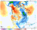
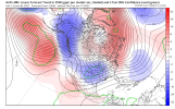
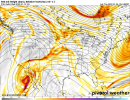
Yep. Noticed sameWouldn’t these be the coldest high temps since Christmas Day 2020 ? View attachment 102226View attachment 102227

