-
Hello, please take a minute to check out our awesome content, contributed by the wonderful members of our community. We hope you'll add your own thoughts and opinions by making a free account!
You are using an out of date browser. It may not display this or other websites correctly.
You should upgrade or use an alternative browser.
You should upgrade or use an alternative browser.
Pattern Januworry
- Thread starter SD
- Start date
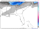
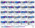
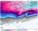
I wanna see the member that skewed the Deep Southhey an EPS snow mean!
View attachment 102261
NBAcentel
Member
whatalife
Moderator
Nice run on the 12z EPS. Cold and stormy pattern. ?
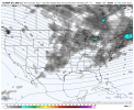
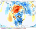
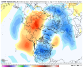
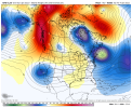
What’s BAM have to say about this??TPV over Hudson Bay about to dump south now that’s interesting View attachment 102241
Asking for a friend!
D
Deleted member 609
Guest
Meh. Need more with snow.
NoSnowATL
Member
Wrong threadIt’s very obvious to me that those of us south of I85 and below are just chasing dreams. This pattern may be good, but only for those above 85. The i20 folks can forget it this winter as well.
597DM
Member
Is that a good look with the mean down to the Gulf Coast Louisiana ?hey an EPS snow mean!
View attachment 102261
NBAcentel
Member
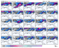
Cold and stormy pattern, iffy pattern with potential, marginal eh pattern all posting up trying to figure out who wins out today View attachment 102271
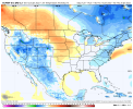
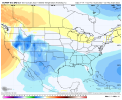
Thanks for reminding me about Dacula Weather. I didn't have his site bookmarked on the PC and had forgotten about his site.No update yet for today. I go to dacula weather for those charts
smast16
Member
Lol the good ol Canadian ridge, @RainlessSnowless & Grumpy favorite !! View attachment 102197
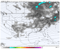
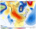
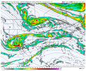
I’m not trying to be negative but I’m not a fan of this trend away from a nice tall western ridge and one more flat/battered and the TPV near Hudson Bay losing connection with the EC trough View attachment 102202View attachment 102203
Of course we'll go more Zonal, Flatten out the ridge so we can nuke all the cold in Canada.
Looks like the rdu heat observatory will be close to recording it's first teens since 2018
- Joined
- Jan 23, 2021
- Messages
- 4,603
- Reaction score
- 15,199
- Location
- Lebanon Township, Durham County NC
RAH has me at 17 on Saturday Morning.
Ron Burgundy
Member
NOW we’re talking!Is this goodView attachment 102279
Downeastnc
Member
Is this goodView attachment 102279
You should put a parental warning before posting porn like this to a family site,,,,,
Last edited:
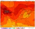
- New Euro weeklies in comparison to the prior run (Monday) are anything but bleak as they're colder in the E US overall for every one of the first 5 weeks! Only week 6 is warmer.
- The new ones are the coldest yet in the E US for 1/10-12, 1/16-19, and 1/23-28.
- They are the coldest yet in the Midwest, a SE cold source region of sorts, 1/9-11 and by a large amount 1/22-28.
- So, suggesting week 3 and the first half of week 4 (i.e., late January) will be cold in most of the E US.
Last edited:
D
Deleted member 1449
Guest
+2" p/hour rates here currently.
Is this good- New Euro weeklies in comparison to the prior run (Monday) are anything but bleak as they're colder in the E US overall for every one of the first 5 weeks! Only week 6 is warmer.
- The new ones are the coldest yet in the E US for 1/10-12, 1/16-19, and 1/23-28.
Nope! Already has that “ convection in the gulf robbing moisture transport” look!Is this goodView attachment 102279
iGRXY
Member
Big Ice storm.Is this goodView attachment 102279
NBAcentel
Member
D
Deleted member 609
Guest
That's better
BHS1975
Member
Looks like the rdu heat observatory will be close to recording it's first teens since 2018
Yeah It's been forever since I've seen teens in the AM.
Sent from my iPhone using Tapatalk
Umm , slacks go bye bye
Avalanche
Member
We know we will fall victim to that sooner or later. LolNope! Already has that “ convection in the gulf robbing moisture transport” look!
From new Euro Weeklies:
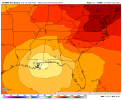
Who knows? Maybe this will be the period for big cold and a major SE winter storm? See precip map, which suggests Gulf low (Miller A?) is quite possible. Also, keep in mind that the MJO MAY be in the favorable low amplitude left side then. Keeping in mind that they likely have a warm bias at 2M:
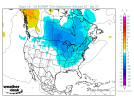
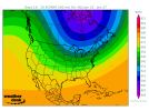
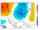
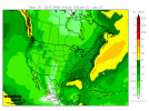
Who knows? Maybe this will be the period for big cold and a major SE winter storm? See precip map, which suggests Gulf low (Miller A?) is quite possible. Also, keep in mind that the MJO MAY be in the favorable low amplitude left side then. Keeping in mind that they likely have a warm bias at 2M:


Stormlover
Member
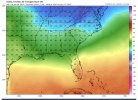
brrrr


Stormlover
Member
wind chilll


bigstick10
Member
Holy shite -35 in GA. January 21, 1985 redux..wind chilll
That’s the lookIs this goodView attachment 102279
Flotown
Member
GEEZwind chilll
NBAcentel
Member
NBAcentel
Member

