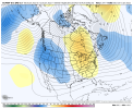
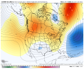
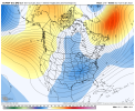
Any further evidence, GaWx, that warm Decembers produced cold Februarys during La Nina’s? Traditionally, December is the colder month in LaNinas, so wondered if the opposite condition also produced the non traditional February cold.Not accompanying the single digit cold. But there was ZR soon following it from NE GA to NC and the very cold February of 1934 had multiple wintry including a big snow/ice around the 10th that later brought ice as far down as N Florida. Feb of 1972 was cold as well as very icey in especially NC. A mild February is far from a certainty and I’d argue not necessarily likely.
-
Hello, please take a minute to check out our awesome content, contributed by the wonderful members of our community. We hope you'll add your own thoughts and opinions by making a free account!
You are using an out of date browser. It may not display this or other websites correctly.
You should upgrade or use an alternative browser.
You should upgrade or use an alternative browser.
Pattern Januworry
- Thread starter SD
- Start date
GeorgiaGirl
Member
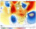
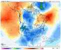
Wouldn’t these be the coldest high temps since Christmas Day 2020 ? View attachment 102226View attachment 102227
Well then, that would certainly be something.
From the 80s to it legitimately being cold in less than two weeks.
I’m tired of chasing 10 day pattern changes!Hey the good thing is this upcoming pattern could deliver it. I think it's overdone but the overnight ensembles hinted at renewed cold and potential decadal cold after D10. Should be fun to watch pan out
I’ll take the vodka cold pattern with no verbatim threats over a meh pattern with a big dog threat 10+ days away. Got plenty of time for the details to sort themselves out.
Any further evidence, GaWx, that warm Decembers produced cold Februarys during La Nina’s? Traditionally, December is the colder month in LaNinas, so wondered if the opposite condition also produced the non traditional February cold.
I wouldn’t go that far but rather would just say there are winters like 1933-4, 1971-2, and 1984-5 with similarly strengthed La Niña that had mild Decembers and produced cold Febs (1934 and 1972) or slightly BN Febs (1985) that tell me to not bet the farm on a mild Feb. Also, fwiw, recent CFS runs have been hinting that Feb will not be mild.
NBAcentel
Member
Pattern already has changedI’m tired of chasing 10 day pattern changes!
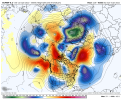
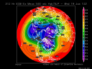
Broadly from a colder pattern standpoint, almost everything about that GFS run was fantastic. GEFS and GEPS as well. Westerly momentum continues to push off E Asia, helping to maintain the Aleutian Low (seen on sfc charts), and prevent it from retreating back to the west Pacific. The GFS run had multiple eastward moving ridges running toward the W Coast and the big wave break north of AK leading to the big cold plunge. Remember, we don't get into a potential pattern of C and E U.S. troughing until Jan 17-18. That's a long ways off and plenty can go wrong, but potential is there. Now to get consistency on all modeling and keep it there as time goes by
I wouldn’t go that far but rather would just say there are winters like 1933-4, 1971-2, and 1984-5 with similarly strengthed La Niña that had mild Decembers and produced cold Febs (1934 and 1972) or slightly BN Febs (1985) that tell me to not bet the farm on a mild Feb. Also, fwiw, recent CFS runs have been hinting that Feb will not be mild.
Further to this, although the Decembers weren’t mild (they were NN to a little BN), the weak La Niña winters of 1894-5 and 1898-9 both had an historically cold and snowy February.
NBAcentel
Member
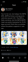
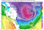
Peaking Twitter folks interests .. vodka cold on the rise .. although we talk about how we don’t want too much cold these type of events always could proceed a CAD event when a storm tries to move them out this type of cold air is heavy and very hard to move all at once View attachment 102244
Bring on the cold!
Mr. Golf
Member
Broadly from a colder pattern standpoint, almost everything about that GFS run was fantastic. GEFS and GEPS as well. Westerly momentum continues to push off E Asia, helping to maintain the Aleutian Low (seen on sfc charts), and prevent it from retreating back to the west Pacific. The GFS run had multiple eastward moving ridges running toward the W Coast and the big wave break north of AK leading to the big cold plunge. Remember, we don't get into a potential pattern of C and E U.S. troughing until Jan 17-18. That's a long ways off and plenty can go wrong, but potential is there. Now to get consistency on all modeling and keep it there as time goes by
I think the main way to eliminate or lessen the chances of returning to warm is not to get the mjo into phases 4-6. I mean sustained warm.
NBAcentel
Member
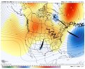
The only concern here is the ridge axis is over the GOA on both ensembles and as @SD hinted earlier, that could dump cold to similar areas as last feb, but that’s a nice signal, I really like that look at the end of the euro tho, active southern stream and a TPV headed towards the GLsPeaking Twitter folks interests .. vodka cold on the rise .. although we talk about how we don’t want too much cold these type of events always could proceed a CAD event when a storm tries to move them out this type of cold air is heavy and very hard to move all at once View attachment 102244
Honestly I’ll take my chances with that sort of evolution again I mean we were on the cusp of a really good winter event but the SER was so strong then .. I haven’t seen many signals pointing towards that type of SER again .. I wouldn’t even mind a little bit of resistance cause that would just bring a volatile storm I feel like it was a rarity to have everything stay out west like that and two years in a row .. that would be rawly unfair to us from Mother Nature .. where was our MJO last February along with new updates on where the models see the MJO going now?The only concern here is the ridge axis is over the GOA on both ensembles and as @SD hinted earlier, that could dump cold to similar areas as last feb, but that’s a nice signal, I really like that look at the end of the euro tho, active southern stream and a TPV headed towards the GLs
NBAcentel
Member
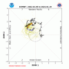
Honestly I’ll take my chances with that sort of evolution again I mean we were on the cusp of a really good winter event but the SER was so strong then .. I haven’t seen many signals pointing towards that type of SER again .. I wouldn’t even mind a little bit of resistance cause that would just bring a volatile storm I feel like it was a rarity to have everything stay out west like that and two years in a row .. that would be rawly unfair to us from Mother Nature .. where was our MJO last February along with new updates on where the models see the MJO going now?
Honestly I’ll take my chances with that sort of evolution again I mean we were on the cusp of a really good winter event but the SER was so strong then .. I haven’t seen many signals pointing towards that type of SER again .. I wouldn’t even mind a little bit of resistance cause that would just bring a volatile storm I feel like it was a rarity to have everything stay out west like that and two years in a row .. that would be rawly unfair to us from Mother Nature .. where was our MJO last February along with new updates on where the models see the MJO going now?
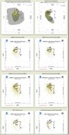
I haven’t seen any tele updates for today for MJO, PNA, AO, and NAO.
That’s yesterday. No updates today yet.
Even though this is yesterdays as GA said this still makes me think we can’t escape this pattern without at LEAST one more winter event .. speaking for NC at least going back and forth between 7/8 (the most favorable for NC winter storms for these months) is certainly an ideal place to be better that than looping in 5/6
NoSnowATL
Member
Mr. Golf
Member
No update yet for today. I go to dacula weather for those charts
D
Deleted member 609
Guest
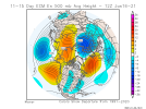
Is this good? Just looks like squiggly lines to me.
NoSnowATL
Member
Yea me tooNo update yet for today. I go to dacula weather for those charts
NBAcentel
Member
NBAcentel
Member
I smell a Miller b
Mr. Golf
Member
Looks colder fo sho
NBAcentel
Member
yeah that was a step towards that look for sure, would be nice if we could phase that TPV that manages to stay in Canada and those -heights over the ATL, that would setup some deep cold CADI smell a Miller b
whatalife
Moderator
I smell a Miller b

D
Deleted member 609
Guest
Seattle roasts, everyone wins.
IS THIS GOOD
If it weren't for that pesky 925 warm nose on the NAM, that would be all snow!Now that’s just crazy
View attachment 102254
Jet retraction is slower and slower on the eps. May end up with 2 ridges one over AK one off the WC with storms entering in the PNW then the jet/flow around the cold vortex in Canada.yeah that was a step towards that look for sure, would be nice if we could phase that TPV that manages to stay in Canada and those -heights over the ATL, that would setup some deep cold CAD
NBAcentel
Member
I didn't articulate this as well as I should have im in a hurry but you guys get the ideaJet retraction is slower and slower on the eps. May end up with 2 ridges one over AK one off the WC with storms entering in the PNW then the jet/flow around the cold vortex in Canada.
NoSnowATL
Member
Snowy pattern?I didn't articulate this as well as I should have im in a hurry but you guys get the idea

