Brent
Member
15 degrees here but zero moisture ?
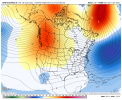
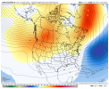
Lol, when is it notCold air was a struggle View attachment 102165View attachment 102166
What about the 70% relative humidity? Just don't heat that air up inside your house!15 degrees here but zero moisture ?
Famous last words…It’s all good lol it still doesn’t really matter given the pacific retrograding, it’s hard to fail in this pattern View attachment 102173
If Kirk 50/50 is interested it’s a good sign.Normal temps for AL and much of GA isnt gonna cut it ! Hopefully after the 15th we can get some cooler temps.
What about the 70% relative humidity? Just don't heat that air up inside your house!
Let me guess two weeks outHoly moly what a cold shot coming on the gfs
Dam Mack gonna break into tiny pieces if he falls downLol -40°F anomsView attachment 102182
My normal high is like 27!????Lol -40°F anomsView attachment 102182


Seriously, the #1 Ingredient for a southern winter storm, always!Gfs isn't great for snow verbatim just a barrage of cold
Is this marginal at best?488 over the great lakes this is basically the opposite of the December patternView attachment 102191
I’ll take ridging everywhere but the SE .. WINThis was the look yesterday at 18z, nice tall PNA ridge and some TPV getting into the mix for cold. A great look View attachment 102185
The gefs now, everything above us is just ridging, there’s no TPV in the mix anymore given it’s locked up near Greenland from the SE can ridge, this is the same look we had last winter, Its not bad, but it’s not great, good pattern for suppressed systems, but marginal at best View attachment 102186
One of these days, a map like that will have an 84 hour timestamp instead of 384. Nevertheless, it is a beaut.488 over the great lakes this is basically the opposite of the December patternView attachment 102191
Lol op at 384 has more validation then a ensemble mean under day 10 ??Is this marginal at best?
