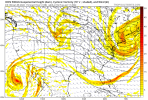
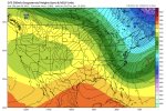
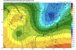
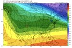
And realistically the whole evolution has already startedWell at least the main show starts here in reality, at hour 120, or at least sets us up View attachment 102092
-
Hello, please take a minute to check out our awesome content, contributed by the wonderful members of our community. We hope you'll add your own thoughts and opinions by making a free account!
You are using an out of date browser. It may not display this or other websites correctly.
You should upgrade or use an alternative browser.
You should upgrade or use an alternative browser.
Pattern Januworry
- Thread starter SD
- Start date
Well, when Webber tells us this pattern is a 9/10 on a favorabllity scale, I’m bound to remember.Bro pulled out receipts from a year ago ???
NBAcentel
Member
Yeah the only way I see us “failing” is we delay the pac jet retraction even more (which seems unlikely) and or we retrograde the pattern in under a week out west between the 15-20th (which seems like is becoming more unlikely esp given the -NAO block showing up now)And realistically the whole evolution has already started
NBAcentel
Member
Let’s just leave last winter behind that was a winter full of pain, one of the most miserable winters everWell, when Webber tells us this pattern is a 9/10 on a favorabllity scale, I’m bound to remember.
brendan123
Member
DT sounds excited...
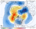
Yeah, I was wondering how we could get to a -NAO in this pattern without a + SCAND, but that setup just might do the trickThis GEFS run should be interesting, stronger +PNA ridge and stronger wave NE of Africa under the developing block might try to force a stronger -NAO sooner via wavebreaking View attachment 102086
It's interesting how so many ninas have this type of modeled look and similar evolution rolling from Dec into Jan but the results are so wildly differentWell, when Webber tells us this pattern is a 9/10 on a favorabllity scale, I’m bound to remember.
D
Deleted member 609
Guest
So how did GEFS end up looking late? TT stopped working.
- Joined
- Jan 23, 2021
- Messages
- 4,603
- Reaction score
- 15,199
- Location
- Lebanon Township, Durham County NC
- Joined
- Jan 23, 2021
- Messages
- 4,603
- Reaction score
- 15,199
- Location
- Lebanon Township, Durham County NC
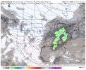
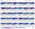
Also noted that in the 16th-ish time period, there were 50% of the GFS members showing at least some snow accumulation.
IS THIS GOOD?Also noted that in the 16th-ish time period, there were 50% of the GFS members showing at least some snow accumulation.
Stephenb888
Member
Can we see the maps?Also noted that in the 16th-ish time period, there were 50% of the GFS members showing at least some snow accumulation.
Stephenb888
Member
Lol this is exactly how I pictured these maps in my mind. Atleast there’s 2 on here that would do me right.
Well just 24 hours ago they were basically blank so it's getting better. Just give me the cold and the setup at 500mb the rest will work out for someone on this boardLol this is exactly how I pictured these maps in my mind. Atleast there’s 2 on here that would do me right.
We’ll find a way!This pattern is like playing Russian roulette with five bullets in six chambers. It’s gonna be tough to not get out of this without another storm.
Ron Burgundy
Member
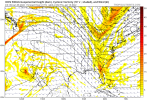
Man, that takes me back to the early ‘80s when I was a yute!one hell of a averaged out H5 pattern for jan 10th-20thView attachment 102077
I hope the SC midlands can finally cash in??Well just 24 hours ago they were basically blank so it's getting better. Just give me the cold and the setup at 500mb the rest will work out for someone on this board
Getting snow
Hate to be the grim reaper but I wouldn’t be shocked if the next 3-5 systems all impacted Virginia south-west into Tennessee. Pattern will need to change for those E of the mtns. Of course it can happen like with our last week event, it’s a bit rare to have tornadoes and high wind and backside snow I say most the snow will scurt to our north or west again and again ?
We always find a way. The problem we have is where the way usually leads us to.We’ll find a way!
All seriousness, pattern is there. Hopefully we can cash a big one in for a change.
Your batting 0 for the season. Excellent call how it would be late January at the earliest before "east of the mtns saw accumulating snow."Hate to be the grim reaper but I wouldn’t be shocked if the next 3-5 systems all impacted Virginia south-west into Tennessee. Pattern will need to change for those E of the mtns. Of course it can happen like with our last week event, it’s a bit rare to have tornadoes and high wind and backside snow I say most the snow will scurt to our north or west again and again ?
iGRXY
Member
There is literally not one single basis that you can pull right now to support this. In fact if anything storms are going to have a much better shot at going OTS or being squashed all together due to extreme cold press from the north.Hate to be the grim reaper but I wouldn’t be shocked if the next 3-5 systems all impacted Virginia south-west into Tennessee. Pattern will need to change for those E of the mtns. Of course it can happen like with our last week event, it’s a bit rare to have tornadoes and high wind and backside snow I say most the snow will scurt to our north or west again and again ?
Not super duper excited seeing the Aleutian ridge coming back...but maybe it's transient. Who knows.
It's going to happen at some point. Hopefully it's the typical models rushing the pattern changeNot super duper excited seeing the Aleutian ridge coming back...but maybe it's transient. Who knows.
NBAcentel
Member
Webber? Dat you?Not super duper excited seeing the Aleutian ridge coming back...but maybe it's transient. Who knows.
For real too much negativity going around ??Webber? Dat you?
D
Deleted member 609
Guest
I'm never in if RC isn'tFor real too much negativity going around ??
Pattern still looks ripe but no tangible storm for us to post around for an hour unfortunately.. I’m sure in 6 hours it’ll change lolIn terms of likeability, the 0Z GFS suite so far is probably not near the top.
Iceagewhereartthou
Member
Well some great discussion tonight guys. We'll have to see how this actually evolves, but the pieces look about as good as they have in years, AT THIS POINT. That's with a huge dose of knowing things can change on a dime.
One key difference from last year is there is a lot of cold air out there to work with. We've already seen some serious cold in both Canada and AK earlier, and the NW and Sierras had their cold and record snow. Last year we had the - NOA but there was little cold on our side to tap into. Gotta have the cold! We still might not score but it's nice to see the players show up like this. Let's see if they take the field.
One key difference from last year is there is a lot of cold air out there to work with. We've already seen some serious cold in both Canada and AK earlier, and the NW and Sierras had their cold and record snow. Last year we had the - NOA but there was little cold on our side to tap into. Gotta have the cold! We still might not score but it's nice to see the players show up like this. Let's see if they take the field.
I leave you guys alone for one 00z run and the wheels fall completely off
Wheels are completely intactI leave you guys alone for one 00z run and the wheels fall completely off
Brent
Member
The 12z was way better ?
ATLwxfan
Member
6z was meh. It will not snow at 50°.
Sent from my iPhone using Tapatalk
Sent from my iPhone using Tapatalk
Im still perked up about 1/16ish: Thats getting in to Euro hr 240 now: If you look at the 0z Euro you can see energy from Texas deep south heading east and cold in place upper south.This is the time-frame the GFS was on to for a few days: Its been quit past few cycles: But its rock solid on the Cold: Just be looking for some energy to show from 1/16-1/23.


