NBAcentel
Member
16 days away, I'm tired of chasing cold, where is the ripeness, it isn't great if it doesn't snow, there was not enough modeled cold and/or snow on the run, where is the tpv, what was the r2r trend, not supported by the ensembles, it isn't as cold as 12z, the AO is positive, the L over Hudson Bay is going to screw it up, no -nao, is this good?
“ I actually would like models more if they showed a snow storm that means conditions are favorable to create one” smh people this morning it was all hands on deck we’re DONE.. and now as a lot have been trying to say on here DONT FREAK OUT this is a fookin good pattern CHILL we will get the weenie maps eventually16 days away, I'm tired of chasing cold, where is the ripeness, it isn't great if it doesn't snow, there was not enough modeled cold and/or snow on the run, where is the tpv, what was the r2r trend, not supported by the ensembles, it isn't as cold as 12z, the AO is positive, the L over Hudson Bay is going to screw it up, no -nao, is this good?
Where have I been a heat miser ?Who’s going to tell me this is a bad look!? View attachment 102340
Also FRO is this fookin ridge TALL enough for you! Sheesh you little heat miser! View attachment 102343
Yeah I don’t think you’ve been much of a heat miser. You seem to have my preference…. You want it hot in summer and cold in winterWhere have I been a heat miser ?
I don't understand the needing weenie maps at D7+ for validation of a great pattern. Very few times have we seen a storm from D7-10 work out and even from D5-7“ I actually would like models more if they showed a snow storm that means conditions are favorable to create one” smh people this morning it was all hands on deck we’re DONE.. and now as a lot have been trying to say on here DONT FREAK OUT this is a fookin good pattern CHILL we will get the weenie maps eventually
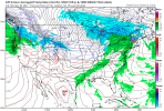
But the dec 2018 storm rememberI don't understand the needing weenie maps at D7+ for validation of a great pattern. Very few times have we seen a storm from D7-10 work out and even from D5-7
View attachment 102344
This was the gfs from 12/30 for today, sorry TN your mega snowstorm isn't real bc the gfs didn't have it at D7
The one storm the Gfs got right and that will be the only one ever ?But the dec 2018 storm remember
Long-term ensemble/model support is very important. Regardless of a specific threat, it tells us if we are interpreting the pattern correctly. So far I've been dissatisfied with the snowy runs, so I'm not excited.I don't understand the needing weenie maps at D7+ for validation of a great pattern. Very few times have we seen a storm from D7-10 work out and even from D5-7
View attachment 102344
This was the gfs from 12/30 for today, sorry TN your mega snowstorm isn't real bc the gfs didn't have it at D7
The one storm the Gfs got right and that will be the only one ever ?
Yep, even last winter during the feb fail for us anyways, there was constantly runs showing a winter storm somewhere, from the beginning of the look till the very end, with lots of ensemble support with a good snow mean/ice, even if it did fail for us further east, it showed us the glimpse of potential it had and there was still winter storms for areas west of us, hopefully ensembles can look better then next few days wrt the snow meanLong-term ensemble/model support is very important. Regardless of a specific threat, it tells us if we are interpreting the pattern correctly. So far I've been dissatisfied with the snowy runs, so I'm not excited.
Yeah we had mega cold and winter storms and in the end not ----....sooo.... since they aren't impressive we are supposed to say awww shucks pattern sucks?Yep, even last winter during the feb fail for us anyways, there was constantly runs showing a winter storm somewhere, from the beginning of the look till the very end, with lots of ensemble support, even if it did fail for us further east, it showed us the glimpse of potential it had and there was still winter storms/a few
Not necessarily, the pattern doesn’t look bad at all, I’m not saying disregard H5 because of a bad snow mean, but it probably shows that there’s some issues with it, and that it could be better, like it could be a pattern that favors more cold shots vs snow, or just doesn’t have the right pieces for snow, like I said even with the fail, if it wasn’t for the bad trend around the Aleutians, we probably would have scoredYeah we had mega cold and winter storms and in the end not ----....sooo.... since they aren't impressive we are supposed to say awww shucks pattern sucks?
Same time it had that 51 inch several days ago.Big mid range classic Miller A nor’easter
Warning though. The northern stream always slows down.CONTENT
*edit - some Miller Bs popping up on ensemble members
View attachment 102328View attachment 102329
From new Euro Weeklies:
Who knows? Maybe this will be the period for big cold and a major SE winter storm? See precip map, which suggests Gulf low (Miller A?) is quite possible. Also, keep in mind that the MJO MAY be in the favorable low amplitude left side then. Keeping in mind that they likely have a warm bias at 2M:
View attachment 102292
View attachment 102295
View attachment 102297
View attachment 102298
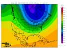
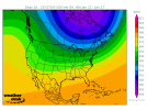
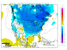
Based on the temp departures there’s likely a lot of CAD here as well.Following up with the weeklies suggestion of cold and also a possible threat in the 16-20 day period, the 12Z CFS also has cold followed by Gulf action.
Here is the H5 pattern in the 11-15 bringing in the cold with a nice +PNA:
View attachment 102346
Once the cold has arrived, the 500 mb flow becomes moist WSW as the +PNA retrogrades:
View attachment 102347
But the 16-20 remains cold over most of the SE just like the Euro weeklies show:
View attachment 102348
Check out the Gulf moisture:
View attachment 102349
Based on the temp departures there’s likely a lot of CAD here as well.
As weather hobbyists, we all enjoy the long track winter storms that the operational and ensemble models latch onto 10-14 days out and we can just look at every run with growing anticipation… one of the most fun examples of this was the February 2014 storms that we watched from 10 days out and just followed it from there. However, we’ve all seen too many storms over the years that didn’t show up until inside 5-7 days to completely ignore possibilities this progressing pattern has a chance to give us. I said the last couple of days and still continue to believe that the 15th-20th timeframe looks very good with potential for a widespread hit across the south, including places that are very much overdue.I don't understand the needing weenie maps at D7+ for validation of a great pattern. Very few times have we seen a storm from D7-10 work out and even from D5-7
View attachment 102344
This was the gfs from 12/30 for today, sorry TN your mega snowstorm isn't real bc the gfs didn't have it at D7
The map was posted this morning. I do think it will be filled in tomorrow.That snow depth map is incorrect. The whole state of Kentucky and nearly all of Tennessee has snow on the ground right now.
That snow depth map is incorrect. The whole state of Kentucky and nearly all of Tennessee has snow on the ground right now.
Um yeah - BIG failure for some of us. Our governor called a state of emergency ahead of the storm and called it "Historic." We were expected to get the biggest dump in decades and it was modeled for days. Reality.... 3 inches of sloppy icy mess for a few areas. ?But the dec 2018 storm remember
I’d take that at this pointUm yeah - BIG failure for some of us. Our governor called a state of emergency ahead of the storm and called it "Historic." We were expected to get the biggest dump in decades and it was modeled for days. Reality.... 3 inches of sloppy icy mess for a few areas. ?
Definitely has that Miller B ish look on the 500 mb chart .. still nothing but it’s much closer to something
Ours is coming around 18th. And it will be a big oneGuess Tennessee wins again View attachment 102366View attachment 102367
2 more weeks!Ours is coming around 18th. And it will be a big one
Sent from my SM-A526U using Tapatalk
On the…ICON?Guess Tennessee wins again View attachment 102366View attachment 102367
Damn you’re way ahead of me..TT slow?
Yep.Damn you’re way ahead of me..TT slow?
