D
Deleted member 1449
Guest
18z ICON getting closer.

Yes BOUT got it done....18z ICON getting closer.

Not bad at all and friday isnt all that far away. Lets get 1 more before the warm-up.18z ICON getting closer.


Fair point but once it goes full coastal it usually doesn’t come backYou guys really don't want this coming closer this far out... I can't remember the last storm (aside from a system a couple weeks ago that setup a 50/50) that didn't trend closer and closer at 00 hour. I prefer to see it start around Thursday morning.

The only issue is, that was 12 years ago and models have improved. I still haven't forgotten about this disaster from 2019. Sometimes suppression never comes back.Before the 2/12/10 storm, the models had the low in Cuba a few days before the event, suppression is definitely good right now because this will come back NW.
Yea I would have loved to see the next 24 hours on that18z ICON was going neg tilt at the end. That would have pulled the low back in and rapidly strengthened it. Might have been a hair late but great trend if it will hold.
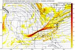
View attachment 109989
That looks a lot like the epic 18z run from yesterday
Yeah… I remember switching to the news during halftime and saw that WBTV here in CLT had added a chance of light snow Monday afternoon to the forecast… didn’t expect to be driving home in heavy snow 24 hours laterIronically 22 years ago this day I watched the NFC championship game between the Rams and Buccaneers. That night after the game the forecast for the following Monday night called for clear skies only to wake up Tuesday morning, January 25th to 18” of snow in Durham, NC. So... today 22 years later January 23rd we are watching the Rams and Buccaneers yet again. Let’s reel another big one in...
Sent from my iPad using Tapatalk
That's probably what's going on. I'll bet in a lot of these cases, you see these big storms and then some of the energy that is key to the system gets lost for a couple of days or so and then gets back on the grid and guess what? You see the storm start showing up again.Getting this to dig farther west is a good thing. Think we just need another shortwave to drop down the backside of the trough to achieve better tilt at the end. Models could easily miss on something like that this far out
I’m not great at reading the the H5, and really need to work on it, but was that run not isanely close to a boardwide bomb?

That's probably what's going on. I'll bet in a lot of these cases, you see these big storms and then some of the energy that is key to the system gets lost for a couple of days or so and then gets back on the grid and guess what? You see the storm start showing up again.
What an amazing jump on the ICON which is exactly what we need to see a larger storm. Pinch off the northern stream TPV a little more to get it to cut off and tilt negative.
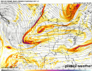
View attachment 109986
Yeah, troughs don't tilt negatively if there are troughs behind it -- that screwed up this run.View attachment 110002
See the energy around Lake Superior? As Grit just mentioned, we need something to go down the back of the trough to tilt it some so it can go negative, if that or another pocket of energy streams down sooner and/or further west, that would do the trick.
We're rooting for the TPV to get out of here so the wave can tilt negatively. Typically shortwaves that cut off from the TPV at the last minute do a good job of supplying cold air.I’m confused. Wouldn’t the TPV separating and pulling North remove our source of cold air? Aren’t we usually rooting for the TPV to come close enough to provide the cold air?
Haha you ain’t kidding. Look how similar yesterday’s 18z GFS was to today’s 18z run. Same players in almost the same position, just slightly different strengths.That's probably what's going on. I'll bet in a lot of these cases, you see these big storms and then some of the energy that is key to the system gets lost for a couple of days or so and then gets back on the grid and guess what? You see the storm start showing up again.

Back in the day we would be buying snow shovels with the GFS/GEFS showing this at day 5
