Cad Wedge NC
Member
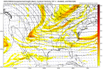
I'll take that look all day long at this range.Down the stovepipe and right smack dab into the middle of the four corners region. Honk honk. Cant ask for much more than that.View attachment 110007
I'll take that look all day long at this range.Down the stovepipe and right smack dab into the middle of the four corners region. Honk honk. Cant ask for much more than that.View attachment 110007

Is 18z EPS out for day 6?That’s a lot of flizzard members View attachment 110011
Comes out in an hour.Is 18z EPS out for day 6?
Is this Fro’s burner account!!??First post on this forum. I found you all last Monday and after seeing how everyone was polite and didn't make fun of novices like myself, I was sold.
I have no metrology schooling. I can't read models at all. Just a native North Carolinian who knows all about near misses, hates warm nose scenarios, and will watch it snow for hours given the chance.
Glad to be here!!!
Man that western ridge is absolute textbook.18z Euro update....trend loop here shows the Euro dropping the wave farther west each run, now into western Wyoming

Just keeps getting tallerMan that western ridge is absolute textbook.
Getting close to our benchmark here at Idaho.18z Euro update....trend loop here shows the Euro dropping the wave farther west each run, now into western Wyoming

Welcome aboard!First post on this forum. I found you all last Monday and after seeing how everyone was polite and didn't make fun of novices like myself, I was sold.
I have no metrology schooling. I can't read models at all. Just a native North Carolinian who knows all about near misses, hates warm nose scenarios, and will watch it snow for hours given the chance.
Glad to be here!!!
I don’t see any reason why this wouldn’t lead to a winter storm. That sucker would be riding right down the Rockies and the WR continues getting taller and taller.18z Euro update....trend loop here shows the Euro dropping the wave farther west each run, now into western Wyoming

Thanks so much."-)Welcome aboard!
welcome!First post on this forum. My name is Mia and I found you all last Monday and after seeing how everyone was polite and didn't make fun of novices like myself, I was sold.
I have no metrology schooling. I can't read models at all. Just a native North Carolinian who knows all about near misses, hates warm nose scenarios, and will watch it snow for hours given the chance.
Glad to be here!!!
Mia
Get a little WAR action here and bring this back about 150miles sw and we'll have the game on
I think it needs to be a lot more than 150 miles.Get a little WAR action here and bring this back about 150miles sw and we'll have the game on
Ugh this looks so good this far out .. please let’s reel one more in for us
It’s just crazy. If you have a s/w positive tilt right here it’s money 90% of the time yet we(most of the SE) are gonna strike out two weeks straight.icon wide right. Flizzard tho. This seems like the more likely outcome atp View attachment 110032View attachment 110033View attachment 110034

I would wait until Wednesday nights runs before you throw the towel in. If they still show this crap by then, then yeah it’s time to move on.It’s just crazy. If you have a s/w positive tilt right here it’s money 90% of the time yet we(most of the SE) are gonna strike out two weeks straight.
View attachment 110035
Nothing wrong with a little flizzard action .. some times these can be a lil dynamic .. short range models like to have fun with themicon wide right. Flizzard tho. This seems like the more likely outcome atp View attachment 110032View attachment 110033View attachment 110034
Also something this close at hour 120 is absolutely in the realm to move back towards a storm .. we just shouldn’t expect anything crazy at this point or you’ll be let downicon wide right. Flizzard tho. This seems like the more likely outcome atp View attachment 110032View attachment 110033View attachment 110034
GFS was a little better. It brought the base of the trough east quicker. It’s kind of funny that we are dealing with the same scenario as last storm of trying to get a positive tilt wave to go neutral quicker. Lot of time for this to go either wayLess TPV this GFS run might get real interesting View attachment 110038
