• Hello, please take a minute to check out our awesome content, contributed by the wonderful members of our community. We hope you'll add your own thoughts and opinions by making a free account!

Pattern Januworry

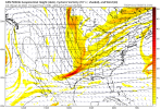
Im still perked up about 1/16ish: Thats getting in to Euro hr 240 now: If you look at the 0z Euro you can see energy from Texas deep south heading east and cold in place upper south.This is the time-frame the GFS was on to for a few days: Its been quit past few cycles: But its rock solid on the Cold: Just be looking for some energy to show from 1/16-1/23.

500hv.conus.png
Definitely has potential, but i am not going to be excited until a good look shows up on operationals. Right now they show way too much Midwest ridging to feel good about the midrange. I know the ensembles show better, but yeah, the ensembles. I really hope we start seeing something to truly get excited about other than another mid Atlantic storm.
 
Im still perked up about 1/16ish: Thats getting in to Euro hr 240 now: If you look at the 0z Euro you can see energy from Texas deep south heading east and cold in place upper south.This is the time-frame the GFS was on to for a few days: Its been quit past few cycles: But its rock solid on the Cold: Just be looking for some energy to show from 1/16-1/23.

500hv.conus.png
Yep it's just a matter of time and the GFS will be popping a Big SE Winter Storm. The Euro I believe will do the Same once it starts getting in Range. The Pattern is Ripe with lots of Energy Starting to show up.

Sent from my SM-A526U using Tapatalk
 
We are going to be threading the needle as always. We will have to see how the PV plays out. Even with all the players on the field, the more likely scenario puts us either in the shredder or too warm. And then it could seemingly look perfect and we get the coldest rain of our lives


Sent from my iPhone using Tapatalk
 
From these past 2 small systems we really didn't even start getting any good model runs showing a storm until well under 200 hours if I am not mistaken. Likely going to be that way for any potential system we may see down the road in a week or 2. We may get a fantasy run here or there as we have seen but nothing consistently showing until we get well into the medium range. Cold looks to be in place, and we have energy all of the map that can easily get something going. Key is to be patient and not think the wheels are falling off if the models still aren't showing fantasy storms.
 
Just looked at the models from last night and was expecting to see a disaster based on what I read here. Nothing looks all that bad to me. We still have plenty of cold air nearby that periodically intrudes, along with some attempts at blocking around Greenland. We also have a fairly favorable pattern out west.

No series of panels look as good as what we were talking about yesterday, but the same general background is in place. There look to be a couple of systems that run by just south or blossom late, off the coast. Those are worth watching for sure.
 
Man the 00z models looked frustrating, there not bad but all I’m seeing on OPs is potential ways to avoid anything during a good pattern, at least it’s far out and we have plenty of time, still overall like the look at H5
 
From these past 2 small systems we really didn't even start getting any good model runs showing a storm until well under 200 hours if I am not mistaken. Likely going to be that way for any potential system we may see down the road in a week or 2. We may get a fantasy run here or there as we have seen but nothing consistently showing until we get well into the medium range. Cold looks to be in place, and we have energy all of the map that can easily get something going. Key is to be patient and not think the wheels are falling off if the models still aren't showing fantasy storms.
This is one of the best posts I have seen in weeks and one everyone should take it to heart! I post very little here because there are those on here that are better at model analysis than me. I also bite my tongue when folks display the emotions of a middle school kid when they think the weather trends are not going their way. This post however, is something we all need to understand and appreciate. The rest of January will likely be the best pattern for potential snow in the SE that we have experienced in a few years! No it won't stay below freezing everyday this month and no, every model run will not be great. However, the potential for winter weather and the availability of cold air should be present most of the time for the rest of the month. 10 days ago, we had folks canceling winter and saying how much "we suck" as usually happens this time of year. Who would have thought 10 days ago that Nashville and surroundings areas were going to get 2 accumulating snows this week. A major pattern change has taken place in the last week. The 2 storms this week are a perfect example of that and what can happen down the road. Rather than splitting hairs over each model run, we should from time to time step back and appreciate where are, what has played out in the last week or so, and the potential that exists for the rest of the month.
 
Yeah, long range doesn't look all that fantastic overnight. Western ridge is retrograding faster than I'd like. 6Z GEFS wasn't ever really cold at all in the SE. Hope that turns around today. :confused:


gfs-ens_z500a_nhem_54.png
 
Just looked at the models from last night and was expecting to see a disaster based on what I read here. Nothing looks all that bad to me. We still have plenty of cold air nearby that periodically intrudes, along with some attempts at blocking around Greenland. We also have a fairly favorable pattern out west.

No series of panels look as good as what we were talking about yesterday, but the same general background is in place. There look to be a couple of systems that run by just south or blossom late, off the coast. Those are worth watching for sure.
He's still in!
 
Just looked at the models from last night and was expecting to see a disaster based on what I read here. Nothing looks all that bad to me. We still have plenty of cold air nearby that periodically intrudes, along with some attempts at blocking around Greenland. We also have a fairly favorable pattern out west.

No series of panels look as good as what we were talking about yesterday, but the same general background is in place. There look to be a couple of systems that run by just south or blossom late, off the coast. Those are worth watching for sure.
Hard to find many examples of lows that ended up off the coast but were modeled to our NW but plenty of examples of lows that started well offshore but backed west, I take that as a good sign.
 
Yeah, long range doesn't look all that fantastic overnight. Western ridge is retrograding faster than I'd like. 6Z GEFS wasn't ever really cold at all in the SE. Hope that turns around today. :confused:


gfs-ens_z500a_nhem_54.png
Eps looks about the same at the same time
ecmwf-ensemble-avg-nhemi-z500_anom-2572000.png

But it reestablished troughing afterecmwf-ensemble-avg-nhemi-z500_anom-2723200.png
 
Can we just take a breath. I came in to catch up and I thought the world was ending. Stop looking a P-type maps and look at the upper dynamics. They are still great for us in the southeast. Let’s not put all our chips on OP runs, but look at them ensembles guys. All of them still look fantastic. Especially since this is the SE and a La Niña year.


A lot of the times we never had both the thread and the needle at the same time. Now we do.


Sent from my iPhone using Tapatalk
 
Man the 00z models looked frustrating, there not bad but all I’m seeing on OPs is potential ways to avoid anything during a good pattern, at least it’s far out and we have plenty of time, still overall like the look at H5

Exactly…the models seem to be illustrating the myriad ways in which we can fail despite having the right ingredients. To be fair it is the most likely scenario so the models are doing as they should.


Sent from my iPhone using Tapatalk
 
Ya'll got anymore of dem jet extensions?
Wouldn't that be nice. It's going to retract in the mid range which should help retrograde the ridge/trough axis in time across the conus. The good thing is no models overnight retracted out far enough for us to go into western trough/ser yet. We will eventually get there you can see the means playing around with the okhotsk Aleutian pattern by d13-16 but we still probably have 21 ish days to score here
 
Anyone who knows how winter works around here knows there’s absolutely nothing to “panic” about. Nothing has changed other than you don’t get to see pretty colors yet. I’ve seen storms pop up in the 120 hour range and some of those are the most notorious. Deep breaths and if you think everything’s coming to an end just don’t come back on here for a few model cycle runs so you can clear your head. I’ve seen this many times before
 
It’s better the models show nothing right now because if they did show something big and then once we got closer it went poof y’all would literally melt down and explode .. we’re seeing a good pattern but no storm yet (which could entirely happen) but I just find it hard to believe we escape without nothing to track eventually. Remember where we live the SE. We aren’t going to see a mega snow storm at hour 300 and see the same mega snow storm at hour 70 .. it almost never works like that
 
Back
Top