packfan98
Moderator
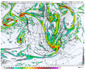
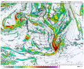
Trough on the 12z GEFS still looks too positively tilted at hr 120 on the mean for a big phase bomb where we need it. Definitely a positive run early on compared to previous runs though.
Considering we've had NW trends with previous systems, this isn't a bad look

If that trend continues it could throw an unforeseen additional piece of northern stream energy into the equation. Happened with this last storm and is actually what brought it back.Noticing a trend south with our TPV during the storm, no bueno for the Ne but we have wiggle room View attachment 109910
The globals are showing huge bombs off the coast. Regardless if we get hit would be great to see this plaster the east.
Eerily similar to the last dud...I mean good snow yall saw! Reel it in fellas
Seeing a lot of “fingers of moisture” trying to really get that phase going but this piece of energy and moisture is what will at least bring a novelty event to some in the SE View attachment 109922

This is honestly a really great look. Dig it a little more to slow the wave down, and you have a big dog in the SE like the 18z GFS yesterday.Could not be a novelty event. Keep the s/w positive and keep diving it west and before long you are gonna get a overrunning event. You can see several GEFS members are picking up on that. You can also see moisture pooling on the coast. This is what we watch east of NC/SC.


It’s definitely fun to have this many storms to track. Exhausting but fun. Especially considering we haven’t had anything to track for 3 years except potential icing events that turned in 32 degree cold rain over on this side of the mountains.Regardless of the outcome, having something to track 3 weeks in a row is amazing.


22.4 here.It appears to me that if there is a storm next weekend, it will most likely deliver frozen precipitation to northern areas of the southeast. The question is how strong and how much. Plenty of time for this to trend further west.
23 degrees here this morning.

Someone else can correct me if I'm wrong, but I don't think we have a true split flow, and we certainly don't have a suppressed enough height field oriented in such a way that you get a bona-fide west to east southern tracking system.Well, better trends I guess today so far but still a while to go. Again depending on a well timed phase sadly.
A little disappointed even with the split flow pattern that's we've had, we haven't had a good old fashioned southern stream threat; from Texas to the Carolinas. Everything's been northern stream dig dependent.
I’m not so sure we are reliant on a phase anymore. But that wave has got to keep digging west.Well, better trends I guess today so far but still a while to go. Again depending on a well timed phase sadly.
A little disappointed even with the split flow pattern that's we've had, we haven't had a good old fashioned southern stream threat; from Texas to the Carolinas. Everything's been northern stream dig dependent.

