Shaggy
Member
We only dropped to 16. We had a small.cloud deck roll in right at sunset from the NE that probably delayed radiational cooling
17.2 was the low in my corner. Coldest this winter as well.I’m at 19.6 surprisingly. Coldest night of the season so far.
Edit: 19.2 now so officially teens.
Not much different than 0z imo.Any analysis from the 6z EPS?
Bottomed out 18.9 here, south wind light and up to 22 now


I think the NWS discussion from Raleigh sums up my thoughts about this coming weekend's system pretty well. It is there on the models and something to watch depending on the track it takes but nothing to get too excited about as of now. I know the members here will be wide awake and among the first to know if we are in store for another round with Old Man Winter.This is good at this point.
RAH
Attention then shifts to a potent shortwave trough which will dive
SE from the Northern Plains into the Deep South on Friday,
potentially inducing surface cyclogenesis off the East Coast Friday
night. Both the GFS and ECMWF have been consistently showing this,
but as to be expected this far out, the placement of the low and how
soon cyclogenesis takes place are very uncertain at this time. The
GFS had been bringing the low and its associated precipitation
shield farther west, but the 00z run is more like the ECMWF and
keeps it farther east and offshore. Most GFS and ECMWF ensembles do
the same. Temperatures would potentially be cold enough to support
some frozen precipitation if it does occur, so this will need to be
watched in the coming days. For now just have a slight chance of
rain or snow in eastern parts of the area. Temperatures will turn
colder once more on Saturday with strong NW flow as the low deepens
offshore.
Just curious when you say this is close, do you mean for all of us or just for NC?This isn't that far away at all. Just a little more disconnection of the trough and boom
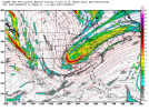
View attachment 109867
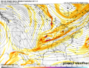
View attachment 109868
This isn't that far away at all. Just a little more disconnection of the trough and boom
View attachment 109867
View attachment 109868


Al-->east would just depend on how quickly if at all you could negative tilt the southern portion of the trough. Odds favor NC/SC thoughJust curious when you say this is close, do you mean for all of us or just for NC?
Oh. it will trend west. Every system this winter has made drastic changes in the final stretch. This one will be no exception. Just sit back and watch the mayhem unfold. It is truly the best part of tracking these winter storms. However, it will drive you insane if you let it.It appears to me that if there is a storm next weekend, it will most likely deliver frozen precipitation to northern areas of the southeast. The question is how strong and how much. Plenty of time for this to trend further west.
23 degrees here this morning.
Agreed… there seems to be good players on the field for some kind of a storm in the Friday/Saturday timeframe. It looks as there will a good amount of cold air to work with if there is a storm. Another thing, as has been pointed out, is this does appear to be around a time where the pattern begin to change or at least reshuffle as it looks like after next weekend we go into not a torch pattern, but one the favors more in the way of average temperatures for the southeast… we’ve seen some very impressive winter storms in the southeast over the years that preluded pattern changesIt appears to me that if there is a storm next weekend, it will most likely deliver frozen precipitation to northern areas of the southeast. The question is how strong and how much. Plenty of time for this to trend further west.
23 degrees here this morning.
I don’t think this is the -1200 odds lock people think it is. With our last storm sure we adjusted at the last minute, but let’s not forget what we were recovering from, a trend south and east a few days out that pretty much took us out of field goal range for a big dog. My thinking hasn’t changed much but if my rosy outlook yesterday afternoon was the yin, consider this the yang.Oh. it will trend west. Every system this winter has made drastic changes in the final stretch. This one will be no exception. Just sit back and watch the mayhem unfold. It is truly the best part of tracking these winter storms. However, it will drive you insane if you let it.
I kind of understood that from what you posted yesterday as well. With that being said, if this puppy doesn't start trending better,at what point should we just move on from this potential? TIA.I don’t think this is the -1200 odds lock people think it is. With our last storm sure we adjusted at the last minute, but let’s not forget what we were recovering from, a trend south and east a few days out that pretty much took us out of field goal range for a big dog. My thinking hasn’t changed much but if my rosy outlook yesterday afternoon was the yin, consider this the yang.
Considering we trended back to a snow storm 12 hours before our last storm tells me we certainly can overcome thisThis isn't that far away at all. Just a little more disconnection of the trough and boom
View attachment 109867
View attachment 109868
Hard to say at what point we should move on, given the models have been complete trash lately. And the fact that the last one basically came back to some of us with under 24 hours to go before the event. I would say if things are not looking somewhat better by Wednesday it’s probably time to look ahead at what’s next.I kind of understood that from what you posted yesterday as well. With that being said, if this puppy doesn't start trending better,at what point should we just move on from this potential? TIA.
That’s a great question. As it stands right now, no need to move on unless we get more east shifts with pieces at large since it’s pretty borderline for the coast as it stands now. This set up reminds me of the Jan 3 2018 storm, which similarly had this deep diving trough. If memory serves me correct I don’t think that storm had too many synoptic adjustments, instead CAMs began to suggest it may form a little closer to the coast and what first looked like a coast scraper eventually ceded to put more people inland in the game (but correct me if I’m wrong. Since that storm was around the holidays I didn’t follow every run/trend). That’s a reasonable expectation. A western shift with our players though, even something as minor as 25 miles, would do a lot to brighten my outlook.I kind of understood that from what you posted yesterday as well. With that being said, if this puppy doesn't start trending better,at what point should we just move on from this potential? TIA.
Yeah I noticed that piece of energy is staying together longer each run and pushing further east. Not much but something worth watching.Icon miss, but flizzards everywhere View attachment 109887View attachment 109888
