Man I hope so. Hope the HRRR is on to something because 2 inches of snow with 0.5 in of ice on top is a nightmareI think they’re overdoing the ICE around here. Other then maybe a couple hours of light freezing rain, I HIGHLY doubt we get the 0.25-0.5” they’re forecasting. All the sounding support snow to sleet to light freezing rain for a couple of hours to snow again.
-
Hello, please take a minute to check out our awesome content, contributed by the wonderful members of our community. We hope you'll add your own thoughts and opinions by making a free account!
You are using an out of date browser. It may not display this or other websites correctly.
You should upgrade or use an alternative browser.
You should upgrade or use an alternative browser.
Wintry Jan 15-16 Winter Storm Discussion & Obs
- Thread starter SD
- Start date
iGRXY
Member
solid again on the HRRR. It’s staying steadfast. It’s getting within its range and is probably the best model at handling FGEN driven precip and dynamic cooling.

GaSnowhound
Member
Do you have wind direction?38 and overcast in Athens, Ga.
DadOfJax
Member
Where did you find a place to stay?View attachment 105869We made it to lake toxaway around 12:30 last night. Not easy with a 9 month old and two women. It’s beautiful here. For some reason all my pictures post upside down!
iGRXY
Member
Oh the power is gone by that point and the snow helps insulate it on roads so it’s even harder to melt.Man I hope so. Hope the HRRR is on to something because 2 inches of snow with 0.5 in of ice on top is a nightmare
Showmeyourtds
Member
Not really,,,the airport is ENE at 15 currently...
It’s also possible that my anemometer isn’t working.Wow, I've had an East/ENE wind now for a little while...just goes to show you how just being even 25 miles east of ATL can have a difference in the wedging.
According to the WunderMap, most places ITP are reporting 39 to 40 with ENE or ESE winds
iGRXY
Member
I’m going to go ahead and tell you, you’re going to probably get at least a foot. Lake toxaway does great in these winter storms. Moisture gets rung out and rates are always very very good.View attachment 105869We made it to lake toxaway around 12:30 last night. Not easy with a 9 month old and two women. It’s beautiful here. For some reason all my pictures post upside down!
bigstick10
Member
The wind with this is going to be intense, ATL winds will be ENE at 25-35 with gusts to 50 tonight and tomorrow. This alone will cause power outages with the ground saturated.
iGRXY
Member
3K is already initializing with a better push from the CAD and lower 850’s than just 6 hours ago. Small tweaks like that can be a massive deal down the road
SouthGarnerSleet
Member
81.9 inches for the mitches on the Nam3k

It appears to be going in a circle around town? Wunderground says it's ENE though.Do you have wind direction?
Attachments
SnowsWonderful
Member
All short range models continue to show accumulating snow for north AL. What is Huntsville NWS seeing to not go ahead and pull the trigger on at least a WSWatch?
Are they thinking once the surface low transfers the ULL will then rotate through AL on a depleting basis? Drying up?
Are they thinking once the surface low transfers the ULL will then rotate through AL on a depleting basis? Drying up?
Last edited:
It's a tall order to get the ULL track much different than what is modeled. That said, getting the CAD to overperform is doable. For our areas, that is our best hope IMHO with ZR being the main show.I am still holding onto Hope that the ULL won’t cut the wedge and stays on a more E course across Ga….someone was asking about analogs. Does Gawx (Larry) or any of our other local historians have any data on that scenario???
We'll have two chances for some snow. The HRRR is really close to a burst with the FGEN band here and almost to you. The second chance will come on the backside of the ULL and 850Mb lows passage. To me, that is a lower chance scenario since we both know how that works out here. But nevertheless, strange things can happen with such powerful ULLs so I'm trying to keep expectations low but optimistic for a huge surprise.
Where did you find a place to stay?
Cabin that I found on vrbo. Beautiful place.
MotoWeatherman
Meteorologist
38.6 here in Dahlonega. East windI'd love to get a report from anyone Dahlonega to Helen, GA to know what they're seeing. Chattanooga too.
DahlonegaGaWx
Member
I'd love to get a report from anyone Dahlonega to Helen, GA to know what they're seeing. Chattanooga too.
Attachments
Drscottsmith
Member
Duncan, SC (2 mi. S of I-85)
Temp: 38.1
Humidity: 61
Dew: 25.5
Temp: 38.1
Humidity: 61
Dew: 25.5
13/9
Sunny
Sunny
7am Sunday morning. Almost go time. Good luck to everyone. Just remember everyone may not be getting exactly what they wanted but this is going to be one a lot of us look back at in the years to come and long for again. Now let’s get it!

Windergawx
Member
38/32. E9mph
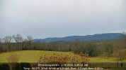
Same here 28/26 in the South Mountains on HWY 64. I'm wondering if the mtns directly behind my house will slow the warm nose down a bit. Idk there definitely some micro climates down this way. This is my first storm at our new home here so will be interesting for sure. I have a gravel road beside my house Rooper Hollow that rides the ridge line gonna ride up in the morning see what 2900 ft is doing.28/26, cloudy here currently.
Be carefully buddy if you need me Hollar I know the area well.7am Sunday morning. Almost go time. Good luck to everyone. Just remember everyone may not be getting exactly what they wanted but this is going to be one a lot of us look back at in the years to come and long for again. Now let’s get it!
View attachment 105876
raine1212
Member
That was short lived sunshine, clouds and wind has picked up just a tick
GaSnowhound
Member
Same here. I’m likely moving as Rivian is going to sit at my back yard……times like this make that idea more palatable…….don’t know if you recall the guy from talkweather who moved to N Maine years ago bc he was so sick of shafts and near misses……that may be me soon?. I think he still checks in to troll the SE/MA weenies over on American?It's a tall order to get the ULL track much different than what is modeled. That said, getting the CAD to overperform is doable. For our areas, that is our best hope IMHO with ZR being the main show.
We'll have two chances for some snow. The HRRR is really close to a burst with the FGEN band here and almost to you. The second chance will come on the backside of the ULL and 850Mb lows passage. To me, that is a lower chance scenario since we both know how that works out here. But nevertheless, strange things can happen with such powerful ULLs so I'm trying to keep expectations low but optimistic for a huge surprise.
raine1212
Member
 MBY, air is chilly
Z
Zander98al
Guest
Wow. Checking spc mesoanalysis CAD is filtering in to parts of central Alabama with temps falling 2 degrees since the sun's come up. About to reach the upper 30s here soon. Starting out at around mid 40s low 40s or so when sun came up up.
Snownut
Member
No way this thing is an Apps runner! It's Transferring energyApps runner? I was told it wouldn't become an apps runner bc it was CAD driven. I'm confused. lol
Sent from my SM-A526U using Tapatalk
I’m stationed near Bank Mountain Northeast of Hendersonville. Holding around the freezing mark currently.
Z
Zander98al
Guest
Impressive Wedge. 

NWMSGuy
Member
Accumulation totals have dropped for Northwest MS since the 0Z run of the HRRR.

NBAcentel
Member
Nice, I’m sold in a heavy burst of snow for a hour or 2 around Charlotte and points N/NW


norcarolinian
Member
32/27
Wind Calm
Wind Calm
susanfrances
Member
41 in Rome, wind NE 3 mph, dew point 34. Plenty of precip showing up on radar, but not a drop falling right now.
iGRXY
Member

The 3K is finally picking up on the dynamic cooling but it’s still struggling compared to the HRRR so far.
I moved from Social Circle 20 years ago thinking that an extra 10 miles north might help one day...not. Sadly, when we bought this house, it was down to this one and another in Habersham. The wife won that round.Same here. I’m likely moving as Rivian is going to sit at my back yard……times like this make that idea more palatable…….don’t know if you recall the guy from talkweather who moved to N Maine years ago bc he was so sick of shafts and near misses……that may be me soon?. I think he still checks in to troll the SE/MA weenies over on American?
38.3 with a light ene wind currently. Forecast high of 51. Let's see if we can top out below 45!
I appreciate it! This cabin has Hughes Net internet service..not really any service out here but we’re only about 10 minutes from I26. Hoping ALL utilities remain in tact.Be carefully buddy if you need me Hollar I know the area well.
- Joined
- Jan 2, 2017
- Messages
- 1,568
- Reaction score
- 4,283
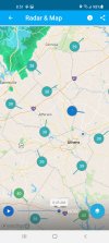
Wedge incoming

Yeah even where it’s showing that sleet south and southeast of Charlotte, the soundings are supportive of snow…borderline, I gotta that if the rates are what they typically are in a band like this it would at the very least be a snow/sleet mixNice, I’m sold in a heavy burst of snow for a hour or 2 around Charlotte and points N/NWView attachment 105881View attachment 105882
Windergawx
Member
anyone have a good temp site to watch the cad build in?
3km NAM doesn't have precip reaching the triangle until 15z-16z tomorrow.

and by 20-21z RDU is above freezing. Hopefully we won't have to worry to much about losing power.

and by 20-21z RDU is above freezing. Hopefully we won't have to worry to much about losing power.