It is 36 with a 29 dew point here and overcast. the wedge has arrived and seems to be building in. Nice wind from the NE - it’s pretty breezy
-
Hello, please take a minute to check out our awesome content, contributed by the wonderful members of our community. We hope you'll add your own thoughts and opinions by making a free account!
You are using an out of date browser. It may not display this or other websites correctly.
You should upgrade or use an alternative browser.
You should upgrade or use an alternative browser.
Wintry Jan 15-16 Winter Storm Discussion & Obs
- Thread starter SD
- Start date
NEGaweather
Member
ENE winds at 10 mph and Dewpoint down 28 in Banks county. Welcome CAD come on in!
Sent from my iPhone using Tapatalk
Sent from my iPhone using Tapatalk
LovingGulfLows
Member
- Joined
- Jan 5, 2017
- Messages
- 1,499
- Reaction score
- 4,100
Models show cad still affecting Northeast quadrant of Alabama through Sunday, can't say it won't reach subfreezing here. Temps are already forecasted at 33/34 by the time the backend of the system comes through. Along with winds coming from the Northeast from the apps through Sunday.

HRRR Model
HRRR model forecast of 2m Temperature (shaded) for Southeast U.S.
 www.tropicaltidbits.com
If you click on that link, then go from hour 22-28, notice how the colder temps are advecting from the NW into NE AL. That's not wedging, but typical CAA on the backside of any cyclone. The wedge doesn't have anything to do with whether or not NE AL sees snow from this system.
I mean this is brutal even if you take 25% off these values
If ever a CAD were to overperform, with those winds speeds, it would have to be this one. Who knows, maybe those crazy wrf models showing the CAD area temps 5-8 degrees lower than the NAM and HRRR are onto something? Or on something

- Joined
- Jan 2, 2017
- Messages
- 1,568
- Reaction score
- 4,283
You will get a nice dumping I do believe. Can't wait for your obsIt is 36 with a 29 dew point here and overcast. the wedge has arrived and seems to be building in. Nice wind from the NE - it’s pretty breezy
Crowndawg007
Member
41/41 and now a slight wind from the NE … in Sandy Springs at 400
ATLwxfan
Member
If ever a CAD were to overperform, with those winds speeds, it would have to be this one. Who knows, maybe those crazy wrf models showing the CAD area temps 5-8 degrees lower than the NAM and HRRR are onto something? Or on something
I spent two days talking up that model. Now I think it might be stone cold crazy! 42° in Alpharetta. I don’t thing we hit our projected high of 47° if the cad builds
Sent from my iPhone using Tapatalk
We are at Ingles in cashiers now and it’s is slammed busy. We’ve got enough food to last a week, lol. We ain’t going hungry.
Z
Zander98al
Guest
The temps are already 33/34 near freezing by that point as the cold air should be rushing in from the northwest. It all works out in tandem. With CAD through most the day sunday keeping us near freezing. And somewhat snowy. Forecast snowfall totals follow this CAD younger through the Northeast quadrant.HRRR Model
HRRR model forecast of 2m Temperature (shaded) for Southeast U.S.
If you click on that link, then go from hour 22-28, notice how the colder temps are advecting from the NW into NE AL. That's not wedging, but typical CAA on the backside of any cyclone. The wedge doesn't have anything to do with whether or not NE AL sees snow from this system.

41.1 and overcast. Wind ene at pines just begging to sway.
Flotown
Member
Not a meteorologist but that upper low position screams some heavy snow on northwest side of it...
Avalanche
Member
Post pics frequently.We are at Ingles in cashiers now and it’s is slammed busy. We’ve got enough food to last a week, lol. We ain’t going hungry.
Snownut
Member
Is it just me or could I see this thing starting in upstate by early evening?
Sent from my SM-A526U using Tapatalk
Sent from my SM-A526U using Tapatalk
Flotown
Member
Still think n Mississippi west Tennessee and North bama does well. Jmo
NoSnowJoe
Member
41 here in Walking Dead country and NW winds at 1 mph. Hoping for a snow miracle tomorrow, if not maybe next weekend.
DadOfJax
Member
It will for the Northeast quadrant of the state. Where a winter storm watch or advisory could be issued depending on the trends of how the
CAD does not keep us snowy….merely cold at the surface. Snowfall does not follow CAD, it follows the track of the ULL, which is why you have snow in TN. CAD will aid in NC where the cold air is much deeper, but it simply doesn’t do it in AL. Never has, never will.The temps are already 33/34 near freezing by that point as the cold air should be rushing in from the northwest. It all works out in tandem. With CAD through most the day sunday keeping us near freezing. And somewhat snowy. Forecast snowfall totals follow this CAD younger through the Northeast quadrant.View attachment 105899
bigstick10
Member
This is a great map to watch CAD in GA
 weather.uga.edu

Georgia Weather - Automated Environmental Monitoring Network Page
University of Georgia Weather Network
weather.uga.edu
dsaur
Member
42 near Griffin, and a nice steady ne wind. Like to see it building, and stay strong thru out.41/41 and now a slight wind from the NE … in Sandy Springs at 400
Current dews, wind, mslp, fronts

DadOfJax
Member

Temps
Z
Zander98al
Guest
Okay I understand ?, it should still be good for us though when the backside comes through and the dynamic cooling takes place.CAD does not keep us snowy….merely cold at the surface. Snowfall does not follow CAD, it follows the track of the ULL, which is why you have snow in TN. CAD will aid in NC where the cold air is much deeper, but it simply doesn’t do it in AL. Never has, never will.
drfranklin
Member
- Joined
- Dec 1, 2016
- Messages
- 511
- Reaction score
- 760
39.6/27, winds NE 13 gusts to 20
intermittent sunshine for about 1 hour earlier this morning, now overcast
wedge effects beginning in this area
(clarify my location: I started a job in Greensboro 3 months ago that I could not turn down; family still lives in Greenville SC, but will eventually move to NC; Triad is highly underrated)
DadOfJax
Member
There’s a small chance we could see more than a few snow showers, albeit small.Okay I understand ?, it should still be good for us though when the backside comes through and the dynamic cooling takes place.
Dig you pig!
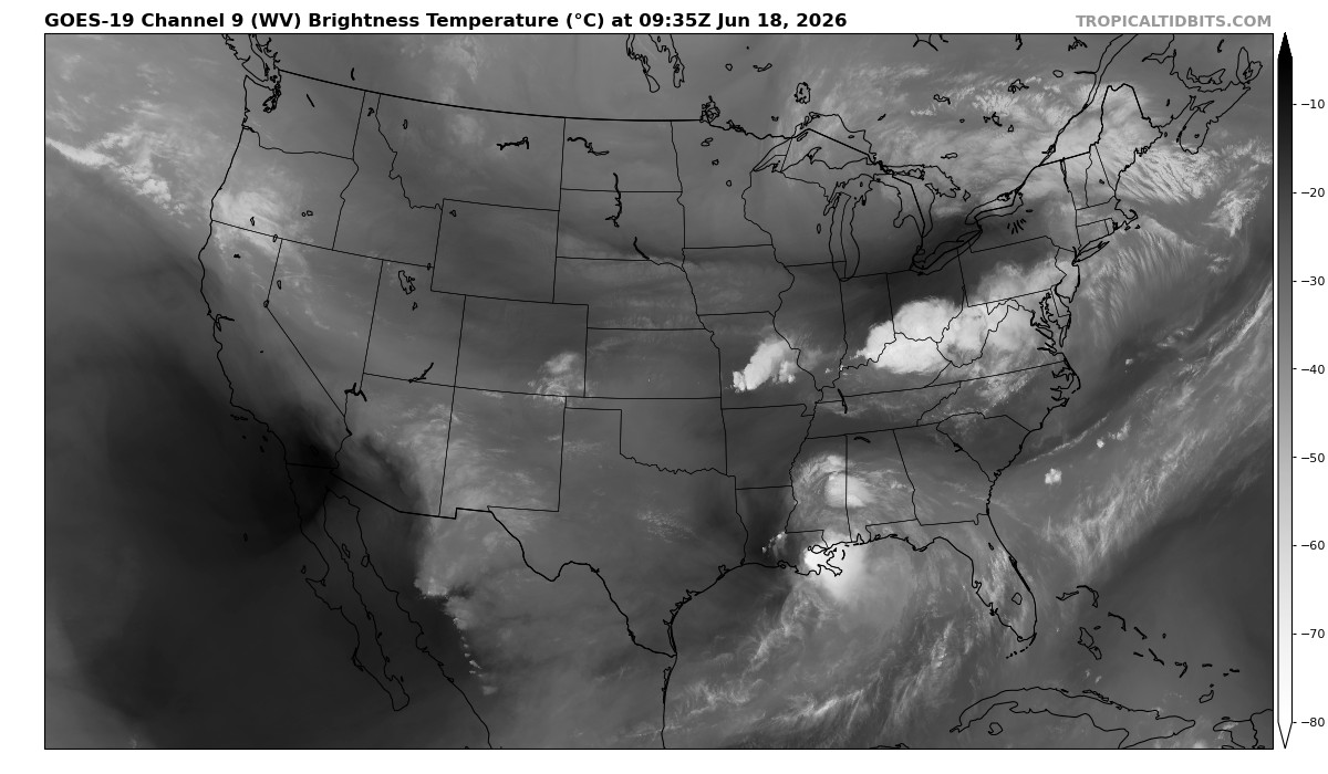 www.tropicaltidbits.com
Water Vapor Satellite Loop for United States | Tropical Tidbits
United States Water Vapor Satellite Loop
www.tropicaltidbits.com
alot of counties in watches/warnings
Them single digit dews, seem far away!Current dews, wind, mslp, fronts
View attachment 105905
We will check back in in a few hoursThem single digit dews, seem far away!
Flotown
Member
Yeah ,can't believe n bama isn't under something
Snownut
Member
Dig you pig!
Water Vapor Satellite Loop for United States | Tropical Tidbits
United States Water Vapor Satellite Loop


Sent from my SM-A526U using Tapatalk
Jessy89
Member
Temp 40 dew point 28
Sent from my iPhone using Tapatalk
Sent from my iPhone using Tapatalk
43 cloud bank moving in Anderson sc
Check the soundings.NAM still showing wraparound show in Alabama fwiw. Still not understanding how part of North Alabama get rain and parts of South Alabama get snow

DadOfJax
Member

gawxnative
Member
41.8 DP 32 ENE at 8
I have to say the air "has that feel" to it..lol
I have to say the air "has that feel" to it..lol
It seems like it is further west....to me.
JLL1973
Member
Wherever the upper low pivots will get the screw job but then again whoever gets the convective bands will be the big winner. Could be anyone in the midsouthAccumulation totals have dropped for Northwest MS since the 0Z run of the HRRR.
View attachment 105880
dropping south?

 weather.cod.edu
COD NEXLAB: Satellite and Radar
Check out COD Meteorology's Satellite and Radar Data
weather.cod.edu
Marginal BL probably ptype driven and its possible by the point there is a good amount of cold wrapped S and SW of the systemNAM still showing wraparound show in Alabama fwiw. Still not understanding how part of North Alabama get rain and parts of South Alabama get snow