-
Hello, please take a minute to check out our awesome content, contributed by the wonderful members of our community. We hope you'll add your own thoughts and opinions by making a free account!
You are using an out of date browser. It may not display this or other websites correctly.
You should upgrade or use an alternative browser.
You should upgrade or use an alternative browser.
Wintry Jan 15-16 Winter Storm Discussion & Obs
- Thread starter SD
- Start date
accu35
Member
is that a 4 contour coming up. oh boy...
BufordWX
Member
Snowflowxxl
Member

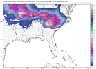
Hi Rez clown was nearly the same as 12z, maybe warmer
definite warmer; snow doesnt expand as far south, at least in sc.
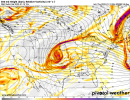
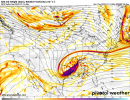
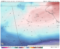
@90hrs the trough looks to be setting up from Mississippi to savannah where the new surface low takes shape. It looks like its warmer though, board wide.
Snowflowxxl
Member
yep definelty a warmer run. bleh
hm, i have crappy maps but im not sure that's a run we'd like to see as a whole. ... I don't have between frames, but looks more inland vs 12
Reducing the noise, this will likely be a Gulf low coming out of the eastern Panhandle, more A ish, expect these transition zones to continue sharpening. Natural baroclinic zone would support a track along or just offshore.
Reducing the noise, this will likely be a Gulf low coming out of the eastern Panhandle, more A ish, expect these transition to continue sharpening. Natural baroclinic zone would support a track along or just offshore.
Tomorrow nights suites will hopefully get this down with all the data available. Seems like on my end; didn't know what to do with the lower pressure and where to put it etc.
Reducing the noise, this will likely be a Gulf low coming out of the eastern Panhandle, more A ish, expect these transition to continue sharpening. Natural baroclinic zone would support a track along or just offshore.
I suspect the same. However this would bring warmer temps into the Carolinas.
BufordWX
Member
I suspect the same. However this would bring warmer temps into the Carolinas.
Indeed it will
Stephenb888
Member
What’s causing warmer temps?I suspect the same. However this would bring warmer temps into the Carolinas.
What’s causing warmer temps?
Warm air advection at the mid levels, 700-850mb, cranking in to a rapidly deepening mid latitude cyclone.
Stephenb888
Member
So what do we need to make it better less amped?Warm air advection at the mid levels, 700-850mb, cranking in to a rapidly deepening mid latitude cyclone.
So what do we need to make it better less amped?
Assuming you are in Anderson SC, you are in a good spot for major impacts, be safe.
Stephenb888
Member
I just mean what would we need to get less freezing rain and more snow in the upstate.How much for your back yard?
Downeastnc
Member
Reducing the noise, this will likely be a Gulf low coming out of the eastern Panhandle, more A ish, expect these transition zones to continue sharpening. Natural baroclinic zone would support a track along or just offshore.
Yeah too Miller Aish to see a I 95 track IMO......just does not seem likely given the setup....still need a lot of work for our backyards to sniff anything significant not gonna be our storm.
I just mean what would we need to get less freezing rain and more snow in the upstate.
Determinations at least 24 hours out, rough guess you will start as snow and likely see several inches before IP/ Maybe ZR but profiles look like sleet, than back to snow as the surface lifts NNE.
Not a good run with temps this morning. Some areas stayed the same or was extremely warmer. Possible transferring of the surface low?

Sent from my iPhone using Tapatalk

Sent from my iPhone using Tapatalk
Temps are lock imo up this way but qpf busts are quiet possible I see. Up to 0.75” of fantasy moisture could lower snow amounts by a large margin for some esp @BIG FROSTY and up into south-west Virginia.
I’m very hesitant to go above 6” for anyone in NC until it’s actually on radar. I just have to see the final track and moisture returns I’ve been down this road too many times. Maybe we can pin point the track sooner to see who gets that 12”+ but for now it’s still low confidence. I’m high confidence tho on amounts up to 6”.
Snowflowxxl
Member
Whose got the eps
olhausen
Member
Snowflowxxl
Member
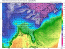
850s are on fire on the NAM in most places outside mtns
Snowflowxxl
Member
So going over the overnight model data.
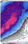
Latest NAM, Euro, & CMC all ticked back warmer
UKMET is the only model that looks better from it's previous run
Not to wake everyone up with negativity, but we are ticking back the wrong direction.
On to the morning runs.
Latest NAM, Euro, & CMC all ticked back warmer
UKMET is the only model that looks better from it's previous run
Not to wake everyone up with negativity, but we are ticking back the wrong direction.
On to the morning runs.
Downeastnc
Member
Snowflowxxl
Member
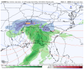
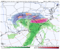
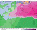
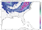
6Z ICON is another huge hit. Might even be a tick colder
Looks like its a literal tick warmer at the beginning of the storm, but a tick colder during the middle and end of the storm.6Z ICON is another huge hit. Might even be a tick colder
Icon looks like a lot of ice again.. ?
Snowflowxxl
Member
NBAcentel
Member
Probably gonna start seeing winter storm watches being issued later today/tomorrow morning
Time to buy a generator... Geez hope them south trends continue.

