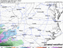
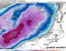
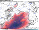
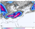
One thing for CLT metro and then up the I-85 corridor to keep an eye on is the path of the upper low. The Euro and Icon both want to move it just south of I-20 from ATL to CAE and then turn it NE from there… this is a great track to put down some heavy snow on the back side of the storm for those areas… February 2004 had a similar track with the upper low
-
Hello, please take a minute to check out our awesome content, contributed by the wonderful members of our community. We hope you'll add your own thoughts and opinions by making a free account!
You are using an out of date browser. It may not display this or other websites correctly.
You should upgrade or use an alternative browser.
You should upgrade or use an alternative browser.
Wintry Jan 15-16 Winter Storm Discussion & Obs
- Thread starter SD
- Start date
NBAcentel
Member
iGRXY
Member
Still had the deform band to slide thru so these would have increased
NBAcentel
Member
ATLwxfan
Member
NAM this AM quite a bit colder but that warm nose gives major ice to northeast GA. Will be interesting to see where we go now that there system is ashore.
I am a bit surprised that general modeling consensus has the thermals so warm even with a deeper track of the low but what do I know?
Sent from my iPhone using Tapatalk
I am a bit surprised that general modeling consensus has the thermals so warm even with a deeper track of the low but what do I know?
Sent from my iPhone using Tapatalk
6z euro is right at 7-8 inches of snow here: I'll assume theres alot of sleet that gets thrown in there( so its a pretty safe bet for 4-5 inches of concrete). Then this is followed by .70 of freezing Rain. Get a whiff of backside snow to stick on top of all the freezing rain coated limbs. Then prob 20-28 mph gust as she rolls away off to the NE. Couple all that with probably not spending 1-3 hours at or above freezing till like the middle/end of next week.
ATLwxfan
Member
One thing for CLT metro and then up the I-85 corridor to keep an eye on is the path of the upper low. The Euro and Icon both want to move it just south of I-20 from ATL to CAE and then turn it NE from there… this is a great track to put down some heavy snow on the back side of the storm for those areas… February 2004 had a similar track with the upper low
The tail end of the NAM was not very impressive in terms of back end snow. The energy rapidly transferred…maybe some nice flakes for pictures though.
Sent from my iPhone using Tapatalk
6z RGEM and 6z Nam


Dang so close for North Miss/Alabama. Needs this thing to trend a little colder and south. I bet surface temps are really close on the surface maps.
Thats 4 contours closed off on the RDPS verse 2 on the Nam. def stronger and precip is faster futher east RDPS. Both have Horrendous Ice accums I85corridor out of North GA into SC
- Joined
- Jan 2, 2017
- Messages
- 1,566
- Reaction score
- 4,279
Yea man this one is gonna be fun. Safely using kuchera method is still a major for a lot of us coupled with big winds...what a day this will be if the euro is correct. It may be wrong but you can't argue the consistency which is believable.6z euro is right at 7-8 inches of snow here: I'll assume theres alot of sleet that gets thrown in there( so its a pretty safe bet for 4-5 inches of concrete). Then this is followed by .70 of freezing Rain. Get a whiff of backside snow to stick on top of all the freezing rain coated limbs. Then prob 20-28 mph gust as she rolls away off to the NE. Couple all that with probably not spending 1-3 hours at or above freezing till like the middle/end of next week.
Getting close enough for a chase.Dang so close for North Miss/Alabama. Needs this thing to trend a little colder and south. I bet surface temps are really close on the surface maps.
I think the best chance for significant backside snow with this is gonna be greater for the Carolinas than back into GA… now that this is trended more to a Hybrid Miller A/B, once the transfer occurs it should take on more the look of a Miller A with a pronounced comma head and strong deform band moving with the upper level energy… Upstate SC and western/central NC up into VA would be favored with thatThe tail end of the NAM was not very impressive in terms of back end snow. The energy rapidly transferred…maybe some nice flakes for pictures though.
Sent from my iPhone using Tapatalk
ATLwxfan
Member
I think the best chance for significant backside snow with this is gonna be greater for the Carolinas than back into GA… now that this is trended more to a Hybrid Miller A/B, once the transfer occurs it should take on more the look of a Miller A with a pronounced comma head and strong deform band moving with the upper level energy… Upstate SC and western/central NC up into VA would be favored with that
I’d agree. If you’re in GA you’re almost hoping this trends warmer to avoid ice on the front end.
Sent from my iPhone using Tapatalk
Looking at 6z hr 84 framefrom GFS,NAM,RDPS. The GFS is the fastest further east, Nam slowest. RDPS and GFS same strength at 4 contours verse 2 for the NAM. The RDPS is further south.
I cant see 500mb 6z euro op map at 84 to compare.
These things usually will get in here quicker than modeled as well as exit quicker. Keep that in your grey matter.
I cant see 500mb 6z euro op map at 84 to compare.
These things usually will get in here quicker than modeled as well as exit quicker. Keep that in your grey matter.
Z
Zander98al
Guest
Im wondering wether models still aren't grasping the dense cold air well. Cause the apps run all the way to northeast of Birmingham. With CAD and strong ones at that. It should reach us. I'm hesitant on believing that atleast a good chunk of northern of Northeast quadrant of the state doesn't recieve a decent bit of snowDang so close for North Miss/Alabama. Needs this thing to trend a little colder and south. I bet surface temps are really close on the surface maps.
I suppose if you are in metro ATL, that is true. We are on the edge of something possibly good in the N GA mountains. Holding out hope anyway.
Todays 12z will tell us alot: The ens should really tighten up and the track become in better agreement. Should be able to leave the ens behind
ATLwxfan
Member
I suppose if you are in metro ATL, that is true. We are on the edge of something possibly good in the N GA mountains. Holding out hope anyway.
I think you’ll get ice but enough snow to make it worth your while.
Sent from my iPhone using Tapatalk
12z suite will be fun to watch
One thing I would watch for you N GA folks is the HRRR as it begins to come into view… it does great at picking up strong FGEN bands and this set up screams that potential. A strong FGEN band can crash a column very quicklyI’d agree. If you’re in GA you’re almost hoping this trends warmer to avoid ice on the front end.
Sent from my iPhone using Tapatalk
ForsythSnow
Moderator
Aside from my area NEward where it's so borderline on many models that if it stays or is even a hair colder it will be mostly snow with less ice or more sleet than iceI’d agree. If you’re in GA you’re almost hoping this trends warmer to avoid ice on the front end.
Sent from my iPhone using Tapatalk
Z
Zander98al
Guest
Still believe us in central Alabama have a good shot at some snow. Thing tO watch for is the surprises we usually have on snow day. With any snow event there's usually a surprise or two. Maybe that snow line is pushed south about 50 miles or so ?. Really hopeful for some snow here.Getting close enough for a chase.
ATLwxfan
Member
One thing I would watch for you N GA folks is the HRRR as it begins to come into view… it does great at picking up strong FGEN bands and this set up screams that potential. A strong FGEN band can crash a column very quickly
Maybe…particularly if you believe the ICON after it goes negative tilt.
Sent from my iPhone using Tapatalk
Looks good, if I were a map maker I'd probably slide it west some or either eliminate the pink area, at the very least label that as onset sn/ip/zr quickly transitioning to all rn. That low track on the 6z euro will put an end to any frozen quick around hereFirst call, thinking I-20 and north especially has the chance of significant ice accumulation. Then as you get towards the NC/SC border towards 85 the chances of snow and sleet accumulation pick up significantly, then in WNC/northern counties of the upstate and VA, there could be some bigtime snow accumulation. I have a small circle for FGEN snow band potential View attachment 104893
I'm a little scared by the 06z RGEM and 06z NAM. Both have egregious 850's and go above freezing especially to areas to the east. Fortunately, the RGEM is less of an issue than the NAM for the upstate. I think that the mesoscale models are starting to get a better handle on the temperature profile. Fortunately, the east shifts should decrease that concern should it continue.
This a problem if you want frozen precip


Nerman
Member
Yea man this one is gonna be fun. Safely using kuchera method is still a major for a lot of us coupled with big winds...what a day this will be if the euro is correct. It may be wrong but you can't argue the consistency which is believable.
The Euro has been rock solid on this storm for days while the GFS gives everyone heart palpitations. I'm sticking with it until I see a change and will rely on the HRRR as we get in it's range. The Low we're watching enters the south in approx 48 hours. It's go time.
Yeh I’m not entirely sure why y’all don’t seem concerned about the overnight and 06z runs. All of them ticked warmer. Maybe for areas snow trended higher in your specific area, but in general, temps and temps aloft ticked warmer or maybe stayed about the same. East trend doesn’t mean a ton if that HP in the NE doesn’t cooperate better. On to the 12z runs.
PS, Shawn, I hope we get an Ice storm the size of Kansas.
PS, Shawn, I hope we get an Ice storm the size of Kansas.
But...... and maybe I'm wishcasting, but, the Euro isn't necessarily in it's wheelhouse at this juncture. I'll reserve too many negative comments (for Central/Eastern NC) until we see what the 12z suite looks like. If the NAM/RGEM still show very good cold dry air feed with a smidge better slp track, then could still be a significant event around here. Still lots to sort out
Ron Burgundy
Member
FFC delivering a swift kick to the nads this morning. ?
Warmer temps towards the ATL metro will lend towards all rain with
snow possibly mixing in at times. However, if the wedge is stronger
than anticipated, will have to monitor for light icing, especially
in the eastern ATL `burbs. Do think that ptype will finish off as
ra/sn on the back side of the low across much of north Georgia.
Good news
Robert, the temps ticking up or down a few degrees are within a certain margin of error for sure. I agree with "on to the 12z" suites as that shed a little more light on temps but still, things can variate right up until "go time".Yeh I’m not entirely sure why y’all don’t seem concerned about the overnight and 06z runs. All of them ticked warmer. Maybe for areas snow trended higher in your specific area, but in general, temps and temps aloft ticked warmer or maybe stayed about the same. East trend doesn’t mean a ton if that HP in the NE doesn’t cooperate better. On to the 12z runs.
PS, Shawn, I hope we get an Ice storm the size of Kansas.
Showmeyourtds
Member
Can't say that I blame them based on what occurred overnight. I'm honestly skeptical of any backside impact other than novel flakes.FFC delivering a swift kick to the nads this morning. ?
Warmer temps towards the ATL metro will lend towards all rain with
snow possibly mixing in at times. However, if the wedge is stronger
than anticipated, will have to monitor for light icing, especially
in the eastern ATL `burbs. Do think that ptype will finish off as
ra/sn on the back side of the low across much of north Georgia.
Last edited:
Good news
Wobble SE - good, slower - bad
Clem282340
Member
Good news
Will slowing down the storm help us
No.Will slowing down the storm help us
- Joined
- Jan 2, 2017
- Messages
- 1,566
- Reaction score
- 4,279
It's a fine line up here..always on the razors edge. I'm concerned but still expect a major storm. Fine adjustment in placement, track and timing are coming. The 12z suite will be telling after sampling for sure.Yeh I’m not entirely sure why y’all don’t seem concerned about the overnight and 06z runs. All of them ticked warmer. Maybe for areas snow trended higher in your specific area, but in general, temps and temps aloft ticked warmer or maybe stayed about the same. East trend doesn’t mean a ton if that HP in the NE doesn’t cooperate better. On to the 12z runs.
PS, Shawn, I hope we get an Ice storm the size of Kansas.
NBAcentel
Member
I’m worried about that energy but damn we need any positive trend with our 50/50
packfan98
Moderator
looks like the 6z EPS was improved over 0z much like the operational Euro. Still has the most western tracks through NC compared to GEFS


