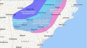
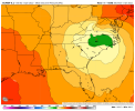
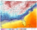
Yeah a smidge of improvement, not bad your waylooks like the 6z EPS was improved over 0z much like the operational Euro. Still has the most western tracks through NC compared to GEFS


Yeah a smidge of improvement, not bad your waylooks like the 6z EPS was improved over 0z much like the operational Euro. Still has the most western tracks through NC compared to GEFS


12z suite will be fun to watch
You know what's gonna suck? If this thing shift S/SE to almost a perfect track but slows down so that by the time it arrives we've lost most of the cold air, not out of the questionThis is it imo. Any wholesale change's will happen in the next 2 to Maybe 3 cycles. After that it's it's lock.
But...... and maybe I'm wishcasting, but, the Euro isn't necessarily in it's wheelhouse at this juncture. I'll reserve too many negative comments (for Central/Eastern NC) until we see what the 12z suite looks like. If the NAM/RGEM still show very good cold dry air feed with a smidge better slp track, then could still be a significant event around here. Still lots to sort out
These things are going to sway from time to time it is encouraging to see the 6z Ensembles improve toward the backend and GA side this seems to swing back toward cooler tempsYeah a smidge of improvement, not bad your way


Yeah that is still plausible. You know sometimes models show a storm in the long range but lose it mid range only to bring it back to some form the original long range depiction. Usually it shows no storm. I've been wondering as these slight SE adjustments show up if we were gonna eventually see it revert back to its early depictions. Not sure we get that but it's possible I suppose.You know what's gonna suck? If this thing shift S/SE to almost a perfect track but slows down so that by the time it arrives we've lost most of the cold air, not out of the question
Correct me if I'm wrong, this is for gfs output which was already progged 6hrs ahead of euro. This in fact should slow the storm on the gfs to be more in line with the euro as far as timing.
What’s weird is they say they went on the cooler side of guidance, but looking at EPS trends it seems things look better for us, not worse.Can't say that I blame them based on what occurred overnight. I'm honestly skeptical of any backside impact other than novel flakes.
If the CAD holds stronger than at some point the models have to show the slp track further east, it will not hold on long at all if it tracks inland like they are all showing. That's my experience anyway and according to @Lickwx I've got the most experience on here by about 100 years LolFor the central NC folks, this will be another "right on the line" event. Many transitions between p-types. The big question right now is do we go above freezing (to rain). Most models say we do, but there is some thought that the CAD may hold stronger. Lee Ringer (Spectrum Meteorologist) thinks there is a possibility this could occur. Maybe the latest data being collected (storm is now moving on shore) and the short-range models (now coming in range) will make things a little clearer later today.
That's true. It might be until the storm is occurring, do we see the track adjusting eastward. Regardless of what happens, this is a fun storm to track.If the CAD holds stronger than at some point the models have to show the slp track further east, it will not hold on long at all if it tracks inland like they are all showing. That's my experience anyway and according to @Lickwx I've got the most experience on here by about 100 years Lol
Not really things have been really consistent it’s just social media confusing people with snow maps when it’s clearly a mixed bag. It’s been a i77 snow storm for days with severe ice down to Charlotte metro and even further south. Yea there have been trends but by and large this storm has been “easy” with no rug pulls.Like most storms around here we really have no clue outside of ~72 hours. It’s crunch time now with our energy being sampled out west and then up north later today. It can go either way imo.
Sounds like they're hedging due to the uncertainty of the warm nose based on that, and those usually aren't sampled until its go time. Gonna be tight either way.What’s weird is they say they went on the cooler side of guidance, but looking at EPS trends it seems things look better for us, not worse.
Getting into the weeds a bit about temperatures, the ECMWF is
slightly colder across the far NE at the onset of precipitation
through about 18Z Sun. The GFS is much faster bringing in the cold
air aloft, which makes sense because it is the faster solution. This
becomes important because it speaks to the strength/depth of the
warm nose aloft which plays a large role in ptype forecasting. GFS
model soundings look pretty consistent with the strength of the warm
nose as in previous runs. The ECMWF has a slimmer warm nose, but
starts out colder at the surface. The GFS has bounced back and forth
a bit with surface temps. The NAM is just starting to give us a peek
at into early Sunday, and is closer to the ECMWF with colder temps
at the surface. Still think that it is prudent to go on the cooler
side of the temp guidance, especially since it will be precipitating
much of Saturday, which can definitely reinforce the wedge.

If the CAD holds stronger than at some point the models have to show the slp track further east, it will not hold on long at all if it tracks inland like they are all showing. That's my experience anyway and according to @Lickwx I've got the most experience on here by about 100 years Lol
That's true. It might be until the storm is occurring, do we see the track adjusting eastward. Regardless of what happens, this is a fun storm to track.


Not really things have been really consistent it’s just social media confusing people with snow maps when it’s clearly a mixed bag. It’s been a i77 snow storm for days with severe ice down to Charlotte metro and even further south. Yea there have been trends but by and large this storm has been “easy” with no rug pulls.
Cage should read Cad. Yea there’s always the fine transition line but I think most Mets would agree it’s been a more consistent winter storm than in recent memory. A lot of us here do live in the heart of the Cad.Consistent? Maybe with a winter storm being modeled for the region, yes but for many of us, it's been a lot of options on the table with regards to front end thumps, p-types etc. You know not all of us live in a cage.
I remember not too long ago we were talking about this being one of the strongest CADs in almost a decade. Now we're right on the line like we are with your average run of the mill CAD with the low tracking right up the middle of it. Fun times.For the central NC folks, this will be another "right on the line" event. Many transitions between p-types. The big question right now is do we go above freezing (to rain). Most models say we do, but there is some thought that the CAD may hold stronger. Lee Ringer (Spectrum Meteorologist) thinks there is a possibility this could occur. Maybe the latest data being collected (storm is now moving on shore) and the short-range models (now coming in range) will make things a little clearer later today.


I hope that’s wrong. Being north of Charlotte I want zilch if I have to deal with ice and long term power outages. Been there before and want nothing to do with that.Not really things have been really consistent it’s just social media confusing people with snow maps when it’s clearly a mixed bag. It’s been a i77 snow storm for days with severe ice down to Charlotte metro and even further south. Yea there have been trends but by and large this storm has been “easy” with no rug pulls.
I don't like a lot tbh. I think you have a better chance at a slightly longer duration period of snow to start but 850s already near 0c as the precip is starting means snow will likely be brief, no goof initial fgen push yet that I've seen. Looking at the nam soundings vs ptype I think with the dry nose present between 875 and 950 we can over perform on ip vs zr through mid morning early afternoon but eventually we go to zr by that point though we are inching so close to freezing at the sfc it may not be of huge consequence like it'll be even 50 miles west of us.
48 hr HRRR, so big nugget of salt, but it had the 850 mb low and surface low still moving SE at that hour. I need that 850 mb low to stay south of me for any chance at backside snow, so I'm watching the trends closely. I don't want this thing amplifying until it gets to Panama City!
This is one of the rare times I agree with Brad P. He’s been skiing in Colorado with Jim Cantore but he’s been screaming at people (paid weather sites) for misleading all snow maps circulating on FB. It’s always been ice but communication sucks with people using the weather channel app with no human input.I hope that’s wrong. Being north of Charlotte I want zilch if I have to deal with ice and long term power outages. Been there before and want nothing to do with that.
