• Hello, please take a minute to check out our awesome content, contributed by the wonderful members of our community. We hope you'll add your own thoughts and opinions by making a free account!

Wintry Jan 15-16 Winter Storm Discussion & Obs

Wind gust 44 mph ???
Man, high winds with ZR and wet snow driving that cold air in from the NE are the things weenie dreams are made of. If somehow we make it to tonight's runs with this bad boy still showing I think I'll have to see if that generator I haven't used in ten years still runs.
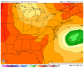
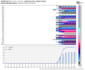
gfs_mslp_wind_us_22.png
 
ATL mets, who in general are very sheepish when it comes to forecasting winter weather, are noticing.


Sent from my iPhone using Tapatalk

Kiss of death. My wife is due any minute with our first and my nightmare was that the little guy would show up ahead of or during a potentially epic winter storm that I can't enjoy.
 
Mentioned this yesterday...we see this almost every time we have a modeled 50/50 at day 6...it tends to lift out quicker. But, this allows a more amped event but probably will end in misery for some and joy for others.


View attachment 103737
Western ridge trends stronger as well. Gives a deeper more western track and amps up more as well.
 
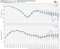
If you're in the upstate or west of 77 in NC you should love the EPS individual storms. Almost all of the big dogs, and there are many, paint the largest swath of totals over these areas. To have the EPS showing this at this range is fantastic.

Yeah, but there's a lot of nothing burgers as well. Still lots of spread. Big dogs and dry clippers too IMO. Interesting to track for sure.
 
Yep we gon rain. Hopefully we have enough CAD that we at least get a little ip/zr before changeover

Yep you cannot have the surface low track right on or inland of the coast if you want snow from I 77 east.....I dont care what the maps show, if there is a 987 low anywhere west of Lookout and Hatteras we gonna rain.....all of us even the mts....maybe some ice in the NW piedmont can hold on for a bit but we need this way less amped or for it to do what it is doing 200 miles further east.....
 
Yep you cannot have the surface low track right on or inland of the coast if you want snow from I 77 east.....I dont care what the maps show, if there is a 987 low anywhere west of Lookout and Hatteras we gonna rain.....all of us even the mts....maybe some ice in the NW piedmont can hold on for a bit but we need this way less amped or for it to do what it is doing 200 miles further east.....
I agree. too far west already.
 
Yeah, but there's a lot of nothing burgers as well. Still lots of spread. Big dogs and dry clippers too IMO. Interesting to track for sure.
Of course there's going to be ensemble members that have nothing. Rarely do you get everyone to show storm at day 5. But A ton have monsters and that is very encouraging at this range.
 
Yep you cannot have the surface low track right on or inland of the coast if you want snow from I 77 east.....I dont care what the maps show, if there is a 987 low anywhere west of Lookout and Hatteras we gonna rain.....all of us even the mts....maybe some ice in the NW piedmont can hold on for a bit but we need this way less amped or for it to do what it is doing 200 miles further east.....
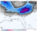
Exactly. This is how you know the Op GFS is lying. Either the snow maps and precip type maps are wrong, or we're not going to have a 979 Low parking itself in the middle of a wedge.
 
Of course there's going to be ensemble members that have nothing. Rarely do you get everyone to show storm at day 5. But A ton have monsters and that is very encouraging at this range.

Yeah. I'd just prefer to have a higher percentage of members with decent hits, rather than a lower percentage of big dogs at this range. Just a preference. The all or nothing runs make me more nervous. Especially since this is such a unique clipper-like system that we don't normally see.
 
ATL mets, who in general are very sheepish when it comes to forecasting winter weather, are noticing.


Sent from my iPhone using Tapatalk

Yeah, the NWS is going to need to go ahead and alert GADOT. They need to start mobilizing if there is indeed 6" + somewhere in North Georgia. I'm not surprised that the possibilities are being mentioned. Way too early for details, though. The means are still low south of Atlanta.
 
Yep you cannot have the surface low track right on or inland of the coast if you want snow from I 77 east.....I dont care what the maps show, if there is a 987 low anywhere west of Lookout and Hatteras we gonna rain.....all of us even the mts....maybe some ice in the NW piedmont can hold on for a bit but we need this way less amped or for it to do what it is doing 200 miles further east.....
This can somewhat apply to the midlands of SC. The 6Z GFS wasn't too far away from a pure rain event towards my way. For the Midlands of SC and eastern NC,we need to hope that the CMC is the most correct here, which brings the storm off the coast and keep the warmer temperatures at bay. The CMC is basically a blend of the 6Z GFS and the 0Z Euro. Amped enough to bring large snow totals,but not too amped to point where a lot of us have to deal with temperature issues.
 
Back
Top