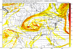
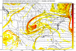
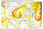
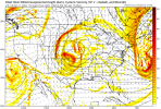
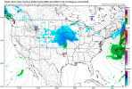
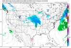
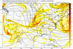
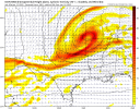
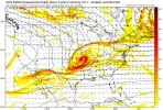
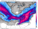
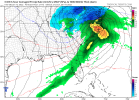
Yep, 5 hrs ago and about 25k pages back I shared how the 18z ICON showed just that. I know it's the ICON but it was just what you said, more interaction with the baja ull, sheared, weakerKey is to get enough interaction with the Baja low that it relaxes the vort enough while coming down the plains. But we also don’t want this thing to completely shear out either with too much interaction. We want a nice closed off ULL but we want it closing off in the southeast. Where in the southeast is really location dependent but for the 85 crowd realistically you want it closing off around Mississippi and Alabama and track around the 20 corridor or just south of there. That way we still get precip generating but not a really amped solution that tries to pull warm air north in the mid levels.
-
Hello, please take a minute to check out our awesome content, contributed by the wonderful members of our community. We hope you'll add your own thoughts and opinions by making a free account!
You are using an out of date browser. It may not display this or other websites correctly.
You should upgrade or use an alternative browser.
You should upgrade or use an alternative browser.
Wintry Jan 15-16 Winter Storm Discussion & Obs
- Thread starter SD
- Start date
Cary_Snow95
Member
NAM at 84 is pretty significantly different than the gfs
accu35
Member
Stronger/South?NAM at 84 is pretty significantly different than the gfs
Cary_Snow95
Member
Much flatter less amped than gfsStronger/South?
Cary_Snow95
Member
Storm5
Member
Stronger/South?
Here's a link for you https://www.tropicaltidbits.com/ana...us&pkg=mslp_pcpn_frzn&runtime=2022011200&fh=0
Sent from my iPhone using Tapatalk
Blue_Ridge_Escarpment
Member
Looks stronger/north than it’s 18Z run thoMuch flatter less amped than gfs
I honestly don’t know where the NAM was going.
Cary_Snow95
Member
Blue_Ridge_Escarpment
Member
ForsythSnow
Moderator
The vort seemed closest in line with the GFS but a bit more west with the energy swing. Prob extrapolates to the GFS's current output or similar.I honestly don’t know where the NAM was going.
iGRXY
Member
Compare the 84 he GFS to the 84 hr NAM and the differences are pretty noticeable. The NAM has a further south and stronger get 50/50, stronger HP over the Midwest and a better CAD push as well. Couple that with a flatter wave and you’re trending in the right direction if the NAM is to be believed
Cary_Snow95
Member
I wouldn’t recommend looking at a surface depiction. H5 is way more telling
iGRXY
Member
H5 shows a much flatter wave and you can see the Baja low pulling just enough that the wave is in tact but it isn’t consolidating quickly like the GFS
Cary_Snow95
Member
H5 is what creates the surface depiction. A more positively tilted more stretched wave is the difference between 00z and 18zI wouldn’t recommend looking at a surface depiction. H5 is way more telling
Weenie question sorry, but is the upstate still looking good for zr?
iGRXY
Member
Depends on how amped the wave is and just how far the LP can track northward against the CAD dome.Weenie question sorry, but is the upstate still looking good for zr?
iGRXY
Member
The wave looks weaker on the ICON as it’s entering the PNW at 43
accu35
Member
What a south shift on the new Icon
ForsythSnow
Moderator
Those temps aren't going to do it on the ICON

Last run we had this

Last run we had this
iGRXY
Member
Don’t look at the temp profiles for the ICONThose temps aren't going to do it on the ICON

Last run we had this

ICON hasn't seen a run it didn't love to put blowtorch too so at least there's thatThose temps aren't going to do it on the ICON

Last run we had this

Hypsometric
Member
@84hrs, 00z NAM and 00z ICON are not too dissimilar at H5.
iGRXY
Member
ICON is a step in the right direction. It closes off but just too late and a little too far north. Luckily the trend has continued to be ULL slowly shifting southwest with track the closer we get to verification.
Showmeyourtds
Member
It’s a good thing this model is hot garbage.Those temps aren't going to do it on the ICON

Last run we had this

Jessy89
Member
The icon temps don’t add up though. The amount of CAD temps will be colder then what Icon shows
Sent from my iPhone using Tapatalk
Sent from my iPhone using Tapatalk
accu35
Member
CAD hasn’t reached most areas yet on the icon so far, wait a few more framesThe icon temps don’t add up though. The amount of CAD temps will be colder then what Icon shows
Sent from my iPhone using Tapatalk
iGRXY
Member
Icon did however trend to a weaker 50/50. Granted this model is really bad but it has continued the less consolidated wave trend.
SnowNiner
Member
Catching up, not great to have the Euro overamped and the gfs so amped it straight Miller B'd straight to crap. Ensembles look great, so that dichotomy is unnerving, especially as the gfs and euro ops continue to trend worse every run imo. Hoping the ensemble means, especially at this lead hold serve and the ops flatten a bit and get reasonable, start to match up. Tonight's runs need to stop the op bleeding stat.
accu35
Member
ATLwxfan
Member
ICON shows the cold really digging in behind the storm. Could get some wraparound action.
Sent from my iPhone using Tapatalk
Sent from my iPhone using Tapatalk
Blue_Ridge_Escarpment
Member
Hypsometric
Member
Definitely feel dumber for having looked at that run. Started out looking somewhere in-between the 12 and 18z runs and ended up tracking way north of both of them.
iGRXY
Member
I was looking at the 18z the whole time lololol. 0z definitely closed off and took an awful track for everybody but the mountains
ICON is carbon copy of CIPS and analogs. I would put a lot of weight into it IMO.

