-
Hello, please take a minute to check out our awesome content, contributed by the wonderful members of our community. We hope you'll add your own thoughts and opinions by making a free account!
You are using an out of date browser. It may not display this or other websites correctly.
You should upgrade or use an alternative browser.
You should upgrade or use an alternative browser.
Wintry Jan 15-16 Winter Storm Discussion & Obs
- Thread starter SD
- Start date
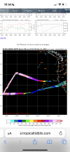
I assume this data would be used in 00z guidance or maybe morning guidance?
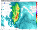
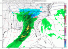
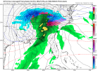
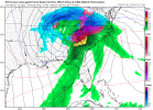
ICON still a significant ice storm for the CAD areas of NC .. Raleigh goes to 36 eventually but places west stay below freezing the whole way … deed will be done by the time it’s just plain rain .. verbatim ICON
0z or the 12z. I believe the 6z guidance runs off what the 0z has.I assume this data would be used in 00z guidance or maybe morning guidance?
Is this data incorporated into the 00z suites?
accu35
Member
That mission was actually yesterday.I assume this data would be used in 00z guidance or maybe morning guidance?
ForsythSnow
Moderator
I'd re-check those timestamps, they're today.That mission was actually yesterday.

Cary_Snow95
Member
iGRXY
Member
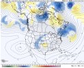
GFS looks like it’s getting pulled on by the Baja low at 69.
Cary_Snow95
Member
0z less amped than 18z by a little, but much less amped than 12z
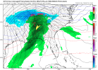
New UKMet tracks if from New Orleans to off Savannah...a bit north from last run


iGRXY
Member
Definitely less amped through 78. But is closed off
GFS looks weaker with the vort but it’s digging a bit more at 81
Cary_Snow95
Member
Sorry I looked at it wrong. ThanksI'd re-check those timestamps, they're today.

iGRXY
Member
Ukmet track NO to Sav is the benchmark track for Triad.
ATLwxfan
Member
A tick colder at the surface
Sent from my iPhone using Tapatalk
Sent from my iPhone using Tapatalk
What's Atlanta/Athens GA best hope as far as track goes?
Looks like another nw move on the gfs
Cary_Snow95
Member
GFS gonna be another amped inland runner
iGRXY
Member
Yeah this isn’t going to end well from what I can see
ATLwxfan
Member
Here comes the rain 
Sent from my iPhone using Tapatalk

Sent from my iPhone using Tapatalk
brendan123
Member
Eventually the GFS will have to change its solution or the GEFS will, it's a matter of when... something has to give
Major ice at the surface too cold low 20s no way it recovers
iGRXY
Member
Ice storm
CLT now with even just an hour or two of some light snow before a very quick changeover
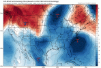
It was like it wants to do a U-turn. Straight from North Dakota to Arkansas back to Chicago with that low... What a freaking mess.View attachment 104170This model sucks. Last 5 runs.
Catastrophic Ice Storm Warning run
LukeBarrette
im north of 90% of people on here so yeah
Meteorology Student
Member
2024 Supporter
2017-2023 Supporter
GFS is a full on Miller-B now
Lows in ky , western ky at that almost. Unreal 1500 mile shift in 30 hrs
Temps 15 to 21 degrees and snow changes over to ice ?

