-
Hello, please take a minute to check out our awesome content, contributed by the wonderful members of our community. We hope you'll add your own thoughts and opinions by making a free account!
You are using an out of date browser. It may not display this or other websites correctly.
You should upgrade or use an alternative browser.
You should upgrade or use an alternative browser.
Wintry Jan 15-16 Winter Storm Discussion & Obs
- Thread starter SD
- Start date
NWMSGuy
Member
BelmontWX79
Member
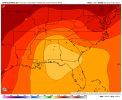
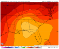
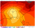
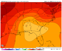
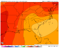
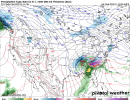
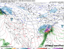
If anything 850 are slightly lower in the ENS but really splitting hairs here.
accu35
Member
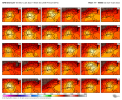
Seeing more north on the individual members. hm
whatalife
Moderator
What a damn mess. ??
accu35
Member
iGRXY
Member
Just looking at the the individual members at 102 and a ton are still mostly snow for a good portion of 85.
How can there be so many different solutions. I guess we need to hope the Euro comes in with the result it had earlier or it might be game over for a lot of us.
Blue_Ridge_Escarpment
Member
The snow mean on the GFS ensemble is going to be insane for the mtns.
Jessy89
Member
At some point we need to take the possibility of a dangerous Ice storm in the Carolinas and NE Georgia seriously. Not ready to just yet though but this time tomorrow?
Sent from my iPhone using Tapatalk
Sent from my iPhone using Tapatalk
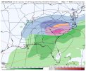
P24 is the only one that comes remotely close to op. It transfers 150+ miles futher souteast
Closer to reality. I mentioned earlier this evening about how the warm nose can surge out of Statesville NC to Danville VA but struggle going west into Sparta/Wilkes counties. I think the snow maps were outrageously too high prior runs but now match what I said earlier exactly for the Charlotte metro region. Totals will pick up northern Mecklenburg back north west. Maybe 3-6” along i40 and 6-12” west of i77. Mixing could alter this by 2-4”.
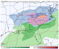
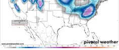
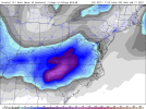
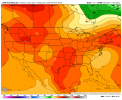
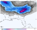
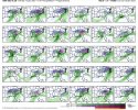
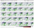
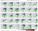
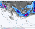
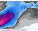
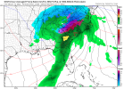
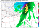
How in the heck. It actually did better for North Alabama. There must be one skewed member in there.The snow mean on the GEFS definitely reflects a bit of a NW shiftView attachment 104209
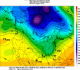
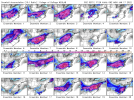
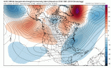
There's support for a Miller B here but nothing asv extreme as the opView attachment 104210
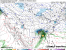
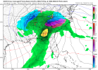
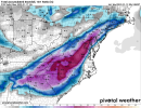
View attachment 104211
GFS has always been really bad with transfers. Though that’s probably weenie wish casting on my past.
Blue_Ridge_Escarpment
Member
Seeing the GEFS snow mean this run tells me much less spread. Starting to get a consensus.
I don’t think a transfer to the coastal plain makes much sense like the GFS depicts (transfer would be offshore or right on it, IMO), though it could still be on the mark with the warmer thermals still.
iGRXY
Member
Miller B support but the progression is much more believable with some of the individual members. You still get a Miller B but it doesn’t penetrate through the CAD dome before transfer to … shocker … off the coast instead of 95 corridor … which means there was still a ton of members with mostly snow solutions.
Stormsfury
Member
The OP GFS doing GFS things again WRT to the first SFC low... some things never change with whatever version of it that's run.
Why in the hell does it take the first SFC low on a cyclonic trip directly to the mid/upper low and even ends up NW of its upper parent (*cough* BS *cough*) .. it shouldn't... but as GFS is as GFS does... already with that, it snowball effects and basically derails the rest of its prog...
cold air damming is extremely stubborn to scour, especially when it's reinforced with precip, latent heat aloft or not...
The parent high appears to be more or less in a really primed spot to stay entrenched for quite awhile ahead of the storm and the SFC low will still likely follow the wedge boundary... still be it, may Miller B but SFC lows don't bust through entrenched wedges quite so readily and the GFS is notorious for scouring wedges out too quickly..
After reviewing 0z I’m ready to book my travel to Mount Rogers, Virginia. More ensemble support there and displayed away from the warm nose that will impact all of North Carolina save 2-3 mountain counties. This setup would not favor south-west NC imo although it’s still solid warning criteria there.
accu35
Member
Even if this takes a track up through TN, Alabama still does well especially if you have a ULL wraparound swinging south before shooting north. I think east of the apps would hurt if the gfs OP verified. That’s my 2 cents tho.How in the heck. It actually did better for North Alabama. There must be one skewed member in there.
Snowman63
Member
CMS coming around...


iGRXY
Member
whatalife
Moderator
iGRXY
Member
Bingo. We have some Miller B members on the GEFS but they make it as far as central and northern Alabama before transferring to the coast. Which is actually a believable setup. The GFS OP just isn’t believable no matter how you slice it. The GEFS showed a clear picture of either a quick transfer without it pushing through the CAD or the southern members pivot around the CAD dome to the coast.The OP GFS doing GFS things again WRT to the first SFC low... some things never change with whatever version of it that's run.
Why in the hell does it take the first SFC low on a cyclonic trip directly to the mid/upper low and even ends up NW of its upper parent (*cough* BS *cough*) .. it shouldn't... but as GFS is as GFS does... already with that, it snowball effects and basically derails the rest of its prog...
cold air damming is extremely stubborn to scour, especially when it's reinforced with precip, latent heat aloft or not...
The parent high appears to be more or less in a really primed spot to stay entrenched for quite awhile ahead of the storm and the SFC low will still likely follow the wedge boundary... still be it, may Miller B but SFC lows don't bust through entrenched wedges quite so readily and the GFS is notorious for scouring wedges out too quickly..

