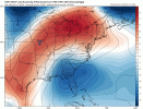
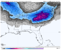
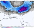
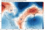
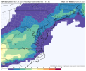
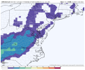
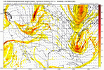
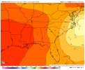
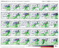
Yeah I really think we would have liked where that run went. 850’s were a tick cooler at 90Closed off over Nebraska? The 00z wasn't close to that I do not think. Makes one wonder if the blend of the Euro and GFS is the best way to go here.
FFC says a rain event for Atlanta with a slight chance of a wintry mix in the northern suburbs.Atlanta, Am I missing something here???
SATURDAY NIGHT
Mostly cloudy with a chance of showers. Chance of snow showers after midnight. Lows in the lower 30s. Chance of precipitation 30 percent
SUNDAY
Mostly sunny. Highs in the lower 40s
SUNDAY NIGHT
Partly cloudy. Lows in the upper 20s
MARTIN LUTHER KING JR DAY
Mostly sunny. Highs in the upper 40s
FFC says a rain event for Atlanta with a slight chance of a wintry mix in the northern suburbs.
No weather channel/site are going to pull the trigger on significant verbiage on winter threat 5 days out on models... If all these models still are close agreement including short range by Thursday afternoon expect it to change real quickAtlanta, Am I missing something here???
SATURDAY NIGHT
Mostly cloudy with a chance of showers. Chance of snow showers after midnight. Lows in the lower 30s. Chance of precipitation 30 percent
SUNDAY
Mostly sunny. Highs in the lower 40s
SUNDAY NIGHT
Partly cloudy. Lows in the upper 20s
MARTIN LUTHER KING JR DAY
Mostly sunny. Highs in the upper 40s
It's too far out from the event for the FCC to make a solid statement on this storm. See what they say on Wed or Thursday. If they start changing their statement then you can start to monitor the storm with excitement.FFC says a rain event for Atlanta with a slight chance of a wintry mix in the northern suburbs.
Correct, for a example the 93 storm wasn’t spoken about in the news until 72hrs out. Even tho burns and Ken cook said they saw it on the models 5 days out.No weather channel/site are going to pull the trigger on significant verbiage on winter threat 5 days out on models... If all these models still are close agreement including short range by Thursday afternoon expect it to change real quick
I bet TWC will be all about it this morning !No weather channel/site are going to pull the trigger on significant verbiage on winter threat 5 days out on models... If all these models still are close agreement including short range by Thursday afternoon expect it to change real quick
I think the Euro was actually already looking more amped over it's extremely flat weak 12z run yesterday. Don't forget, the euro a couple days back first had the monster amped up system right up I-95. At least now it's starting further south so there's wiggle room.Nice to wake up to 13 new pages of storm tracking! Thanks for everyone's PBP by the way, it's appreciated.
At this point I'm not yet buying the GFS amped up solution. Again, this seems really unique, but I don't see that the energy is going to have enough time to get under us, go neutral/negative tilt and crush us. The Ukmet/Euro not taking that road is a big red flag IMO. If today they close off and start to tilt under us, then let's go. Now that I say that watch this thing over amp and hit DC again! lol.
Great thing about this one so far IMBY, it's cold!
Report ad
Contiguous United States Extremes
Weather Folklore The moon her face be red, of water she speaks. | +- Leaflet | © OpenStreetMap contributors, ©AerisWeather Click here for Interactive Radar Report ad Already a Clear Sky subscriber? Click here to login Report ad More Roswell, GA, Weather Information Weather Warnings Doppler Radar State Weather Conditions Satellite Report ad |
WeatherForYou.com, LLC is not responsible for any damages or problems caused by this service. Current weather conditions for Roswell, GA, are obtained from the closest government operated station, a personal station contributing to the PWSweather.com network which may have varying degrees of accuracy or from the Meteorological Assimilation Data Ingest System (MADIS). WeatherForYou.com, NOAA and their data providers disclaim liability of any kind whatsoever, including, without limitation, liability for quality, performance, merchantability and fitness for a particular purpose arising out of the use or inability to use the data. Weather forecasts are powered by AerisWeather. Like all things, this site belongs to Jesus Christ... He just trusts us to maintain it. If you have any questions or comments email [email protected] Copyright © 2021, WeatherForYou.com LLC. All rights reserved. |
I think the Euro was actually already looking more amped over it's extremely flat weak 12z run yesterday. Don't forget, the euro a couple days back first had the monster amped up system right up I-95. At least now it's starting further south so there's wiggle room.