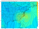
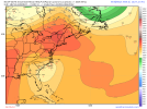
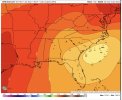
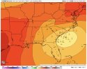
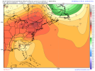
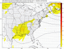
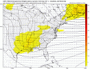
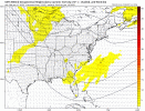
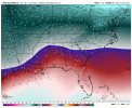
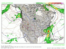
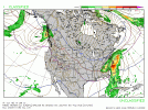
Yeah, I don't understand an inland track if the CAD is stronger...something has to giveBull is ready to drop the hammer on us (me included). The stronger wave actually creates more confluent flow into PA/NY, so it makes sense that the damming is getting stronger. It was just kind of shocking seeing that wave run the apps like it did

-
Hello, please take a minute to check out our awesome content, contributed by the wonderful members of our community. We hope you'll add your own thoughts and opinions by making a free account!
You are using an out of date browser. It may not display this or other websites correctly.
You should upgrade or use an alternative browser.
You should upgrade or use an alternative browser.
Wintry Jan 15-16 Winter Storm Discussion & Obs
- Thread starter SD
- Start date
I would say.....if you just want a winter storm, (snow or ice), then the worst case scenario is a super amped Miller A like you mentioned where the wave is west of the Apps (kind of hard to imagine, but still possible I guess). Probably the best we can do here is a Miller A/B hybrid where the parent low runs into S Bama, then shuffles due east to the coast. In that case, with the strong CAD, you'd get accumulating snow & sleet based on the cold temperatures we are seeing. If you go true Miller B, with weak low west of the Apps, you are going to put more pressure on the damming high, and you'd get less snow, then go to sleet or frz rain depending on strength of the CADAt this point couldn't a Miller B actually be better for the 85 corridor instead of an amped low cruising across south GA into the coastal plain?Seems if the parent low stays weak west of the apps and doesn't hit us with a warm nose and the new low pops far enough se that we may avoid the majority of its warm nose as well? We may sacrifice some precip in the transfer though. Am I out in left field with that or not?
Cary_Snow95
Member
BHS1975
Member
As Webb has shown on his maps, CLT metro actually does better with Miller Bs than Miller As
I thought when the low transfers it screws the Charlotte area with less precip.
Sent from my iPhone using Tapatalk
Nerman
Member
Here are the individual GFS Ens members for precip type. Many are showing snow and decent snow at that over most of North Carolina and Upstate. This should pull some of you from the cliff...or not.View attachment 104026
More members with snow in GA each run.
Yeah and globals will struggle with sfc low evolution with strong CAD for sureYeah, I don't understand an inland track if the CAD is stronger...something has to give
Outside the gfs op. I dont see one, not one ens track that far west of an inland track
Edit, i stand corrected, theres one coming up i 95.
Edit, i stand corrected, theres one coming up i 95.
iGRXY
Member
I’ll reiterate my sentiments from earlier. I just don’t see the LP coming this far north. There’s definitely going to be a major ice and sleet threat but personally I think that’s going to be centered much closer to the I20 corridor. Maybe midway between I20 and I85. The CAD dome is too stout for any LP to plow right into it. The GFS has done this for years.
Miller B's are known for having suspect precip output thru the piedmont....but it varies of course. You want to see a healthy storm with a good moisture fetch. Dec 2002 ice storm was a Miller B and had a LOT of precip with itI thought when the low transfers it screws the Charlotte area with less precip.
Sent from my iPhone using Tapatalk
D
Deleted member 609
Guest
Crazy. GFS has the low basically over Raleigh at this time.
Not really because typically a Miller B will produce a solid period of overrunning on the front end that by the time the tranfer happens, the heavy precipitation has already occurred. Now once you go east of CLT metro into the Sandhills the transfer or mixing can hurt thingsI thought when the low transfers it screws the Charlotte area with less precip.
Sent from my iPhone using Tapatalk
accu35
Member
Can you post this map but for places further west? Preferably around hour 108?View attachment 104029Ens SLP at 120. Like others said, almost all members are east of the op run thankfully.
Ron Burgundy
Member
Yep. I counted 23/30. Can’t complain about that, especially given the 12z Euro.More members with snow in GA each run.
lexxnchloe
Member
Honest Q. How often 4 days out are the ensembles right and the OP not?
It's more to it than just looking at the cold surface temps and thinking the low plowed into the CAD. The parent high was retreating and if you notice the isobars digging east of the mtns were retreating with the high and opened the door. The low doesn't care what surface temps are. I'm not saying it's correct, just what it showed and why.
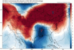

More times than not the confluence lifts out earlier than it appeared at D7. More times than not, these systems amp more than they appear at D7. More times than not, the track ends up farther north and west of the way it appeared at D7. Just playing the odds, once you start seeing hints/signs/signals of a robust system, you can usually count on those things happening. In those cases, the ensemble mean does not jerk way left like the op does. But it will tend to drift in that direction and get there eventually.
But none of that guarantees anything here. I have a concern that the degree of CAD is still being underestimated, even as cold as it looks now. Again, going by the odds, that's a decent bet. I also have strong reservations, given the aforementioned CAD, that a low is going to plow into it. Impossible? No. But likely? I don't see it right now.
I hate going from a ULL/dynamic driven all snow event to a Miller B or Miller B hybrid situation. My expectation is for a lot of ice and slop, the way it looks now. It seems most likely that we're going to see a lot of frozen precipitation. I just wish it was going to be predominately snow for a change. The odds of that scenario have gone down over the last 24 hours, IMO. Can it come back? Sure. If we had a strong west-based -NAO, I'd be much more enthusiastic about that probability. Since we don't, the first paragraph outcome seems reasonable to me.
Not panicking or throwing in the towel or jumping ship or bittercasting or whatever. We're probably going to get a significant winter storm. Tracking it with everyone is fun. This is what we wait all year for.
iGRXY
Member
SimeonNC
Member
A met Im in a discord chat in is claiming that the ensembles have been trending west over the past few runs. If this this true then that might be concerning.
Sent from my LM-Q730 using Tapatalk
Sent from my LM-Q730 using Tapatalk
- Joined
- Jan 23, 2021
- Messages
- 4,602
- Reaction score
- 15,197
- Location
- Lebanon Township, Durham County NC
I thought they looked dang good. We’ll see if the trend holds with them. I think I saw two members as inland as the OP.Here are the individual GFS Ens member for precip type. Many are showing snow and decent snow at that over Most of North Carolina and Upstate. This should pull some of you from the cliff...or not.View attachment 104026
I’m pulling for y’all down there, almost all my family is in Gaston County and I think it’s been since 2018 when they had an event. Btw, the last time I was home, I came through Belmont and couldn’t believe the changes on the south side of town.
Ugh. Dont bring that catostrophe up. It was the coldest storm at the surface ive been in beside the 93 Blizzard up in the mtns. Your right 1.0-1.5Miller B's are known for having suspect precip output thru the piedmont....but it varies of course. You want to see a healthy storm with a good moisture fetch. Dec 2002 ice storm was a Miller B and had a LOT of precip with it
The qpf maps for this one are the same all day, save the last icon. Even It was still well over .5
LickWx
Member
Someone here said totals have been going up , which if true generally means it’s amping more in the mean I’m sure someone can confirm for us.A met Im in a discord chat in is claiming that the ensembles have been trending west over the past few runs. If this this true then that might be concerning.
Sent from my LM-Q730 using Tapatalk
accu35
Member
Thank you!! You can clearly see a much more south then operational run. 999 L south Bama ? Lol!!
lets all just remember that we are going to see multiple solutions every day between all the models and the models itself. I don't know which way this will go, but I do favor further south suppressed look as of now.
Hypsometric
Member
- Joined
- Jan 23, 2021
- Messages
- 4,602
- Reaction score
- 15,197
- Location
- Lebanon Township, Durham County NC
You know, thinking about it, the ICON surface track isn’t too dissimilar from the GEFS
BelmontWX79
Member
Yep 2018 was it. I've lived in Belmont for almost 15 years now and yes its changed a heck of a lot. Real Estate prices here have went through the roof!I thought they looked dang good. We’ll see if the trend holds with them. I think I saw two members as inland as the OP.
I’m pulling for y’all down there, almost all my family is in Gaston County and I think it’s been since 2018 when they had an event. Btw, the last time I was home, I came through Belmont and couldn’t believe the changes on the south side of town.
Stormlover
Member
Jan
Yeah, lame AFD from HUN. They'll have to join the party late, as usual.FCC honking this far out is pretty amazing . KBMX isn't that interested
KHUN says maybe an inch the quickly melts with temps in the 40s sunday
Sent from my iPhone using Tapatalk
Also let’s remember this wave comes on shore the next day or so .. expect models to really “real it in” soon with all the data we can collect as it gets closer
Z
Zander98al
Guest
Looks good for snow potential hear in central Alabama ?
Well said from red tagger in MA
"to put this into perspective, the OP GFS has the low much farther west than the farthest west GEFS member… which is already an outlier
the vast majority of the tracks are near perfect, and it seems as if the real threat to this storm is a missed phase over the Rockies ala the ICON"
"to put this into perspective, the OP GFS has the low much farther west than the farthest west GEFS member… which is already an outlier
the vast majority of the tracks are near perfect, and it seems as if the real threat to this storm is a missed phase over the Rockies ala the ICON"
MichaelJ
Member
As you can see here, the GEFS shows a massive storm in Central and Western NC with good snow also for NGa and upper SC


Z
Zander98al
Guest
I don't know much about forecasting winter weather lol, so I'll just keep to posting info from local meteorligists or forecast offices.
ATLwxfan
Member
Still enough spread we have no idea how this plays out. But…9 sliders. That speaks to the solution Delta favors.
Sent from my iPhone using Tapatalk
Won’t see any changes from me every run. Still going with Mount Rogers, Virginia for this storm! May head up that way Friday as my snow spot winner. Charlotte NC is gonna be very tricky uptown may see 1-3” snow while the city is much less due to ice and rain. To be even more specific, the have and have nots with the ground being white or not is likely to be in Mecklenburg County. Either way, many on this board will score with a mixed bag. I don’t think a widespread ice storm will occur either, it’s likely to be a thin strip of counties over upstate SC and north-east Georgia perhaps stretching north east into Huntersville NC off i77.

