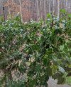
• Hello, please take a minute to check out our awesome content, contributed by the wonderful members of our community. We hope you'll add your own thoughts and opinions by making a free account!

Wintry Jan 15-16 Winter Storm Discussion & Obs

FI_7AW6XoAoyj2h


This is what happens when Greg Fishel isn't there to KO output like this. :rolleyes:
 
We really may not know how far inland the coastal front will make it until it's now casting time. My experience says it shouldn't make it as far as many models show but one could also argue that with all those above normal ssts off shore this low could really wrap up further inland.
 
GFS:
View attachment 105005
Euro:
View attachment 105006
CMC:
View attachment 105007
ICON:
View attachment 105008
This is the kuchera totals which factors in mixing issues and ratios from the most recent runs. even shaving off amounts due to sleet and ice and it's still more than 1-2" and 2-4" for a lot of people.
For the upstate peeps, notice that every one of these maps has a finger of lower amounts into Pickens County, with the one on the GFS being very pronounced. This is interesting as the finger of mins usually expands West to include Oconee, and often, extreme NE GA. In this case I am not exaclty sure why we see such a specific finger over only Pickens, but my guess is this may point to the effect elevation is having here. Even a few hundred feet could make a significant difference AND this is also the usual struggle line between better CAD push and less. I don't remember seeing it so pronounced on so many models for such a small area before but I don't think it can be ignored unfortunately. The other thing to note is that the heavier blue to purple band is a little further south of the 85 corridor itself, which is a good sign, especailly as many of the models continue to press this heavier band a few miles south each run. We really need to pay attention to the short term models tomorrow.
 
For the upstate peeps, notice that every one of these maps has a finger of lower amounts into Pickens County, with the one on the GFS being very pronounced. This is interesting as the finger of mins usually expands West to include Oconee, and often, extreme NE GA. In this case I am not exaclty sure why we see such a specific finger over only Pickens, but my guess is this may point to the effect elevation is having here. Even a few hundred feet could make a significant difference AND this is also the usual struggle line between better CAD push and less. I don't remember seeing it so pronounced on so many models for such a small area before but I don't think it can be ignored unfortunately. The other thing to note is that the heavier blue to purple band is a little further south of the 85 corridor itself, which is a good sign, especailly as many of the models continue to press this heavier band a few miles south each run. We really need to pay attention to the short term models tomorrow.
Upstate lake valley of Western Pickens Eastern Oconee is less than other locations often
 
For the upstate peeps, notice that every one of these maps has a finger of lower amounts into Pickens County, with the one on the GFS being very pronounced. This is interesting as the finger of mins usually expands West to include Oconee, and often, extreme NE GA. In this case I am not exaclty sure why we see such a specific finger over only Pickens, but my guess is this may point to the effect elevation is having here. Even a few hundred feet could make a significant difference AND this is also the usual struggle line between better CAD push and less. I don't remember seeing it so pronounced on so many models for such a small area before but I don't think it can be ignored unfortunately. The other thing to note is that the heavier blue to purple band is a little further south of the 85 corridor itself, which is a good sign, especailly as many of the models continue to press this heavier band a few miles south each run. We really need to pay attention to the short term models tomorrow.
It’s showing that bc those models have surface temps above 32 when the precip first arrives late Saturday night. So it’s the old boundary layer(lower elevation, lakes, etc) screw job killing totals for an hour or two before we go below 32 and that quits mattering for everyone. It’s likely over done, imo. I don’t think we lose too much snow to melting once it starts.
 
Back
Top